Road Stream Crossing Site BSAB_BS11
Big Sable River Watershed, Tributary of Twin Creek
Two-Track west off Hamilton
Sauble Twp,
Lake County
Information collected by:
Site Location
GPS Coordinates: 44.01348
, -86.00108
T19N
R14W
Sec 29
Owned by Private
Federal
Federal
Fish Passability 0
Perch Height: 0.58 ft.
Total Erosion: 0.2332 tons/year
Severity: Severe
Year Inventoried: 2011
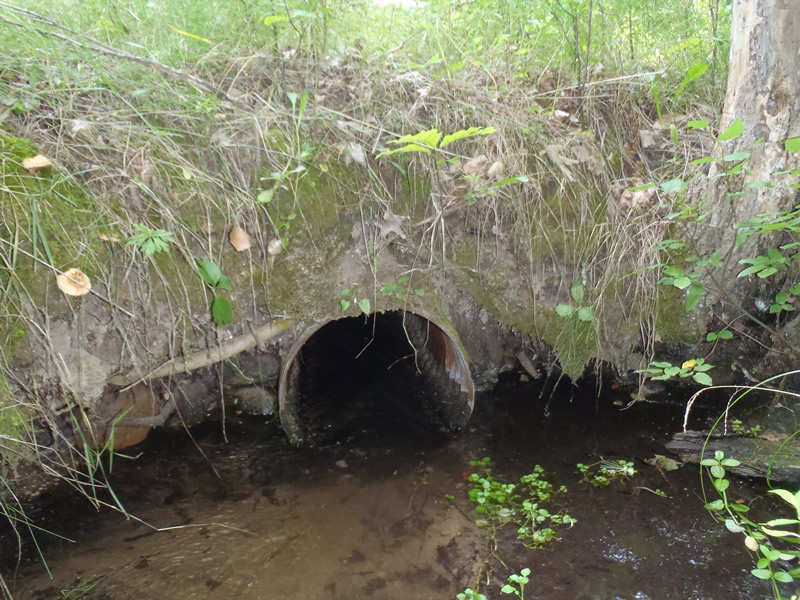
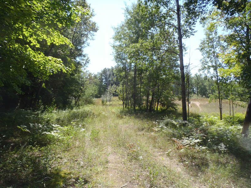
Inlet
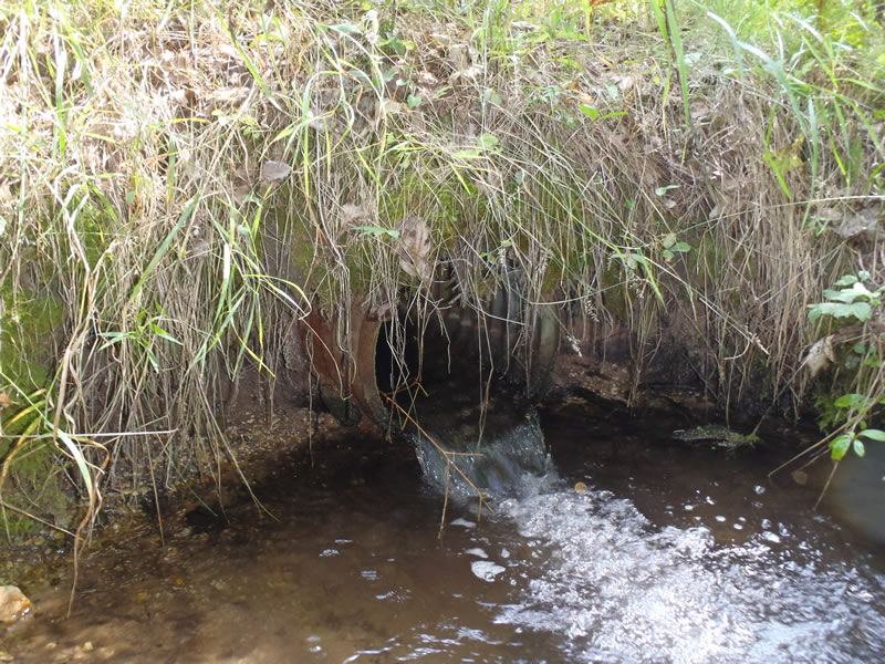
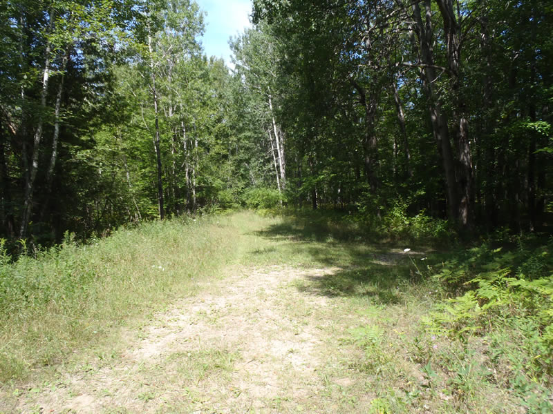
Outlet
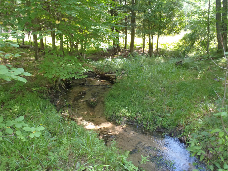
Upstream Conditions
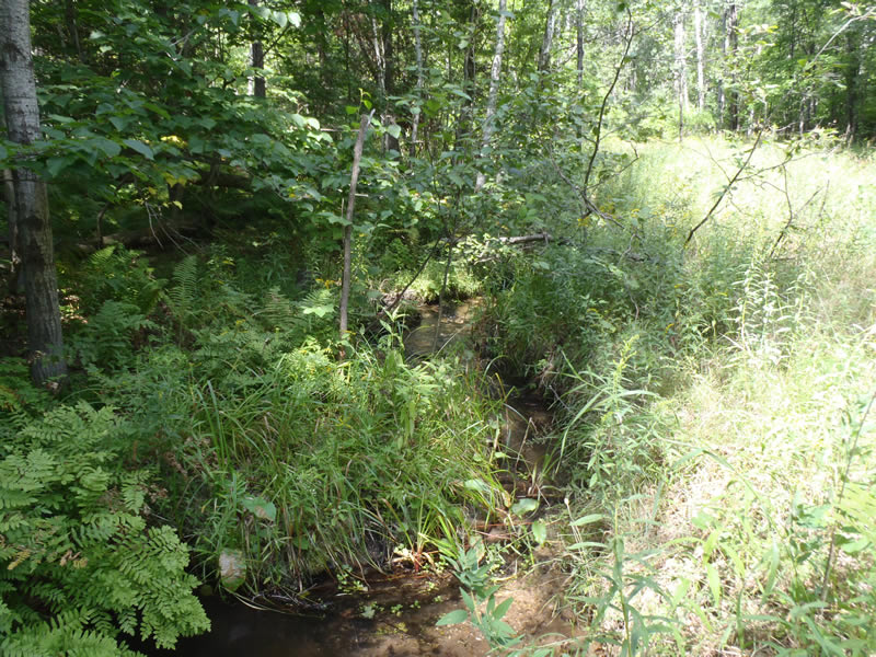
Downstream Conditions
Road Approach - Left
Road Approach - Right
Crossing Information
Type of Crossing: culvert(s)
Number of Structures: 1
Structure Shape: Round
Inlet Type: Projecting
Outlet Type: Freefall into Pool
Structure Material: Metal
Structure Substrate: None
General Conditions: Fair
Structure Interior: corrugated
Dimensions of Structure: Length 30 ft.
, Width 1.5 ft.
, Height 1.5 ft.
Perch Height: 0.58 ft.
Structure Inlet
Water Depth: 0.42 ft.
Embedded Depth of Structure: 0 ft.
Water Velocity*: 2.2 ft./sec.
Structure Outlet
Water Depth: 0.18 ft.
Embedded Depth of Structure: 0 ft.
Water Velocity*: 5.1 ft./sec.
*Water Velocities were measured 0.11 ft. below Surface
(with Meter)
Stream Information
Stream Flow: Less than Bankfull
Scour Pool: Length 6 ft.
, Width 5 ft.
, Depth 1.12 ft.
Riffle Information
Water Depth: 0.19 ft.
Bankfull Width: 6.6 ft.
Wetted Width: 4.8 ft.
Water Velocity: 1.8 ft./sec.
(Measured with Meter)
Dominant Substrate: Gravel
Road Information
Gravel
County Road
Road Condition: Good
Road Width at Culvert: 11 ft.
Location of Low Point: At Stream
Runoff Path: Ditch
Embankments
Upstream
Fill Depth: 2.7 ft.
Slope: Vertical
Downstream
Fill Depth: 2.5 ft.
Slope: Vertical
Approaches
Left Approach
Length: 66 ft.
Slope: Less Than 1%
Vegetation: Heavy
LS Factor: 0.05
Erosion: 0.01 tons/year
Right Approach
Length: 177 ft.
Slope: 1% to 5%
Vegetation: Heavy
LS Factor: 0.416
Erosion: 0.2232 tons/year
Erosion Information
Total Erosion at Crossing: 0.2332 tons/year
Summary Information
Fish Passability 0
�