Road Stream Crossing Site BSAB_BS12
Big Sable River Watershed, Tributary of Sauble Lake #1 and Sauble Lake #2
Utter Dr
Sauble Twp,
Lake County
Information collected by:
Site Location
GPS Coordinates: 44.07063
, -85.95613
T19N
R14W
Sec 2
Owned by Private
Fish Passability 1
Structure is NOT Perched
Total Erosion: 5.3388 tons/year
Severity: Severe
Year Inventoried: 2011
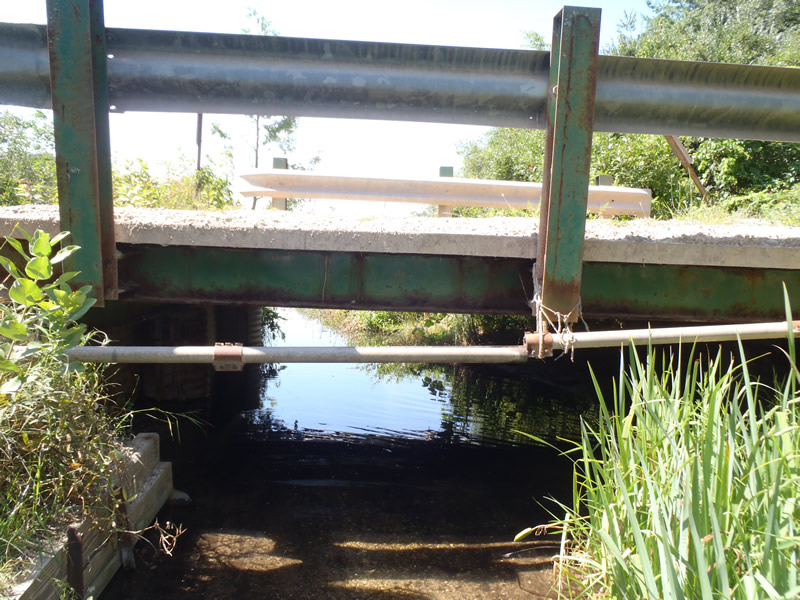
Inlet
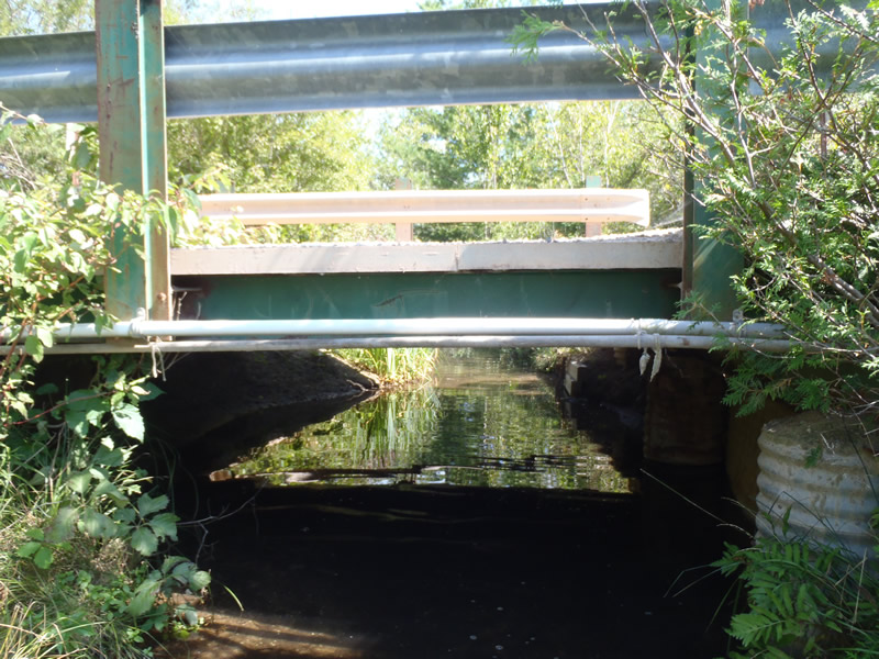
Outlet
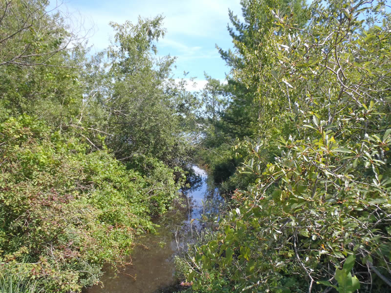
Upstream Conditions
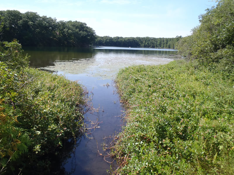
Downstream Conditions
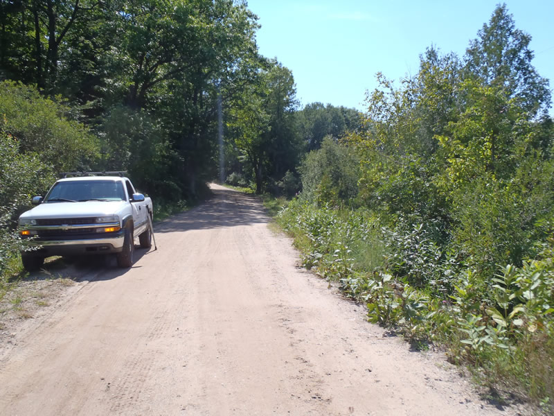
Road Approach - Left
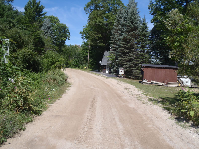
Road Approach - Right
Crossing Information
Type of Crossing: Bridge
Structure Shape: Open Bottom Square/Rectangle
Inlet Type: Other
Outlet Type: At Stream Grade
Structure Material: Metal
Structure Substrate: Mixture
General Conditions: Good
Structure Interior: corrugated
Dimensions of Structure: Length 17 ft.
, Width 18 ft.
, Height 3 ft.
Structure is NOT Perched
Structure Inlet
Water Depth: 0.36 ft.
Embedded Depth of Structure: 0 ft.
Water Velocity*: 0.05 ft./sec.
Structure Outlet
Water Depth: 0.56 ft.
Embedded Depth of Structure: 0 ft.
Water Velocity*: 0.05 ft./sec.
*Water Velocities were measured 0.22 ft. below Surface
(with Meter)
Additional Comments
1) Crossing is a one lane bridge 2) A true riffle does not exist since it is a trib between lakes
Stream Information
Stream Flow: Less than Bankfull
Riffle Information
Water Depth: 0.9 ft.
Bankfull Width: 20 ft.
Wetted Width: 15 ft.
Water Velocity: 0.05 ft./sec.
(Measured with Meter)
Dominant Substrate: Organics
Road Information
Gravel
County Road
Road Condition: Fair
Road Width at Culvert: 17 ft.
Location of Low Point: Other
Runoff Path: Roadway
Fill Depth: 0 ft.
Slope: 1:1
Fill Depth: 0 ft.
Slope: 1:1
Approaches
Left Approach
Length: 1000 ft.
Slope: 1% to 5%
Vegetation: Heavy
LS Factor: 0.57
Erosion: 2.6694 tons/year
Right Approach
Length: 1000 ft.
Slope: 1% to 5%
Vegetation: Heavy
LS Factor: 0.57
Erosion: 2.6694 tons/year
Erosion Information
Total Erosion at Crossing: 5.3388 tons/year
Extent of Erosion: Minor
Erosion is occurring and corrective actions can be installed to address the problem.
Notes: Road sediment reaches tributary via direct bridge runoff
Summary Information
Fish Passability 1
�