Road Stream Crossing Site RIF_OG68
Rifle River Watershed, Dedrich Creek
Gerald Miller Rd
Churchill Twp,
Ogemaw County
Information collected by:
Site Location
GPS Coordinates: 44.28487
, -84.06496
T22N
R3E
Sec 21
Fish Passability 0.5
Structure is NOT Perched
Total Erosion: 0.3463 tons/year
Severity: Moderate
Year Inventoried: 2012
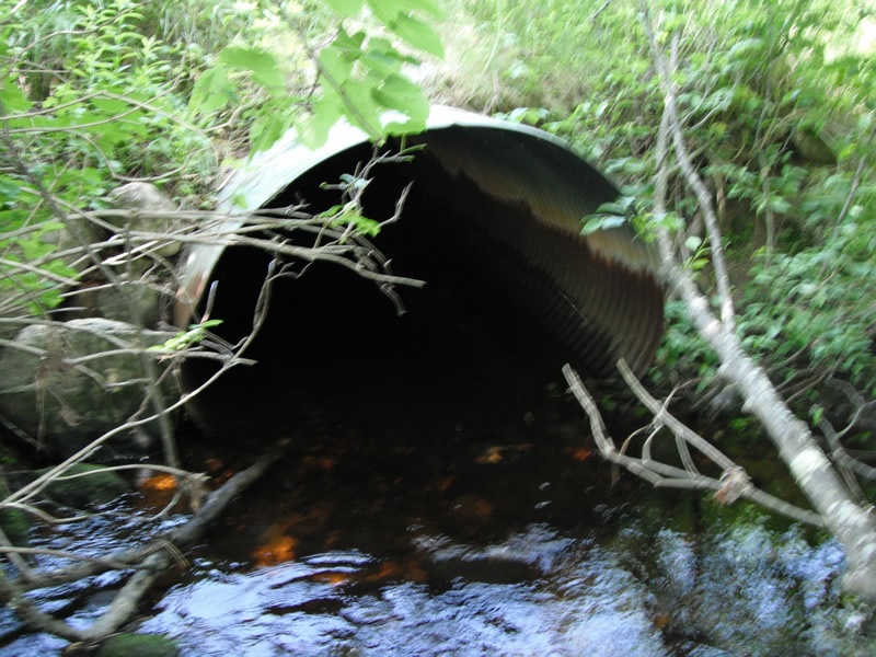
Inlet
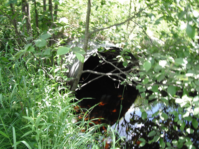
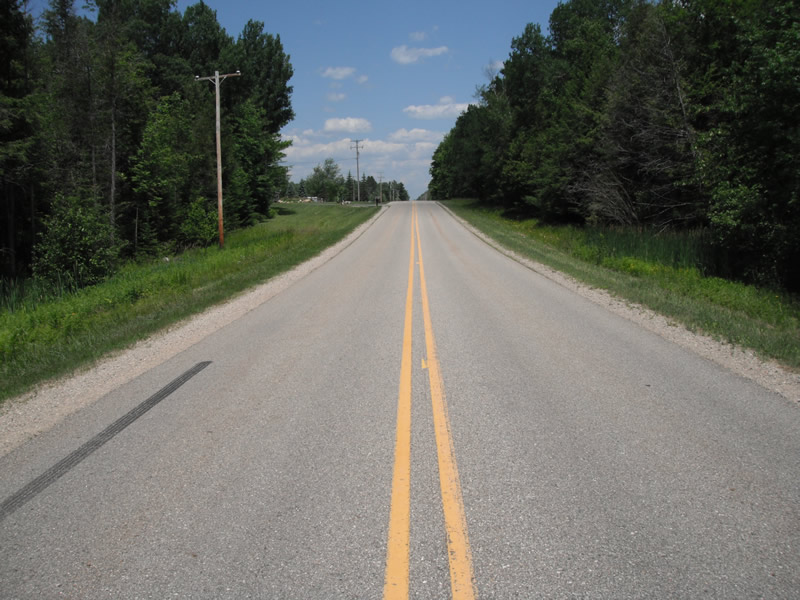
Outlet
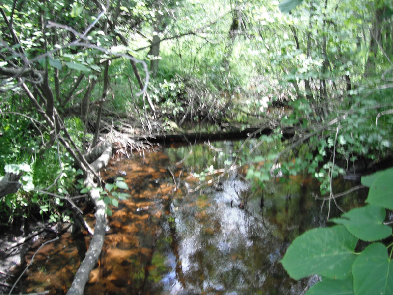
Upstream Conditions
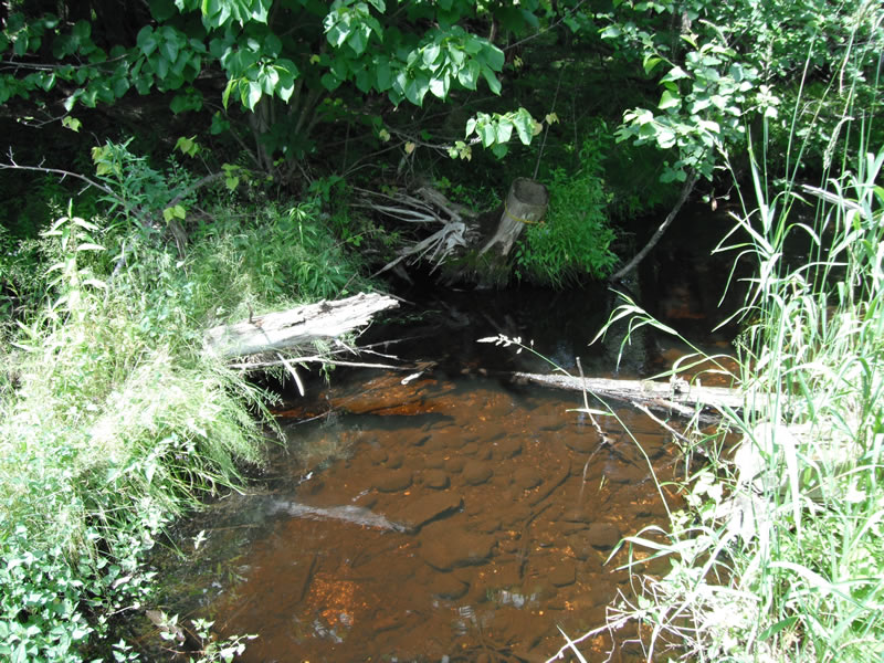
Downstream Conditions
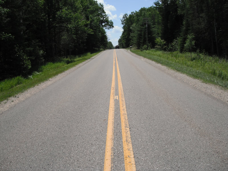
Road Approach - Left
Road Approach - Right
Crossing Information
Type of Crossing: culvert(s)
Number of Structures: 1
Structure Shape: Pipe Arch
Inlet Type: Projecting
Outlet Type: At Stream Grade
Structure Material: Metal
Structure Substrate: None
General Conditions: Poor
Structure Interior: corrugated
Dimensions of Structure: Length 68 ft.
, Width 5.8 ft.
, Height 4.2 ft.
Structure is NOT Perched
Structure Inlet
Water Depth: 0.9 ft.
Embedded Depth of Structure: 0 ft.
Water Velocity*: 0.5 ft./sec.
Structure Outlet
Water Depth: 1 ft.
Embedded Depth of Structure: 0 ft.
Water Velocity*: 0.5 ft./sec.
*Water Velocities were measured at the Surface
(with Float Test)
Stream Information
Stream Flow: Less than 1/2 Bankfull
Scour Pool: Length 25 ft.
, Width 20 ft.
, Depth 2 ft.
Upstream Pond: Length 20 ft.
, Width 11.4 ft.
, Depth 0 ft.
Riffle Information
Water Depth: 0.4 ft.
Bankfull Width: 13.6 ft.
Wetted Width: 11.9 ft.
Water Velocity: 1 ft./sec.
(Measured with Float Test)
Dominant Substrate: Cobble
Road Information
Paved
County Road
Road Condition: Fair
Road Width at Culvert: 22 ft.
Location of Low Point: At Stream
Runoff Path: Ditch
Embankments
Upstream
Fill Depth: 3.8 ft.
Slope: More than 1:2
Downstream
Fill Depth: 4 ft.
Slope: More than 1:2
Approaches
Left Approach
Length: 411 ft.
Slope: 1% to 5%
Vegetation: Heavy
LS Factor: 0.482
Erosion: 0.1441 tons/year
Right Approach
Length: 531 ft.
Slope: 1% to 5%
Vegetation: Heavy
LS Factor: 0.506
Erosion: 0.1955 tons/year
Erosion Information
Total Erosion at Crossing: 0.3463 tons/year
Extent of Erosion: Minor
Erosion is occurring and corrective actions can be installed to address the problem.
Location of Erosion | Erosion Dimensions | Eroded Material | Material Eroded | Total Erosion | ||
facing downstream | Length | Width | Depth | Reaching Stream? | (tons/year) | |
Right Upstream |
5.5 ft. |
2.1 ft. |
1.1 ft. |
yes |
Sand |
0.0067 |
Summary Information
Fish Passability 0.5
�