Road Stream Crossing Site RIF_OG7
Rifle River Watershed, Houghton Creek
Rose City Rd
Rose Twp,
Ogemaw County
Information collected by:
Site Location
GPS Coordinates: 44.42147
, -84.10931
T24N
R3E
Sec 31
Severity: Moderate
Year Inventoried: 2012
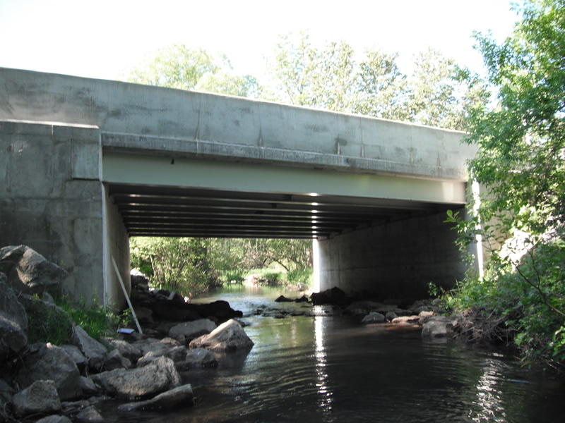
Inlet
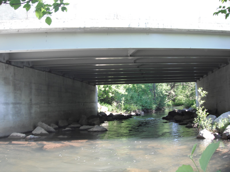
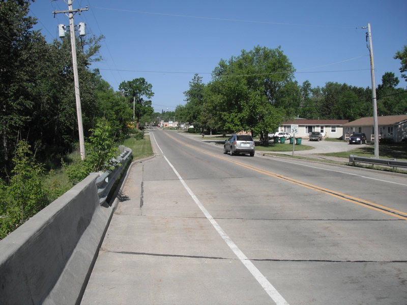
Outlet
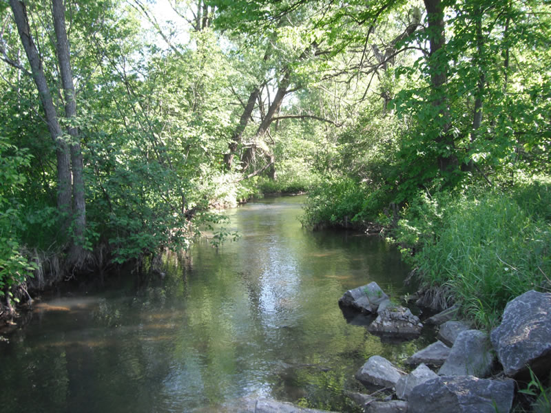
Upstream Conditions
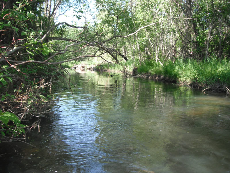
Downstream Conditions
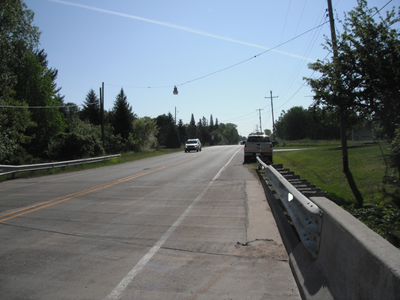
Road Approach - Left
Road Approach - Right
Crossing Information
Type of Crossing: Bridge
Structure Shape: Open Bottom Square/Rectangle
Inlet Type: Headwall
Outlet Type: At Stream Grade
Structure Material: Metal
Structure Substrate: Rock
General Conditions: New
Structure Interior: smooth
Structure Inlet
Water Depth: 2.3 ft.
Embedded Depth of Structure: 1000 ft.
Water Velocity*: 2.7 ft./sec.
Structure Outlet
Water Depth: 2.6 ft.
Embedded Depth of Structure: 1000 ft.
Water Velocity*: 2.7 ft./sec.
*Water Velocities were measured at the Surface
(with Float Test)
Stream Information
Stream Flow: Less than 1/2 Bankfull
Scour Pool: Length 27 ft.
, Width 30 ft.
, Depth 3.6 ft.
Upstream Pond: Length 0 ft.
, Width 0 ft.
, Depth 0 ft.
Riffle Information
Water Depth: 1.4 ft.
Bankfull Width: 24.3 ft.
Wetted Width: 20.5 ft.
Water Velocity: 1 ft./sec.
(Measured with Float Test)
Dominant Substrate: Cobble
Road Information
Paved
County Road
Road Condition: Good
Road Width at Culvert: 25 ft.
Location of Low Point: Other
Runoff Path: Ditch
Embankments
Upstream
Fill Depth: 2.6 ft.
Slope: Vertical
Downstream
Fill Depth: 3 ft.
Slope: Vertical
Length: 461 ft.
Slope: 1% to 5%
Vegetation: Heavy
Vegetation: Heavy
Erosion Information
Extent of Erosion: Moderate
Notes: on downstream bank just apsssed the rip rap
Location of Erosion | Erosion Dimensions | Eroded Material | Material Eroded | Total Erosion | ||
facing downstream | Length | Width | Depth | Reaching Stream? | (tons/year) | |
Left Downstream |
14 ft. |
2.9 ft. |
2 ft. |
no |
Sand |
0.2156 |
Summary Information
�