Road Stream Crossing Site RIF_OG22
Rifle River Watershed, Houghton Creek
Schmitt Rd
Rose Twp,
Ogemaw County
Information collected by:
Site Location
GPS Coordinates: 44.40781
, -84.07637
T23N
R3E
Sec 4
Fish Passability 0.9
Structure is NOT Perched
Severity: Moderate
Year Inventoried: 2012
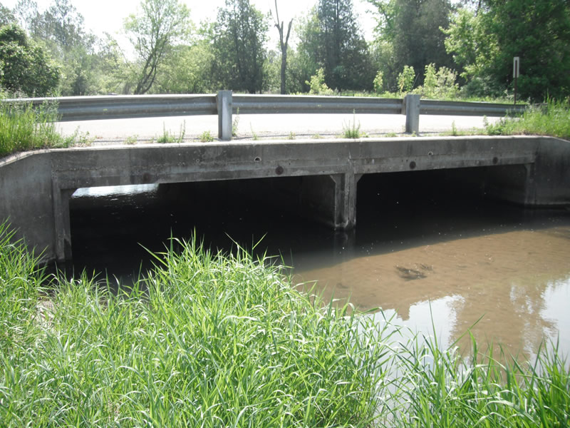
Inlet
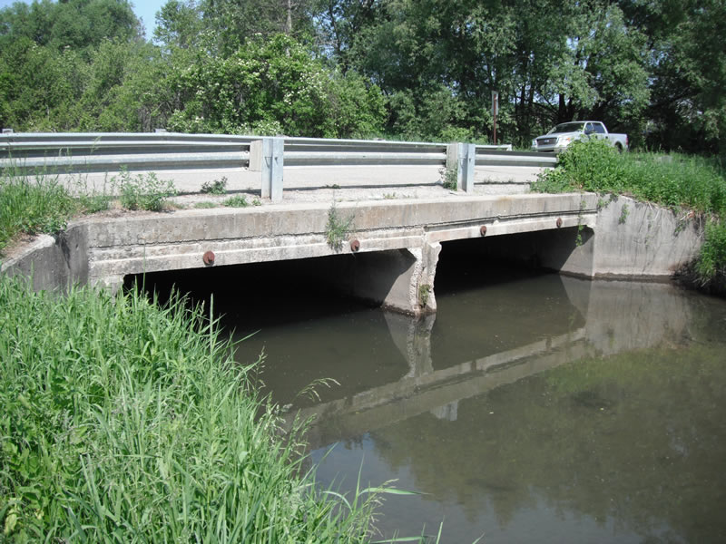
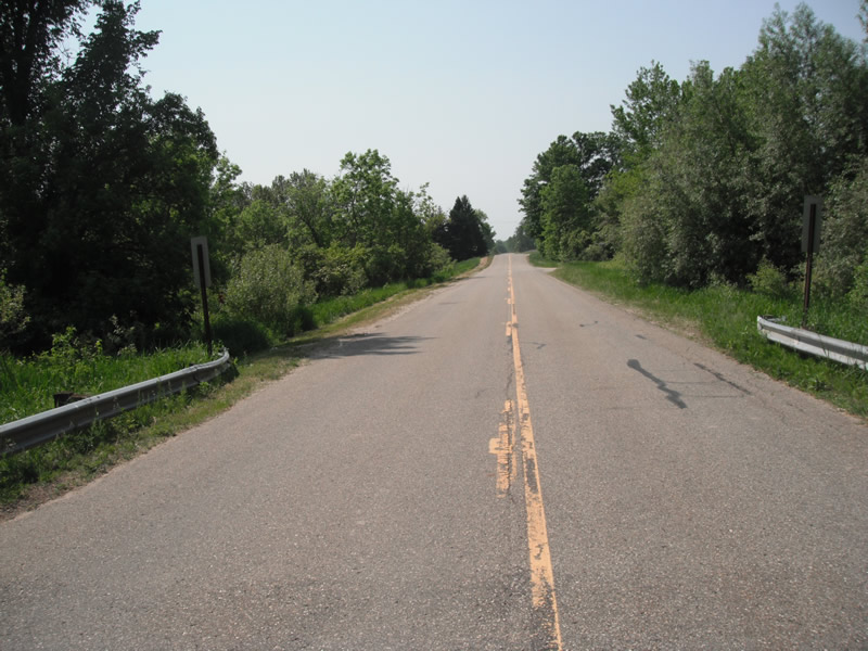
Outlet
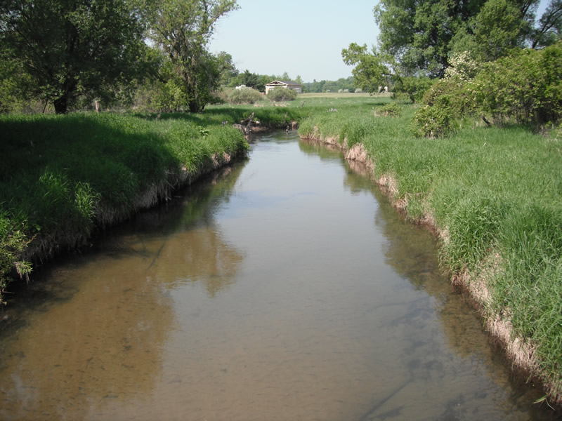
Upstream Conditions
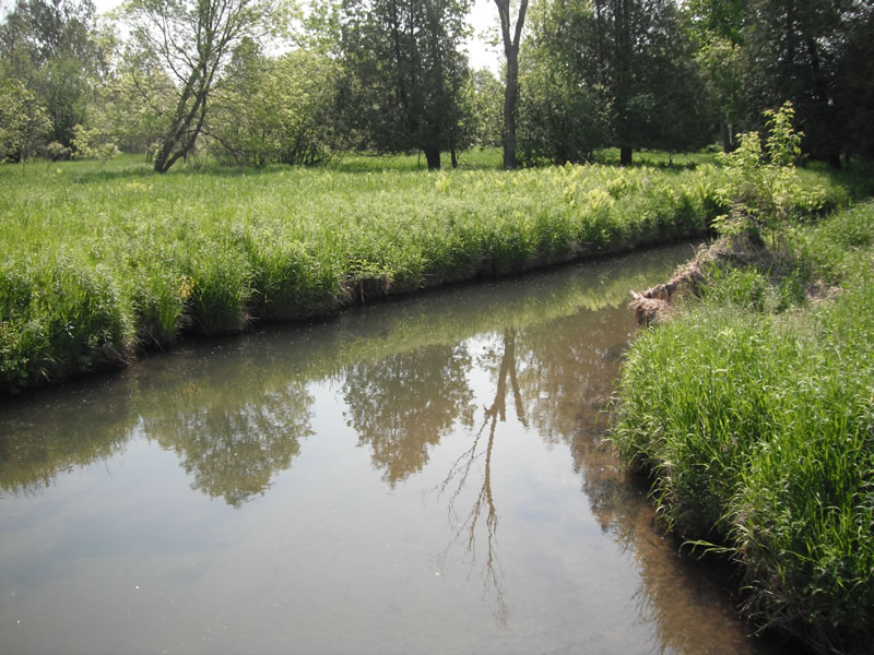
Downstream Conditions
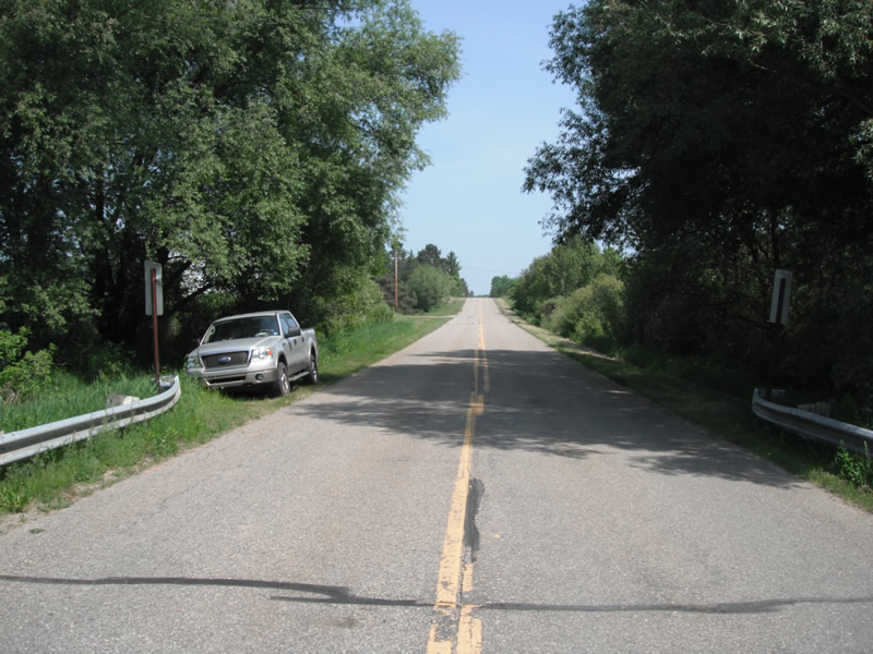
Road Approach - Left
Road Approach - Right
Crossing Information
Type of Crossing: Bridge
Number of Structures: 2
Structure Shape: Open Bottom Square/Rectangle
Inlet Type: Wingwall 10-30 Degree
Outlet Type: At Stream Grade
Structure Material: Concrete
Structure Substrate: Sand
General Conditions: Fair
Multiple Culverts/Spans | ||||
Culvert/Span | Width | Length | Height | Material |
2 |
13.9 ft. |
36 ft. |
6.9 ft. |
Concrete |
Structure Interior: smooth
Dimensions of Structure: Length 36 ft.
, Width 14.6 ft.
, Height 6.9 ft.
Structure is NOT Perched
Structure Inlet
Water Depth: 3.6 ft.
Embedded Depth of Structure: 0 ft.
Water Velocity*: 1 ft./sec.
Structure Outlet
Water Depth: 3.5 ft.
Embedded Depth of Structure: 0 ft.
Water Velocity*: 1 ft./sec.
*Water Velocities were measured at the Surface
(with Float Test)
Stream Information
Stream Flow: Less than 1/2 Bankfull
Scour Pool: Length 25 ft.
, Width 36 ft.
, Depth 3.5 ft.
Upstream Pond: Length 38 ft.
, Width 22 ft.
, Depth 0 ft.
Riffle Information
Water Depth: 2.1 ft.
Bankfull Width: 24 ft.
Wetted Width: 23 ft.
Water Velocity: 1.2 ft./sec.
(Measured with Float Test)
Dominant Substrate: Sand
Road Information
Paved
County Road
Road Condition: Good
Road Width at Culvert: 27 ft.
Location of Low Point: At Stream
Runoff Path: Ditch
Embankments
Upstream
Fill Depth: 2 ft.
Slope: 1:1.5
Downstream
Fill Depth: 2 ft.
Slope: 1:1.5
Length: 1050 ft.
Slope: 1% to 5%
Vegetation: Heavy
Length: 816 ft.
Slope: 1% to 5%
Vegetation: Heavy
Erosion Information
Extent of Erosion: Moderate
Notes: erosion on the side of wingwalls
Location of Erosion | Erosion Dimensions | Eroded Material | Material Eroded | Total Erosion | ||
facing downstream | Length | Width | Depth | Reaching Stream? | (tons/year) | |
Left Upstream |
4.2 ft. |
1.2 ft. |
2.4 ft. |
yes |
Sand |
0.0776 |
Right Upstream |
12 ft. |
1.6 ft. |
0.6 ft. |
yes |
Sand |
0.0554 |
Right Downstream |
1.7 ft. |
6.4 ft. |
1.1 ft. |
yes |
Loam |
0.0115 |
Left Downstream |
5.7 ft. |
2.4 ft. |
0.8 ft. |
yes |
Sand |
0.0351 |
Left Downstream |
4.7 ft. |
3.7 ft. |
1.1 ft. |
yes |
Sand |
0.0398 |
Summary Information
Fish Passability 0.9
A future visit to this site is recommended. bridge itself may need to be inspected
�