Road Stream Crossing Site RIF_OG115
Rifle River Watershed, Mills Creek
Henderson Lake Rd
Mills Twp,
Ogemaw County
Information collected by:
Site Location
GPS Coordinates: 44.1767
, -84.00494
T21N
R3E
Sec 25
Fish Passability 0
Perch Height: 0.5 ft.
Total Erosion: 0.081 tons/year
Severity: Severe
Year Inventoried: 2012
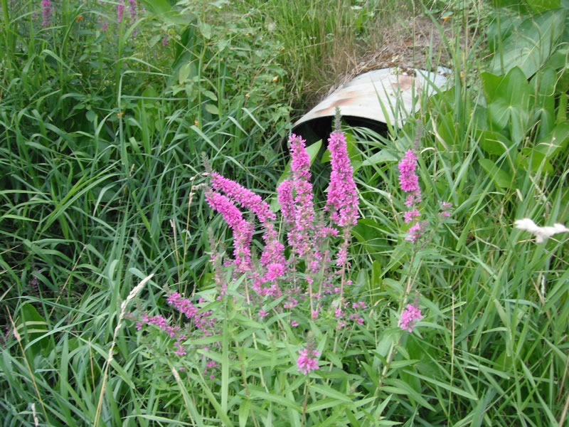
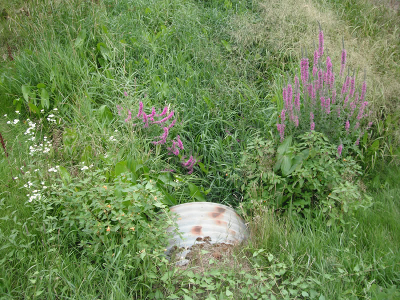
Inlet
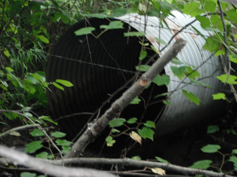
Outlet
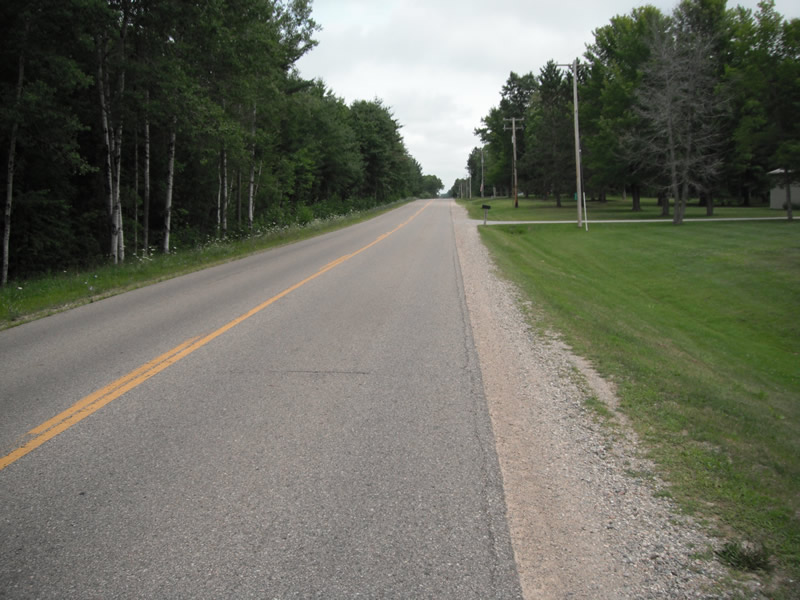
Upstream Conditions
Downstream Conditions
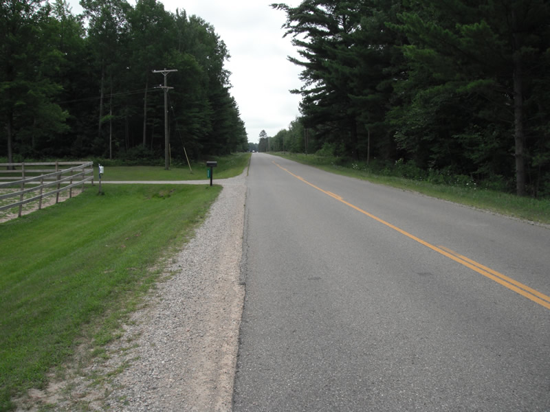
Road Approach - Left
Road Approach - Right
Crossing Information
Type of Crossing: culvert(s)
Number of Structures: 1
Structure Shape: Round
Inlet Type: Projecting
Outlet Type: Freefall into Pool
Structure Material: Metal
Structure Substrate: None
General Conditions: Poor
Structure Interior: corrugated
Dimensions of Structure: Length 59 ft.
, Width 3 ft.
, Height 3 ft.
Perch Height: 0.5 ft.
Structure Inlet
Water Depth: 0.5 ft.
Embedded Depth of Structure: 0 ft.
Water Velocity*: 0.2 ft./sec.
Structure Outlet
Water Depth: 0.1 ft.
Embedded Depth of Structure: 0 ft.
Water Velocity*: 1.5 ft./sec.
*Water Velocities were measured at the Surface
(with Float Test)
Stream Information
Stream Flow: Less than 1/2 Bankfull
Scour Pool: Length 25 ft.
, Width 18 ft.
, Depth 1.3 ft.
Upstream Pond: Length 0 ft.
, Width 0 ft.
, Depth 0 ft.
Riffle Information
Water Depth: 0.2 ft.
Bankfull Width: 3.5 ft.
Wetted Width: 2.8 ft.
Water Velocity: 1 ft./sec.
(Measured with Float Test)
Dominant Substrate: Gravel
Road Information
Paved
County Road
Road Condition: Fair
Road Width at Culvert: 2.7 ft.
Location of Low Point: At Stream
Runoff Path: Ditch
Embankments
Upstream
Fill Depth: 2.7 ft.
Slope: More than 1:2
Downstream
Fill Depth: 3 ft.
Slope: More than 1:2
Approaches
Left Approach
Length: 1000 ft.
Slope: Less Than 1%
Vegetation: Heavy
LS Factor: 0.05
Erosion: 0.0045 tons/year
Right Approach
Length: 997 ft.
Slope: 1% to 5%
Vegetation: Heavy
LS Factor: 0.57
Erosion: 0.0507 tons/year
Erosion Information
Total Erosion at Crossing: 0.081 tons/year
Extent of Erosion: Moderate
Notes: upstream is in yard
Location of Erosion | Erosion Dimensions | Eroded Material | Material Eroded | Total Erosion | ||
facing downstream | Length | Width | Depth | Reaching Stream? | (tons/year) | |
Left Upstream |
4.9 ft. |
3.5 ft. |
0.5 ft. |
yes |
Sand |
0.0189 |
Right Upstream |
9 ft. |
1 ft. |
0.1 ft. |
yes |
Sand |
0.0069 |
Summary Information
Fish Passability 0
Fish Passage is an area of concern for this site.
perched culvert
A future visit to this site is recommended. invaisve and perched culvert
These non-native species were observerd at this site: Purple Loosestrife
�