Road Stream Crossing Site RIF_OG206
Rifle River Watershed, Bixby Creek
M-33
Rose Twp,
Ogemaw County
Information collected by:
Site Location
GPS Coordinates: 44.43491
, -84.12122
T24N
R3E
Sec 31
Fish Passability 0.9
Structure is NOT Perched
Total Erosion: 1.5487 tons/year
Severity: Moderate
Year Inventoried: 2012
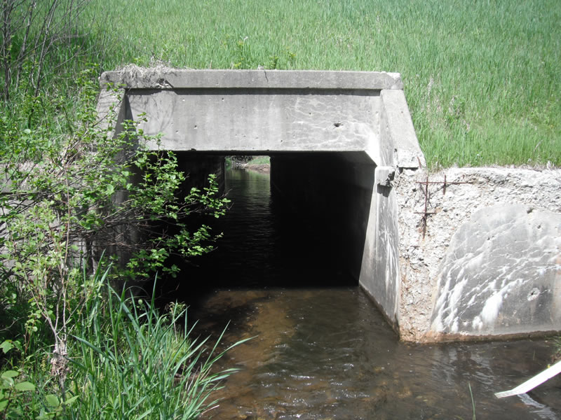
Inlet
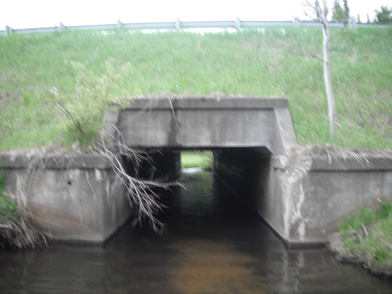
Outlet
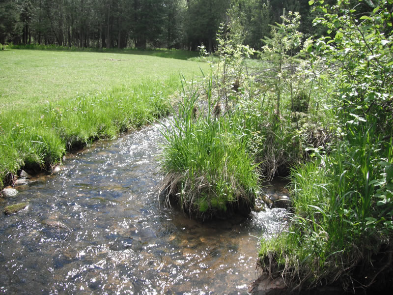
Upstream Conditions
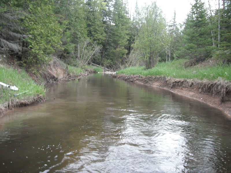
Downstream Conditions
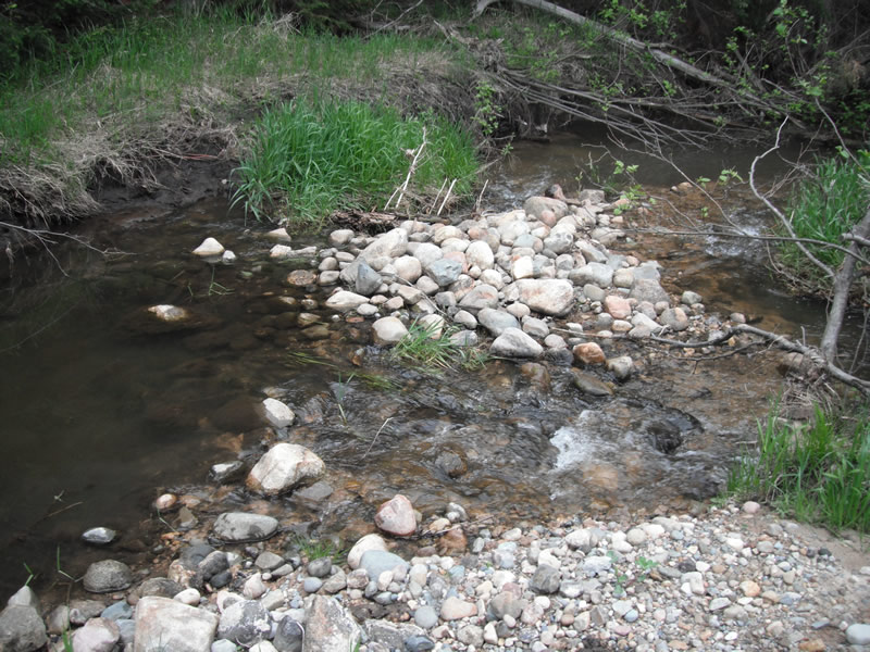
Downstream Conditions
Road Approach - Left
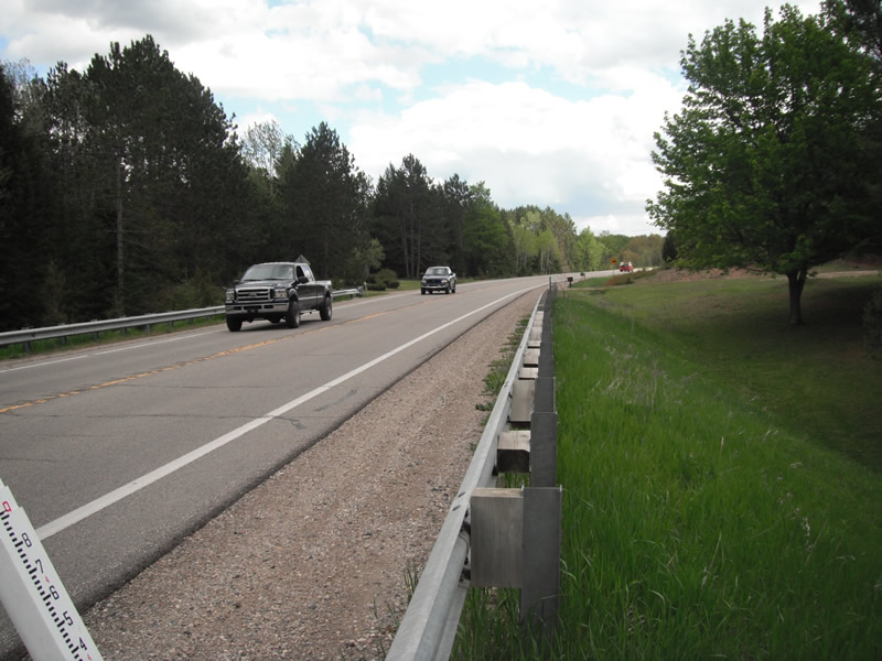
Road Approach - Right
Crossing Information
Type of Crossing: culvert(s)
Number of Structures: 1
Structure Shape: Square/Rectangle
Inlet Type: Headwall
Outlet Type: At Stream Grade
Structure Material: Concrete
Structure Substrate: Sand
General Conditions: Poor
Structure Interior: smooth
Dimensions of Structure: Length 66 ft.
, Width 8 ft.
, Height 6 ft.
Structure is NOT Perched
Structure Inlet
Water Depth: 0.9 ft.
Embedded Depth of Structure: 0.3 ft.
Water Velocity*: 1.7 ft./sec.
Structure Outlet
Water Depth: 1.7 ft.
Embedded Depth of Structure: 0.1 ft.
Water Velocity*: 0.2 ft./sec.
*Water Velocities were measured 0.7 ft. below Surface
(with Meter)
Stream Information
Stream Flow: Less than 1/2 Bankfull
Scour Pool: Length 24 ft.
, Width 13.2 ft.
, Depth 2 ft.
Upstream Pond: Length 7 ft.
, Width 10.6 ft.
, Depth 0 ft.
Riffle Information
Water Depth: 0.9 ft.
Bankfull Width: 13.4 ft.
Wetted Width: 9.2 ft.
Water Velocity: 0.9 ft./sec.
(Measured with Meter)
Dominant Substrate: Gravel
Road Information
Paved
State Road
Road Condition: Good
Road Width at Culvert: 24.9 ft.
Location of Low Point: Other
Runoff Path: Ditch
Embankments
Upstream
Fill Depth: 15 ft.
Slope: 1:1.5
Downstream
Fill Depth: 13 ft.
Slope: 1:1.5
Approaches
Left Approach
Length: 1000 ft.
Slope: 1% to 5%
Vegetation: Heavy
LS Factor: 0.57
Erosion: 0.4692 tons/year
Right Approach
Length: 1000 ft.
Slope: 1% to 5%
Vegetation: Heavy
LS Factor: 0.57
Erosion: 0.4692 tons/year
Erosion Information
Total Erosion at Crossing: 1.5487 tons/year
Extent of Erosion: Moderate
Erosion is occurring and corrective actions can be installed to address the problem.
Notes: upstream erosion is coming from road runoff, downstream erosion is coming from high water
Location of Erosion | Erosion Dimensions | Eroded Material | Material Eroded | Total Erosion | ||
facing downstream | Length | Width | Depth | Reaching Stream? | (tons/year) | |
Right Upstream |
3.7 ft. |
6 ft. |
1.2 ft. |
yes |
Gravel |
0.0311 |
Left Upstream |
1.4 ft. |
6.2 ft. |
1 ft. |
yes |
Sand |
0.0108 |
Right Downstream |
40 ft. |
0 ft. |
2.9 ft. |
yes |
Clay |
0.5684 |
Summary Information
Fish Passability 0.9
Erosion is an area of concern for this site.
floor of culvert is getting erode up it making it bouncy, weaking structure
A future visit to this site is recommended. erosion
�