Road Stream Crossing Site RIF_OG222
Rifle River Watershed, Tributary of Oyster
Rose City Rd
Rose Twp,
Ogemaw County
Information collected by:
Site Location
GPS Coordinates: 44.4215
, -84.04992
T24N
R3E
Sec 34
Fish Passability 0.5
Structure is NOT Perched
Total Erosion: 0.0837 tons/year
Severity: Moderate
Year Inventoried: 2012
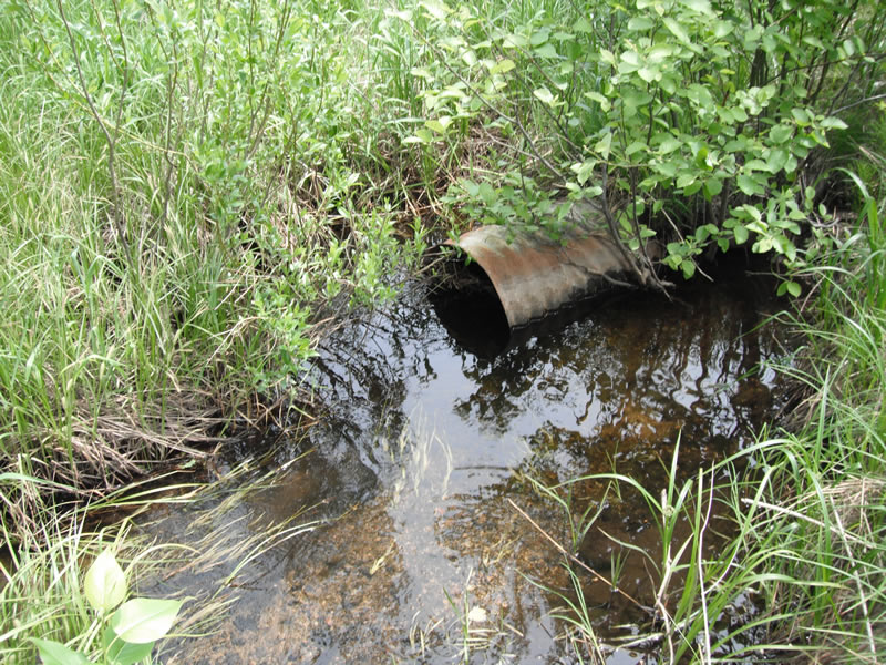
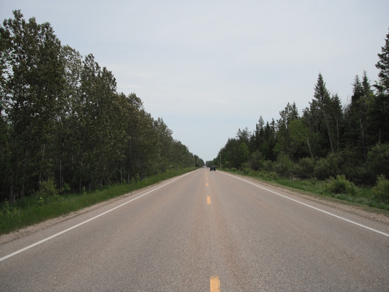
Inlet
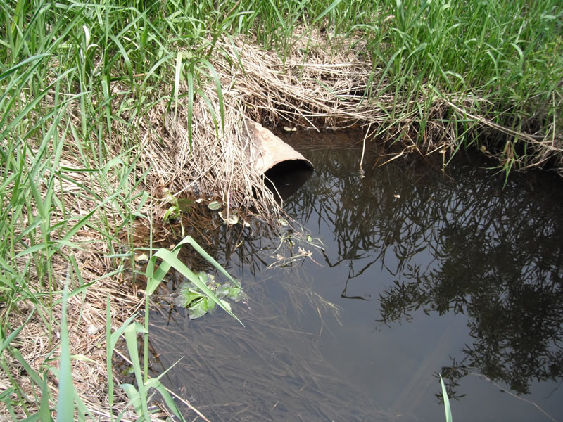
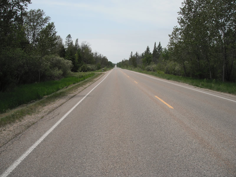
Outlet
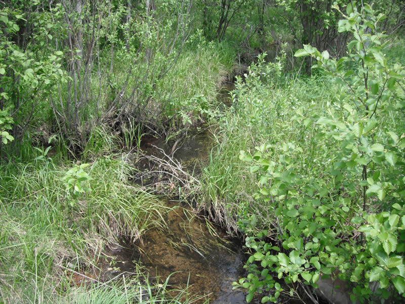
Upstream Conditions
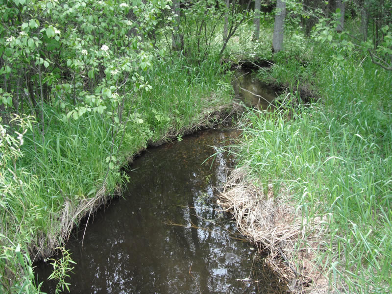
Downstream Conditions
Road Approach - Left
Road Approach - Right
Crossing Information
Type of Crossing: culvert(s)
Number of Structures: 1
Structure Shape: Round
Inlet Type: Projecting
Outlet Type: At Stream Grade
Structure Material: Metal
Structure Substrate: None
General Conditions: Poor
Structure Interior: corrugated
Structure is Rusted through
Dimensions of Structure: Length 66 ft.
, Width 1.5 ft.
, Height 1.5 ft.
Structure is NOT Perched
Structure Inlet
Water Depth: 1 ft.
Embedded Depth of Structure: 0 ft.
Water Velocity*: 0.5 ft./sec.
Structure Outlet
Water Depth: 1.2 ft.
Embedded Depth of Structure: 0 ft.
Water Velocity*: 0.5 ft./sec.
(with Meter)
Stream Information
Stream Flow: Less than 1/2 Bankfull
Scour Pool: Length 11.7 ft.
, Width 8.3 ft.
, Depth 0.7 ft.
Upstream Pond: Length 4.6 ft.
, Width 7.6 ft.
, Depth 0 ft.
Riffle Information
Water Depth: 0.6 ft.
Bankfull Width: 10.1 ft.
Wetted Width: 7.5 ft.
Water Velocity: 0.3 ft./sec.
(Measured with Meter)
Dominant Substrate: Sand
Road Information
Paved
County Road
Road Condition: Good
Road Width at Culvert: 24 ft.
Location of Low Point: At Stream
Runoff Path: Ditch
Embankments
Upstream
Fill Depth: 3.2 ft.
Slope: 1:2
Downstream
Fill Depth: 3 ft.
Slope: 1:2
Approaches
Left Approach
Length: 1000 ft.
Slope: Less Than 1%
Vegetation: Heavy
LS Factor: 0.05
Erosion: 0.0397 tons/year
Right Approach
Length: 1000 ft.
Slope: Less Than 1%
Vegetation: Heavy
LS Factor: 0.05
Erosion: 0.0397 tons/year
Erosion Information
Total Erosion at Crossing: 0.0837 tons/year
Extent of Erosion: Minor
Erosion is occurring and corrective actions can be installed to address the problem.
Notes: little bit on upstream side of culvert
Location of Erosion | Erosion Dimensions | Eroded Material | Material Eroded | Total Erosion | ||
facing downstream | Length | Width | Depth | Reaching Stream? | (tons/year) | |
Right Upstream |
2 ft. |
2.4 ft. |
2 ft. |
yes |
Sand |
0.0044 |
Summary Information
Fish Passability 0.5
�