Road Stream Crossing Site RIF_AR22
Rifle River Watershed, Rifle River
Bishop/grove
Deep River Twp,
Arenac County
Information collected by:
Site Location
GPS Coordinates: 44.08022
, -83.96526
T19n
R4E
Sec 2
Fish Passability 0.5
Structure is NOT Perched
Severity: Moderate
Year Inventoried: 2012
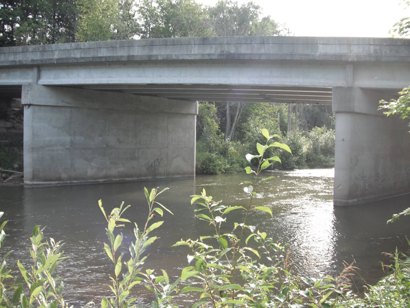
Inlet
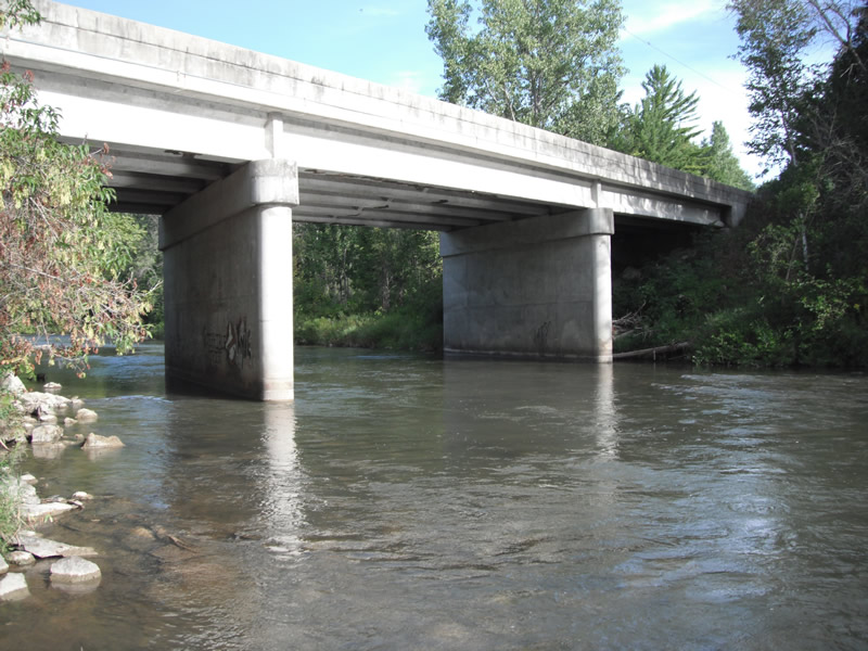
Outlet
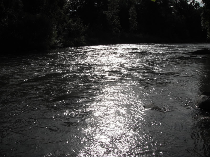
Upstream Conditions
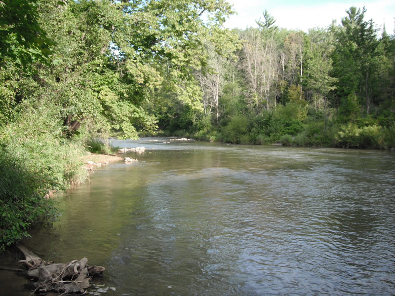
Downstream Conditions
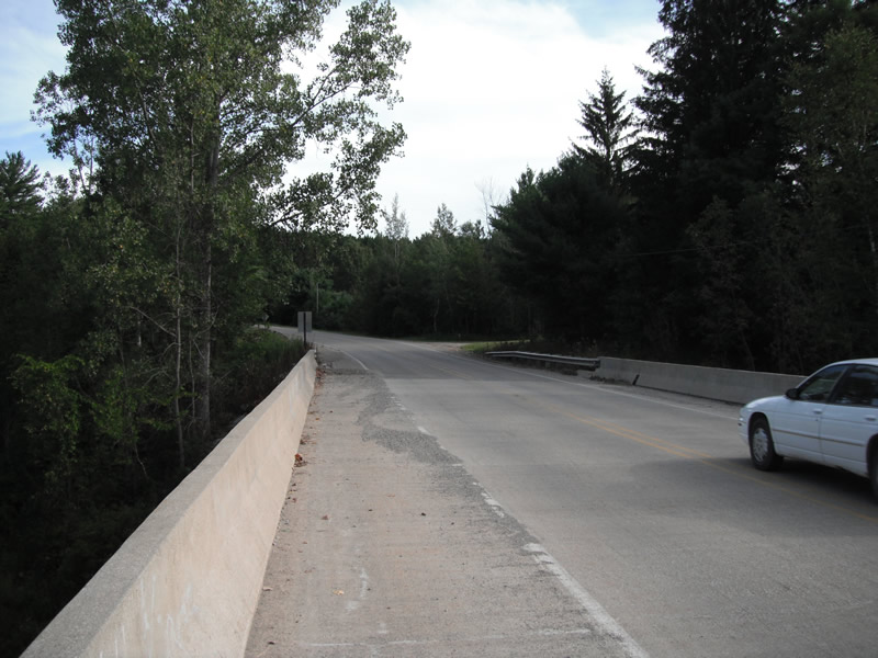
Road Approach - Left
Road Approach - Right
Crossing Information
Type of Crossing: Bridge
Number of Structures: 2
Structure Shape: Square/Rectangle
Inlet Type: Other
Outlet Type: Outlet Apron
Structure Material: Concrete
Structure Substrate: Rock
General Conditions: Good
Multiple Culverts/Spans | ||||
Culvert/Span | Width | Length | Height | Material |
2 |
30 ft. |
40 ft. |
21 ft. |
Concrete |
3 |
20 ft. |
40 ft. |
24 ft. |
Concrete |
Structure Interior: smooth
Dimensions of Structure: Length 40 ft.
, Width 57 ft.
, Height 22 ft.
Structure is NOT Perched
Structure Inlet
Water Depth: 2.5 ft.
Water Velocity*: 2 ft./sec.
Structure Outlet
Water Depth: 2.5 ft.
Water Velocity*: 2 ft./sec.
*Water Velocities were measured at the Surface
(with Float Test)
Additional Comments
pinnicale bridge
Stream Information
Stream Flow: Less than 1/2 Bankfull
Scour Pool: Length 0 ft.
, Width 0 ft.
, Depth 0 ft.
Upstream Pond: Length 0 ft.
, Width 0 ft.
, Depth 0 ft.
Riffle Information
Water Depth: 2 ft.
Bankfull Width: 96 ft.
Wetted Width: 87 ft.
Water Velocity: 2 ft./sec.
(Measured with Float Test)
Dominant Substrate: Cobble
Road Information
Paved
County Road
Road Condition: Fair
Road Width at Culvert: 21 ft.
Location of Low Point: Other
Runoff Path: Ditch
Embankments
Upstream
Fill Depth: 4.7 ft.
Slope: Vertical
Downstream
Fill Depth: 5 ft.
Slope: Vertical
Length: 483 ft.
Slope: 6% to 10%
Vegetation: Heavy
Vegetation: Heavy
Erosion Information
Extent of Erosion: Stabilized
Erosion is occurring and corrective actions can be installed to address the problem.
Notes: rip rap
Summary Information
Fish Passability 0.5
�