Road Stream Crossing Site TW061
Tawas River Watershed, Tributary to Tawas River
Nunn Rd
Baldwin Twp,
Iosco County
Information collected by:
Site Location
GPS Coordinates: 44.28317
, -83.50585
T22N
R08E
Sec 19
Owned by Private
Fish Passability 0.9
Structure is NOT Perched
Total Erosion: 0.2092 tons/year
Severity: Moderate
Year Inventoried: 2012
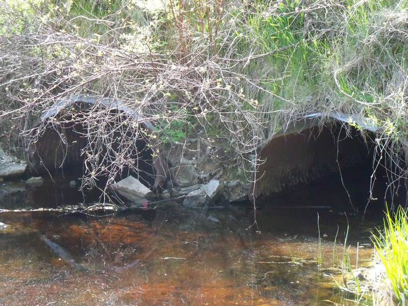
Inlet
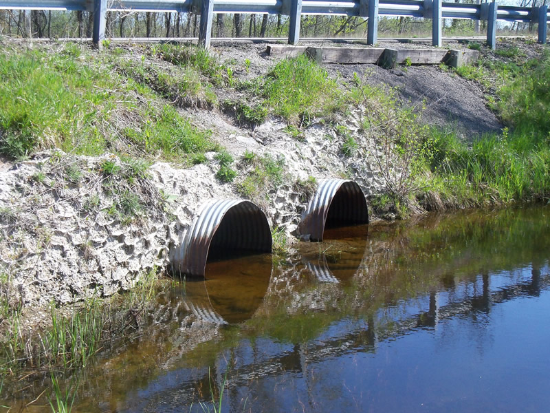
Outlet
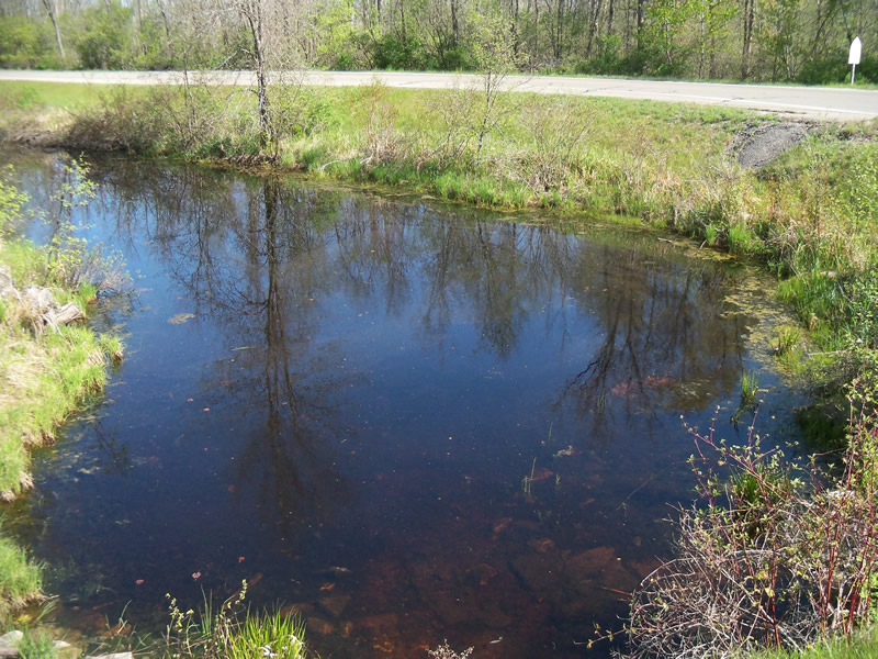
Upstream Conditions
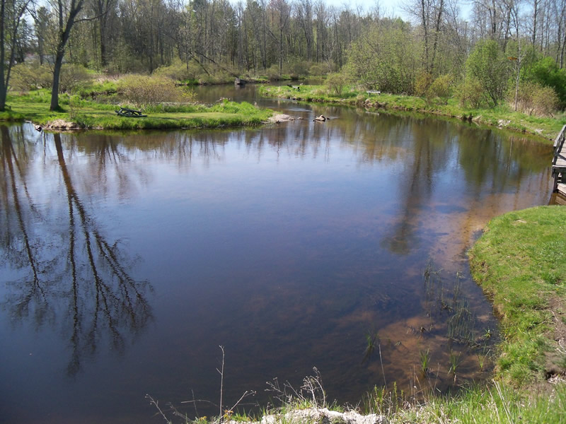
Downstream Conditions
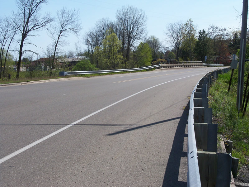
Road Approach - Left
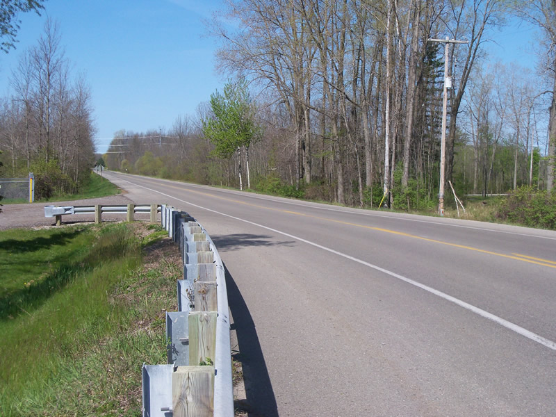
Road Approach - Right
Crossing Information
Type of Crossing: culvert(s)
Number of Structures: 2
Structure Shape: Ellipse
Inlet Type: Projecting
Outlet Type: At Stream Grade
Structure Material: Metal
Structure Substrate: Sand
General Conditions: Fair
Multiple Culverts/Spans | ||||
Culvert/Span | Width | Length | Height | Material |
1 |
4.3 ft. |
70 ft. |
3.2 ft. |
Metal |
2 |
4.3 ft. |
70 ft. |
3.2 ft. |
Metal |
Structure Interior: corrugated
Dimensions of Structure: Length 70 ft.
, Width 4.3 ft.
, Height 3.4 ft.
Percentage Plugged:
Inlet: 1% to 25%
Outlet: 0%
In Pipe: 0%
Percentage Crushed:
Inlet: 1% to 25%
Outlet: 0%
In Pipe: 0%
Structure is NOT Perched
Structure Inlet
Water Depth: 0.6 ft.
Embedded Depth of Structure: 0.1 ft.
Water Velocity*: 0 ft./sec.
Structure Outlet
Water Depth: 0.9 ft.
Embedded Depth of Structure: 0.2 ft.
Water Velocity*: 0 ft./sec.
*Water Velocities were measured at the Surface
(with Meter)
Stream Information
Stream Flow: Less than Bankfull
Scour Pool: Length 0 ft.
, Width 0 ft.
, Depth 0 ft.
Upstream Pond: Length 0 ft.
, Width 0 ft.
, Depth 0 ft.
Riffle Information
Water Depth: 2 ft.
Bankfull Width: 60 ft.
Wetted Width: 35 ft.
Water Velocity: 2.2 ft./sec.
(Measured with Meter)
Dominant Substrate: Clay
Road Information
Paved
County Road
Road Condition: Good
Road Width at Culvert: 40 ft.
Location of Low Point: At Stream
Runoff Path: Ditch
Embankments
Upstream
Fill Depth: 5.5 ft.
Slope: More than 1:2
Downstream
Fill Depth: 5.2 ft.
Slope: More than 1:2
Approaches
Left Approach
Length: 1000 ft.
Slope: Less Than 1%
Vegetation: Heavy
LS Factor: 0.05
Erosion: 0.0661 tons/year
Right Approach
Length: 1000 ft.
Slope: Less Than 1%
Vegetation: Heavy
LS Factor: 0.05
Erosion: 0.0661 tons/year
Erosion Information
Total Erosion at Crossing: 0.2092 tons/year
Extent of Erosion: Moderate
Location of Erosion | Erosion Dimensions | Eroded Material | Material Eroded | Total Erosion | ||
facing downstream | Length | Width | Depth | Reaching Stream? | (tons/year) | |
Right Downstream Embankment |
11 ft. |
8 ft. |
1 ft. |
yes |
Gravel |
0.077 |
Summary Information
Fish Passability 0.9
Erosion is an area of concern for this site.
Downstream side erosion site
A future visit to this site is recommended. Erosion issues
�