Road Stream Crossing Site TW081
Tawas River Watershed, Indian Creek
Old US 23
Wilber Twp,
Iosco County
Information collected by:
Site Location
GPS Coordinates: 44.39347
, -83.47652
T23N
R08E
Sec 16
Owned by Private
Fish Passability 0
Perch Height: 0.4 ft.
Total Erosion: 8.6689 tons/year
11.5 Upstream Miles
Severity: Severe
Year Inventoried: 2012
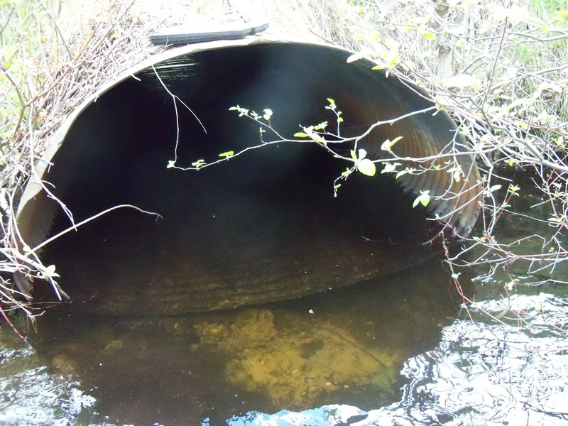
Inlet
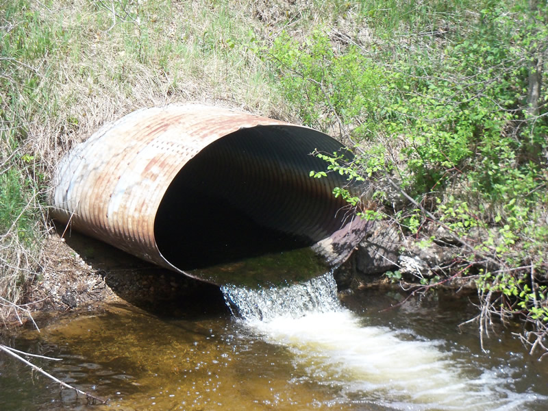
Outlet
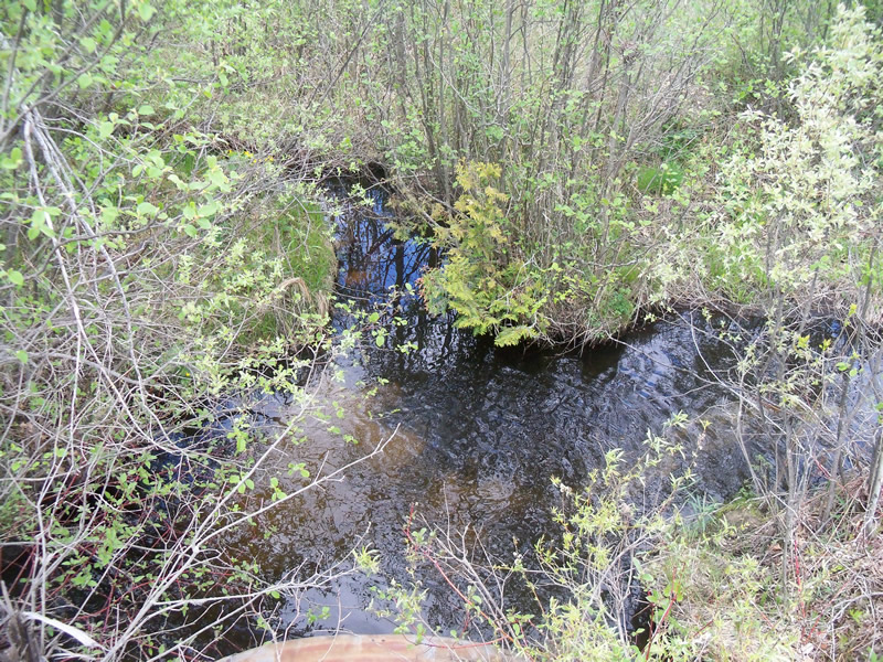
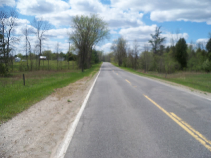
Upstream Conditions
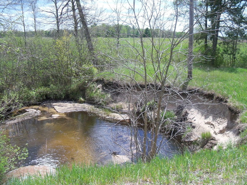
Downstream Conditions
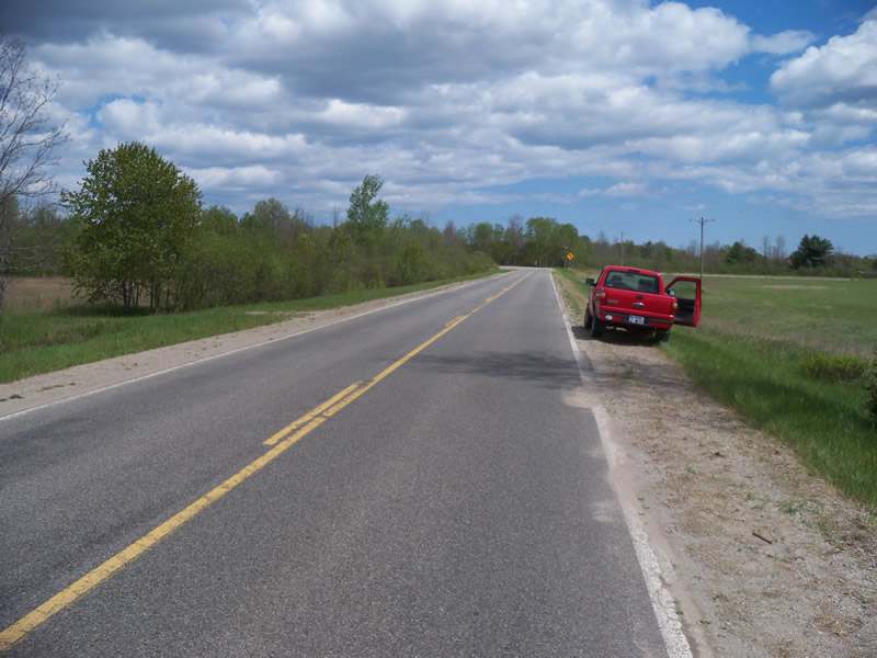
Road Approach - Left
Road Approach - Right
Crossing Information
Type of Crossing: culvert(s)
Number of Structures: 1
Structure Shape: Ellipse
Inlet Type: Projecting
Outlet Type: Freefall into Pool
Structure Material: Metal
Structure Substrate: None
General Conditions: Fair
Structure Interior: corrugated
Dimensions of Structure: Length 63 ft.
, Width 5.8 ft.
, Height 4 ft.
Perch Height: 0.4 ft.
Structure Inlet
Water Depth: 1.4 ft.
Embedded Depth of Structure: 0 ft.
Water Velocity*: 0.2 ft./sec.
Structure Outlet
Water Depth: 1.3 ft.
Embedded Depth of Structure: 0 ft.
Water Velocity*: 4.7 ft./sec.
*Water Velocities were measured at the Surface
(with Meter)
Stream Information
Stream Flow: Less than Bankfull
Scour Pool: Length 45 ft.
, Width 30 ft.
, Depth 3 ft.
Upstream Pond: Length 12 ft.
, Width 10.6 ft.
, Depth 1.4 ft.
Riffle Information
Water Depth: 0.7 ft.
Bankfull Width: 16 ft.
Wetted Width: 10 ft.
Water Velocity: 1.2 ft./sec.
(Measured with Meter)
Dominant Substrate: Sand
Road Information
Paved
County Road
Road Condition: Fair
Road Width at Culvert: 20 ft.
Location of Low Point: At Stream
Runoff Path: Ditch
Embankments
Upstream
Fill Depth: 4.5 ft.
Slope: More than 1:2
Downstream
Fill Depth: 4.5 ft.
Slope: More than 1:2
Approaches
Left Approach
Length: 1000 ft.
Slope: 1% to 5%
Vegetation: Partial
LS Factor: 0.8
Erosion: 0.5289 tons/year
Right Approach
Length: 0 ft.
Slope: Less Than 1%
Vegetation: Partial
LS Factor: 0.05
Erosion: 0 tons/year
Erosion Information
Total Erosion at Crossing: 8.6689 tons/year
Extent of Erosion: Very Severe
Notes: Downstream erosion of the bank around outside bend of scour pool and major erosion of bank just down from the crossing as well.
Location of Erosion | Erosion Dimensions | Eroded Material | Material Eroded | Total Erosion | ||
facing downstream | Length | Width | Depth | Reaching Stream? | (tons/year) | |
Right Downstream Streambank |
74 ft. |
7 ft. |
4 ft. |
yes |
Sand |
8.14 |
Summary Information
Fish Passability 0
11.5 Upstream Miles
Erosion is an area of concern for this site.
Major erosion sites at the downstream scour pool and just downstream from crossing
A future visit to this site is recommended. Erosion issues
�