Road Stream Crossing Site AUS_MO102
Au Sable River Watershed, Middle Branch Big Creek
Cobb Rd
Albert Twp,
Montmorency County
Information collected by:
Site Location
GPS Coordinates: 44.86465
, -84.34644
T29N
R01E
Sec 29
Owned by Private
Fish Passability 0
Perch Height: 0.3 ft.
Total Erosion: 0.2721 tons/year
Severity: Severe
Year Inventoried: 2013
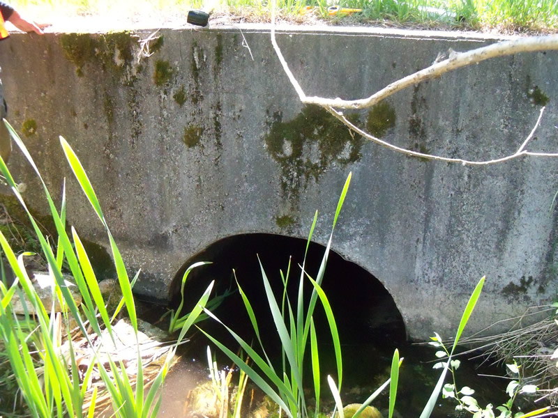
Inlet
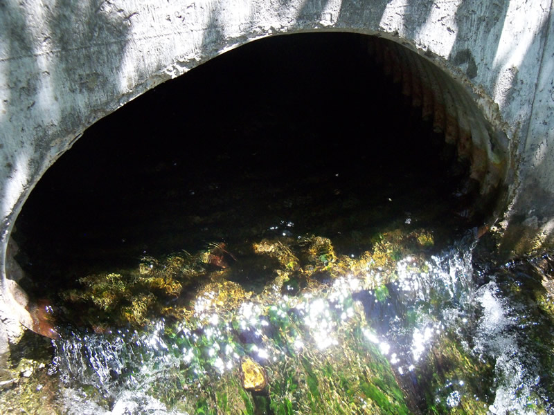
Outlet
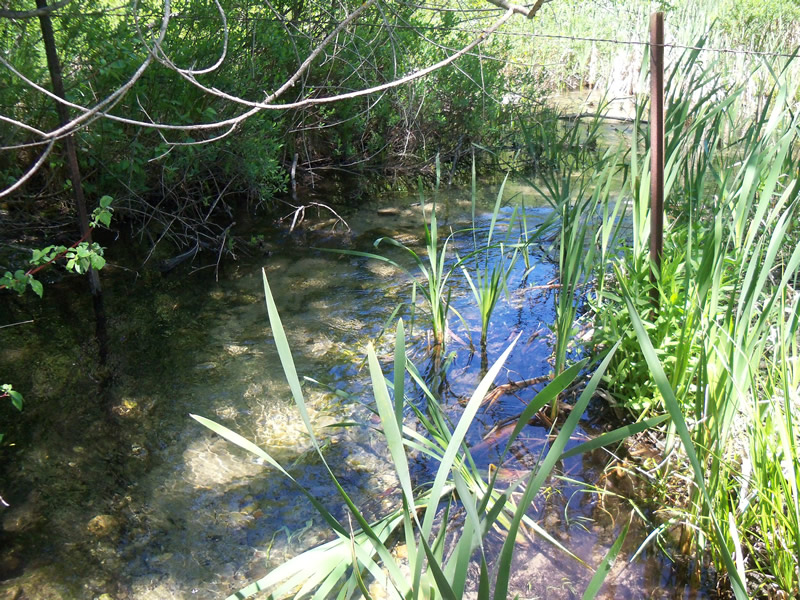
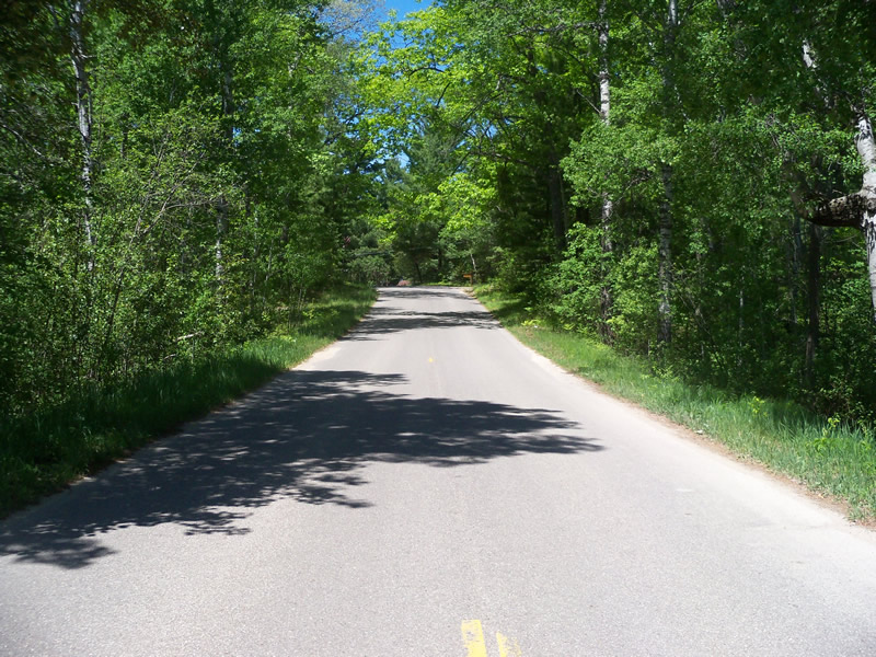
Upstream Conditions
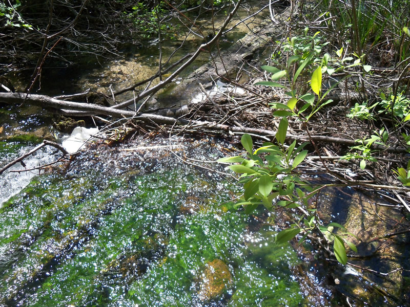
Downstream Conditions
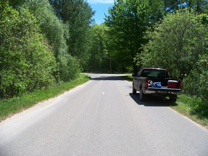
Road Approach - Left
Road Approach - Right
Crossing Information
Type of Crossing: culvert(s)
Number of Structures: 1
Structure Shape: Pipe Arch
Inlet Type: Headwall
Outlet Type: Other
Structure Material: Metal
Structure Substrate: None
General Conditions: Good
Structure Interior: corrugated
Dimensions of Structure: Length 40.6 ft.
, Width 3.8 ft.
, Height 2.3 ft.
Perch Height: 0.3 ft.
Structure Inlet
Water Depth: 0.8 ft.
Embedded Depth of Structure: 0 ft.
Water Velocity*: 1.9 ft./sec.
Structure Outlet
Water Depth: 0.7 ft.
Embedded Depth of Structure: 0 ft.
Water Velocity*: 3.5 ft./sec.
*Water Velocities were measured 0.4 ft. below Surface
(with Meter)
Additional Comments
Outlet is slightly above the stream. The water falls over wood,and there is no pool.
Stream Information
Stream Flow: Less than Bankfull
Scour Pool: Length 0 ft.
, Width 0 ft.
, Depth 0 ft.
Upstream Pond: Length 0 ft.
, Width 0 ft.
, Depth 0 ft.
Riffle Information
Water Depth: 0.7 ft.
Bankfull Width: 26 ft.
Wetted Width: 18.4 ft.
Water Velocity: 1.4 ft./sec.
(Measured with Meter)
Dominant Substrate: Sand
Road Information
Paved
County Road
Road Condition: Good
Road Width at Culvert: 20.4 ft.
Location of Low Point: At Stream
Runoff Path: Roadway
Embankments
Upstream
Fill Depth: 3.2 ft.
Slope: 1:2
Downstream
Fill Depth: 2.7 ft.
Slope: More than 1:2
Approaches
Left Approach
Length: 557.5 ft.
Slope: 1% to 5%
Vegetation: Heavy
LS Factor: 0.512
Erosion: 0.1923 tons/year
Right Approach
Length: 258.3 ft.
Slope: 1% to 5%
Vegetation: Heavy
LS Factor: 0.443
Erosion: 0.0772 tons/year
Erosion Information
Total Erosion at Crossing: 0.2721 tons/year
Extent of Erosion: Minor
Erosion is occurring and corrective actions can be installed to address the problem.
Location of Erosion | Erosion Dimensions | Eroded Material | Material Eroded | Total Erosion | ||
facing downstream | Length | Width | Depth | Reaching Stream? | (tons/year) | |
Left Upstream Ditch |
3.4 ft. |
2.6 ft. |
0.7 ft. |
no |
Sand |
0.0026 |
Summary Information
Fish Passability 0
Fish Passage is an area of concern for this site.
Yes, high velocity at the outlet creates a fish passage barrier.
�