Road Stream Crossing Site AUS_PR121
Au Sable River Watershed, Tributary of Backus Creek
Trask Lake Rd
Millen Twp,
Alcona County
Information collected by:
Site Location
GPS Coordinates: 44.68404
, -83.5359
T26N
R07E
Sec 1
Owned by Private
Fish Passability 0.5
Structure is NOT Perched
Total Erosion: 0.6271 tons/year
Severity: Moderate
Year Inventoried: 2013
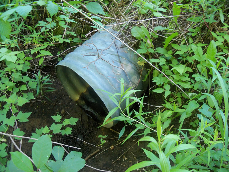
Inlet
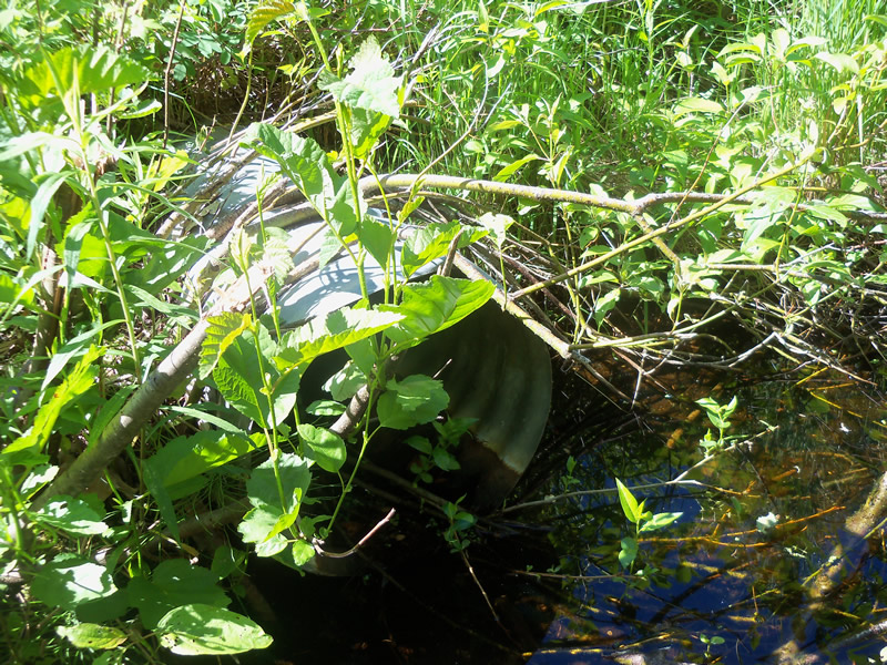
Outlet
Upstream Conditions
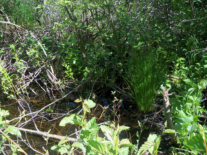
Downstream Conditions
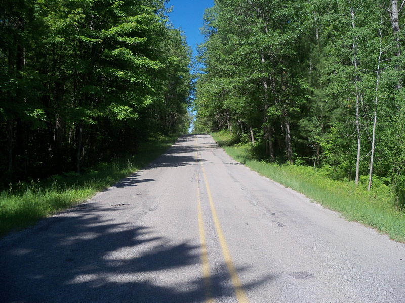
Road Approach - Left
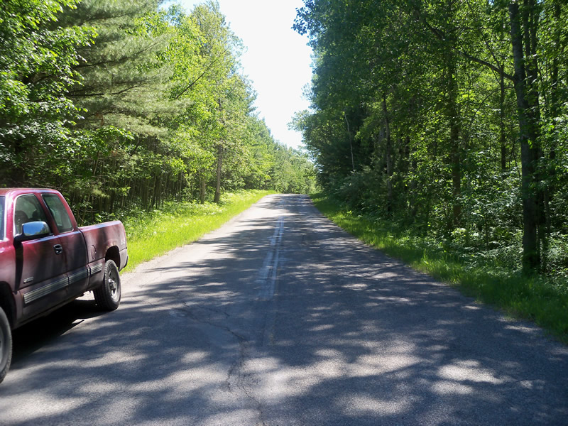
Road Approach - Right
Crossing Information
Type of Crossing: culvert(s)
Number of Structures: 1
Structure Shape: Round
Inlet Type: Projecting
Outlet Type: At Stream Grade
Structure Material: Metal
Structure Substrate: None
General Conditions: Fair
Structure Interior: corrugated
Dimensions of Structure: Length 47.5 ft.
, Width 1.5 ft.
, Height 1.5 ft.
Structure is NOT Perched
Water Depth: 0 ft.
Embedded Depth of Structure: 0 ft.
Water Velocity*: 0 ft./sec.
Structure Outlet
Water Depth: 0.05 ft.
Embedded Depth of Structure: 0 ft.
Water Velocity*: 0 ft./sec.
Additional Comments
This site was found on Trask Lake Road west of Hubbard Lake Road, not where it is marked on the map. Also, there is no riffle as the crossing turns into a swamp.
Stream Information
Stream Flow: None
Scour Pool: Length 0 ft.
, Width 0 ft.
, Depth 0 ft.
Upstream Pond: Length 0 ft.
, Width 0 ft.
, Depth 0 ft.
Riffle Information
Water Depth: 0 ft.
Bankfull Width: 0 ft.
Wetted Width: 0 ft.
Water Velocity: 0 ft./sec.
Road Information
Paved
County Road
Road Condition: Fair
Road Width at Culvert: 23.8 ft.
Location of Low Point: At Stream
Runoff Path: Roadway
Embankments
Upstream
Fill Depth: 2.2 ft.
Slope: More than 1:2
Downstream
Fill Depth: 2.1 ft.
Slope: More than 1:2
Approaches
Left Approach
Length: 1000 ft.
Slope: 1% to 5%
Vegetation: Heavy
LS Factor: 0.57
Erosion: 0.4485 tons/year
Right Approach
Length: 461 ft.
Slope: 1% to 5%
Vegetation: Heavy
LS Factor: 0.492
Erosion: 0.1785 tons/year
Erosion Information
Total Erosion at Crossing: 0.6271 tons/year
Extent of Erosion: Minor
Erosion is occurring and corrective actions can be installed to address the problem.
Location of Erosion | Erosion Dimensions | Eroded Material | Material Eroded | Total Erosion | ||
facing downstream | Length | Width | Depth | Reaching Stream? | (tons/year) | |
Left Downstream Ditch |
0.9 ft. |
0.5 ft. |
0.1 ft. |
no |
Gravel |
0.0001 |
Summary Information
Fish Passability 0.5
A future visit to this site is recommended. To see if there is stream flow at other times of year which would result in fish passage barriers.
These non-native species were observerd at this site: Autumn Olive, Reed Canarygrass?
�