Road Stream Crossing Site AUS_PR062
Au Sable River Watershed, East Branch Pine River
McConnell Rd
Gustin Twp,
Alcona County
Information collected by:
Site Location
GPS Coordinates: 44.96921
, -84.68192
T26N
R08E
Sec 14,15
Owned by Private
Fish Passability 1
Structure is NOT Perched
Total Erosion: 10.8489 tons/year
Severity: Severe
Year Inventoried: 2013
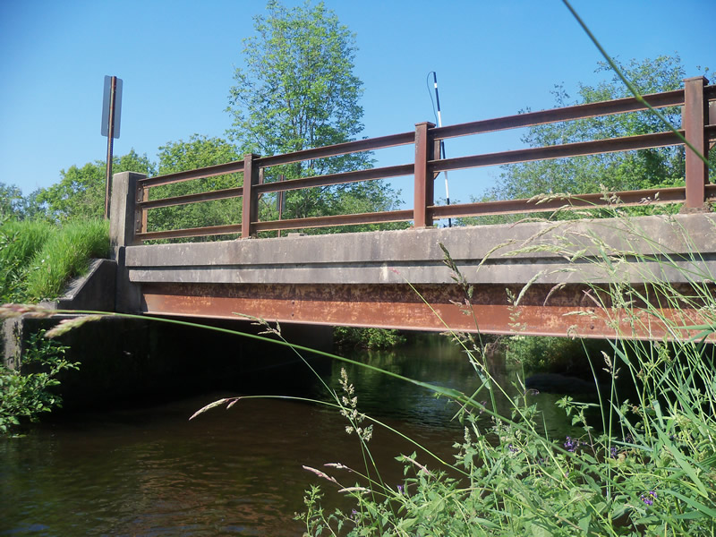
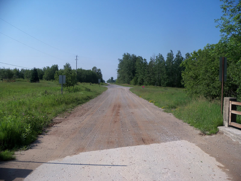
Inlet
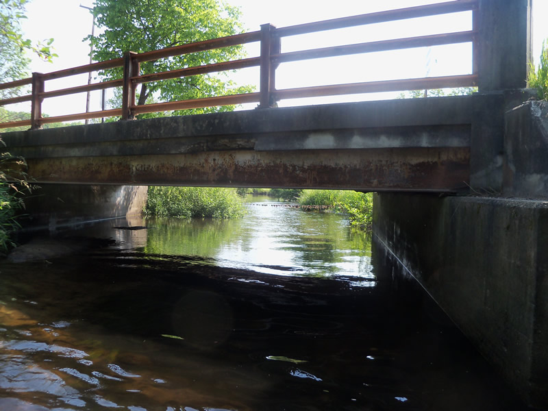
Outlet
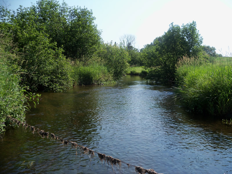
Upstream Conditions
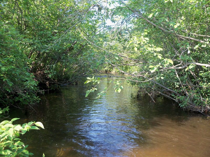
Downstream Conditions
Road Approach - Left
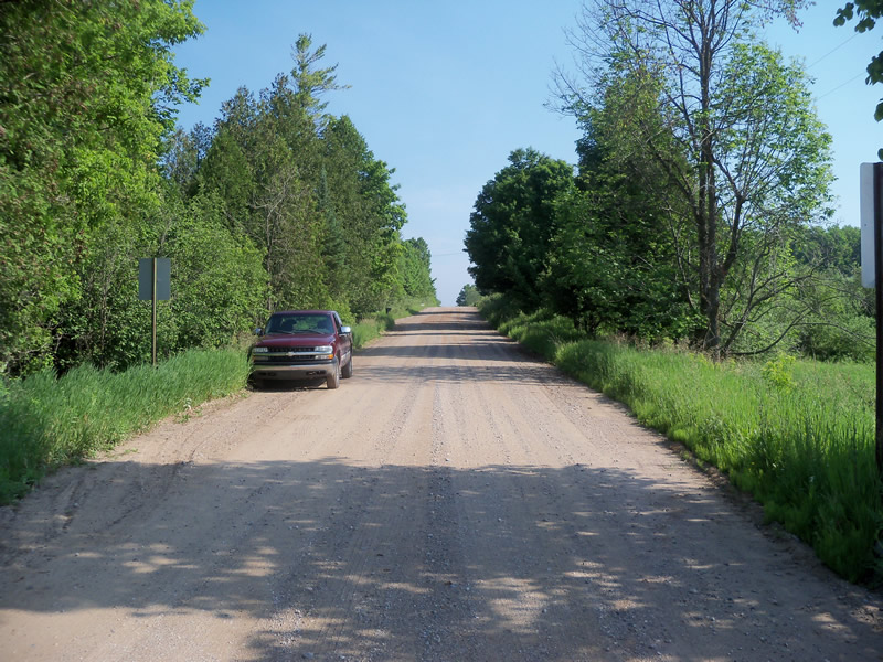
Road Approach - Right
Crossing Information
Type of Crossing: Bridge
Structure Shape: Open Bottom Square/Rectangle
Inlet Type: Other
Outlet Type: At Stream Grade
Structure Material: Metal
Structure Substrate: Mixture
General Conditions: Fair
Structure Interior: smooth
Dimensions of Structure: Length 22.5 ft.
, Width 36 ft.
, Height 5.3 ft.
Structure is NOT Perched
Structure Inlet
Water Depth: 1.8 ft.
Embedded Depth of Structure: 0 ft.
Water Velocity*: 1 ft./sec.
Structure Outlet
Water Depth: 1.3 ft.
Embedded Depth of Structure: 0 ft.
Water Velocity*: 0.5 ft./sec.
*Water Velocities were measured at the Surface
(with Float Test)
Additional Comments
Landowner nearby says that the bridge is going to be replaced soon.
Stream Information
Stream Flow: Less than Bankfull
Scour Pool: Length 0 ft.
, Width 0 ft.
, Depth 0 ft.
Upstream Pond: Length 0 ft.
, Width 0 ft.
, Depth 0 ft.
Riffle Information
Water Depth: 0.6 ft.
Bankfull Width: 30 ft.
Wetted Width: 28 ft.
Water Velocity: 1.2 ft./sec.
(Measured with Float Test)
Dominant Substrate: Cobble
Road Information
Gravel
County Road
Road Condition: Good
Road Width at Culvert: 39.4 ft.
Location of Low Point: At Stream
Runoff Path: Roadway
Embankments
Upstream
Fill Depth: 3.6 ft.
Slope: Vertical
Downstream
Fill Depth: 3.6 ft.
Slope: Vertical
Approaches
Left Approach
Length: 1000 ft.
Slope: 1% to 5%
Vegetation: Heavy
LS Factor: 0.57
Erosion: 6.1868 tons/year
Right Approach
Length: 783.5 ft.
Slope: 1% to 5%
Vegetation: Heavy
LS Factor: 0.548
Erosion: 4.6562 tons/year
Erosion Information
Total Erosion at Crossing: 10.8489 tons/year
Extent of Erosion: Minor
Erosion is occurring and corrective actions can be installed to address the problem.
Location of Erosion | Erosion Dimensions | Eroded Material | Material Eroded | Total Erosion | ||
facing downstream | Length | Width | Depth | Reaching Stream? | (tons/year) | |
Right Approach |
7.7 ft. |
4 ft. |
0.7 ft. |
no |
Sand |
0.0059 |
Summary Information
Fish Passability 1
A future visit to this site is recommended. The crossing seems fine, there are no barriers to fish passage, and there is minor erosion. However, the landowner says it is going to be replaced in the near future so we recommend a future visit to evaluate the new bridge.
These non-native species were observerd at this site: Honeysuckle, Autumn Olive, , Bittersweet Nightshade, burdock
�