Road Stream Crossing Site AUS_PR130
Au Sable River Watershed, Surface Drain
Bean Hill Rd
Millen Twp,
Alcona County
Information collected by:
Site Location
GPS Coordinates: 44.65919
, -83.56485
T26N
R07E
Sec 10,11
Owned by Private
Fish Passability 0.5
Structure is NOT Perched
Total Erosion: 2.267 tons/year
Severity: Moderate
Year Inventoried: 2013
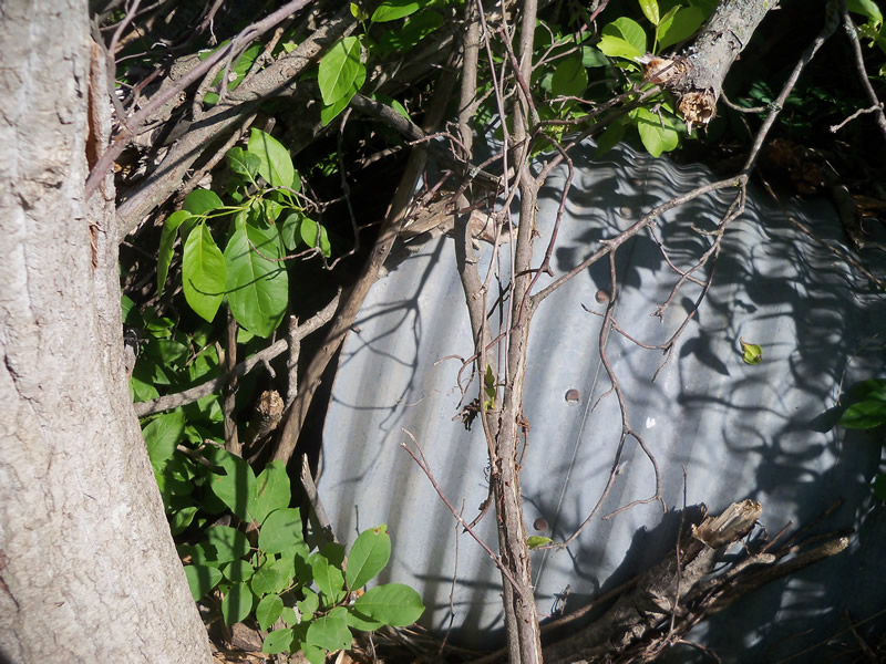
Inlet
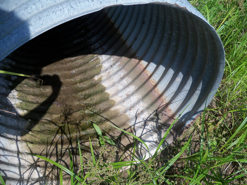
Outlet
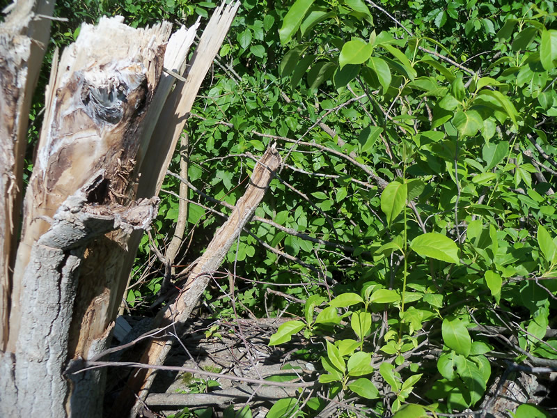
Upstream Conditions
Downstream Conditions
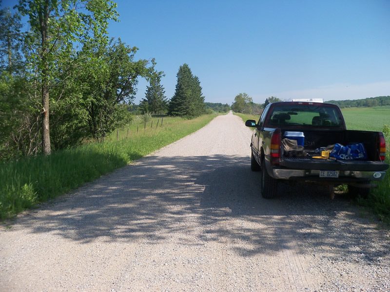
Road Approach - Left
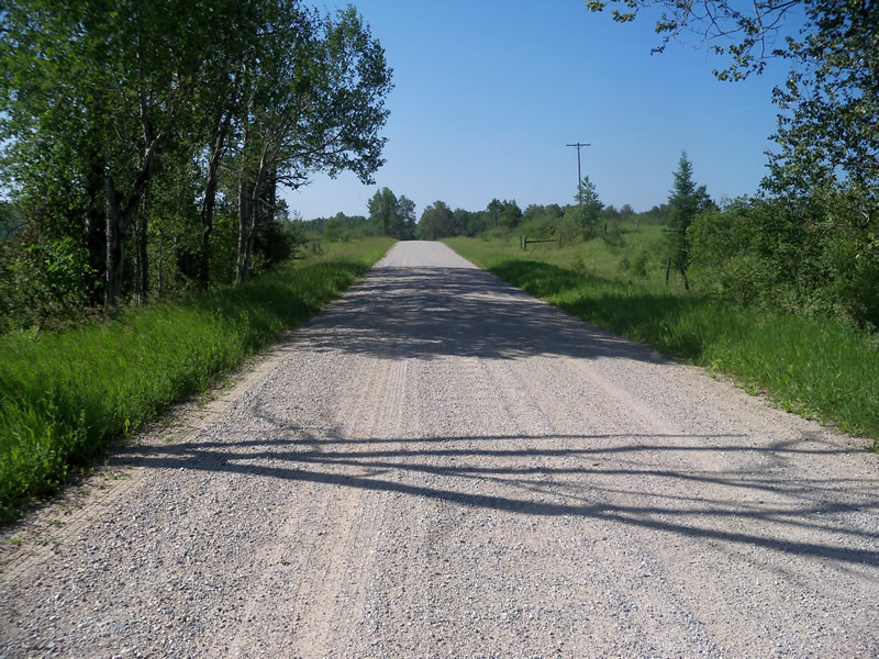
Road Approach - Right
Crossing Information
Type of Crossing: culvert(s)
Number of Structures: 1
Structure Shape: Round
Inlet Type: Projecting
Outlet Type: At Stream Grade
Structure Material: Metal
Structure Substrate: None
General Conditions: Good
Structure Interior: corrugated
Dimensions of Structure: Length 51 ft.
, Width 3 ft.
, Height 3 ft.
Percentage Crushed:
Inlet: 0%
Outlet: 0%
In Pipe: 1% to 25%
Structure is NOT Perched
Water Depth: 0 ft.
Embedded Depth of Structure: 0 ft.
Water Velocity*: 0 ft./sec.
Water Depth: 0 ft.
Embedded Depth of Structure: 0 ft.
Water Velocity*: 0 ft./sec.
Additional Comments
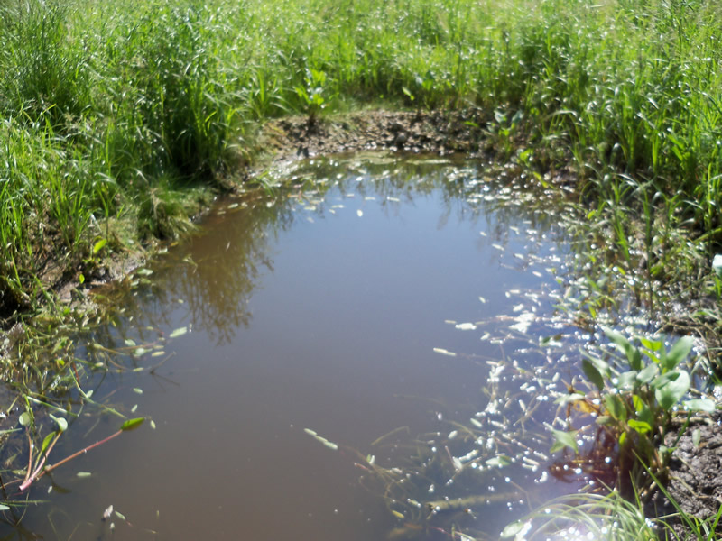
There is no riffle. The water ends in a scour pool. There is no water in the culvert or upstream. Downstream scour pool amy have been dug out or dammed by humans-gravel is piled at the end and is stopping stream flow further down. Agricultural fields are downstream of the scour pool.
Stream Information
Stream Flow: None
Scour Pool: Length 20 ft.
, Width 9.9 ft.
, Depth 1.5 ft.
Upstream Pond: Length 0 ft.
, Width 0 ft.
, Depth 0 ft.
Riffle Information
Water Depth: 0 ft.
Bankfull Width: 0 ft.
Wetted Width: 0 ft.
Water Velocity: 0 ft./sec.
Road Information
Gravel
County Road
Road Condition: Good
Road Width at Culvert: 19.5 ft.
Location of Low Point: At Stream
Runoff Path: Roadway
Embankments
Upstream
Fill Depth: 2.8 ft.
Slope: More than 1:2
Downstream
Fill Depth: 2.4 ft.
Slope: More than 1:2
Approaches
Left Approach
Length: 394 ft.
Slope: 1% to 5%
Vegetation: Heavy
LS Factor: 0.479
Erosion: 1.0134 tons/year
Right Approach
Length: 472 ft.
Slope: 1% to 5%
Vegetation: Heavy
LS Factor: 0.494
Erosion: 1.2536 tons/year
Erosion Information
Total Erosion at Crossing: 2.267 tons/year
Summary Information
Fish Passability 0.5
A future visit to this site is recommended. To evaluate the culvert when there is water in it and see if there is a stream.
These non-native species were observerd at this site: Sweet Clover, Autumn Olive
�