Road Stream Crossing Site AUS_CR109
Au Sable River Watershed, West Branch Big Creek
Snowmobile Trail
Lovells Twp,
Crawford County
Information collected by:
Site Location
GPS Coordinates: 44.96926
, -84.68189
T28N
R01W
Sec 4
Owned by State
Fish Passability 1
Structure is NOT Perched
Total Erosion: 0.9434 tons/year
Severity: Moderate
Year Inventoried: 2012
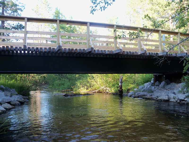
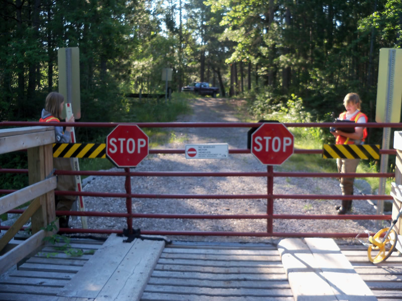
Inlet
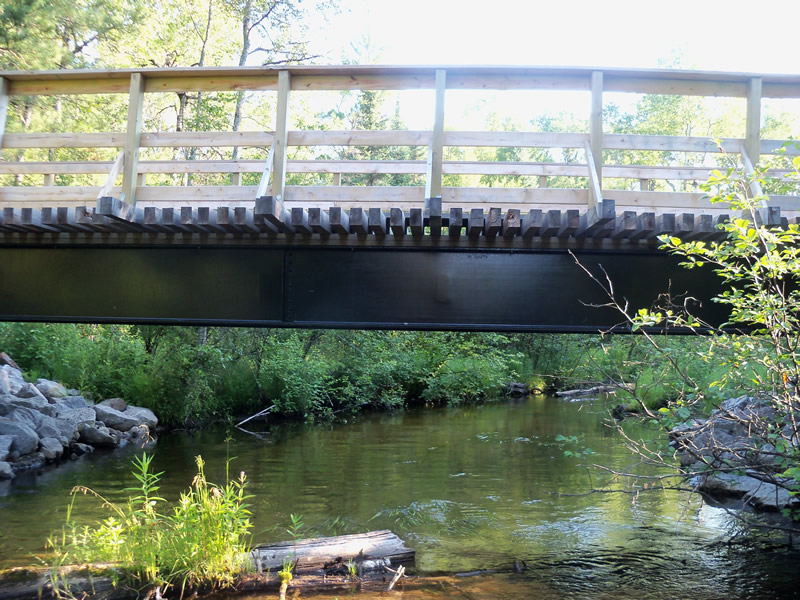
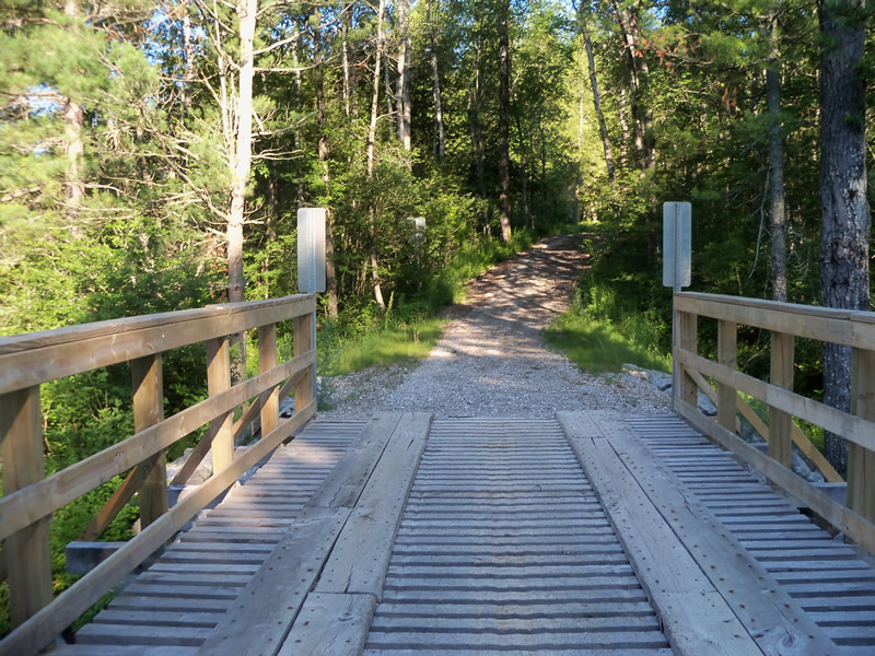
Outlet
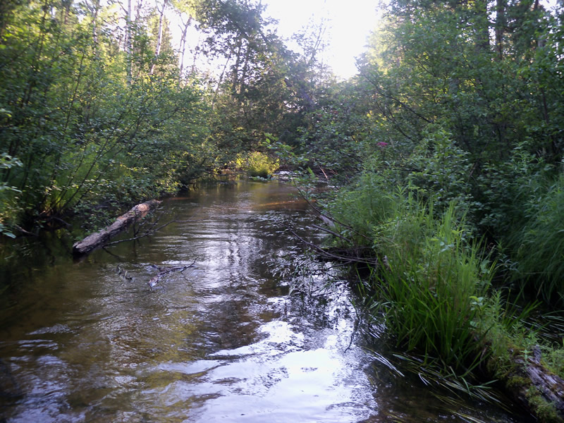
Upstream Conditions
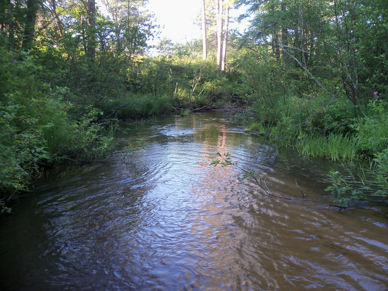
Downstream Conditions
Road Approach - Left
Road Approach - Right
Crossing Information
Type of Crossing: Bridge
Structure Shape: Open Bottom Square/Rectangle
Inlet Type: Other
Outlet Type: Outlet Apron
Structure Material: Wood
Structure Substrate: Sand
General Conditions: New
Structure Interior: smooth
Dimensions of Structure: Length 12 ft.
, Width 42 ft.
, Height 5.8 ft.
Structure is NOT Perched
Structure Inlet
Water Depth: 0.7 ft.
Embedded Depth of Structure: 0 ft.
Water Velocity*: 0.6 ft./sec.
Structure Outlet
Water Depth: 0.7 ft.
Embedded Depth of Structure: 0 ft.
Water Velocity*: 0.8 ft./sec.
*Water Velocities were measured at the Surface
(with Meter)
Stream Information
Stream Flow: Less than Bankfull
Scour Pool: Length 0 ft.
, Width 0 ft.
, Depth 0 ft.
Upstream Pond: Length 0 ft.
, Width 0 ft.
, Depth 0 ft.
Riffle Information
Water Depth: 0.5 ft.
Bankfull Width: 24 ft.
Wetted Width: 22.7 ft.
Water Velocity: 1.2 ft./sec.
(Measured with Meter)
Dominant Substrate: Sand
Road Information
Gravel
Other Road
Road Condition: Fair
Road Width at Culvert: 12 ft.
Location of Low Point: At Stream
Runoff Path: Roadway
Embankments
Upstream
Fill Depth: 3 ft.
Slope: Vertical
Downstream
Fill Depth: 3 ft.
Slope: Vertical
Approaches
Left Approach
Length: 170 ft.
Slope: 1% to 5%
Vegetation: Heavy
LS Factor: 0.412
Erosion: 0.2315 tons/year
Right Approach
Length: 440 ft.
Slope: 1% to 5%
Vegetation: Heavy
LS Factor: 0.488
Erosion: 0.7098 tons/year
Erosion Information
Total Erosion at Crossing: 0.9434 tons/year
Extent of Erosion: Minor
Erosion is occurring and corrective actions can be installed to address the problem.
Location of Erosion | Erosion Dimensions | Eroded Material | Material Eroded | Total Erosion | ||
facing downstream | Length | Width | Depth | Reaching Stream? | (tons/year) | |
Left Approach |
4 ft. |
2.1 ft. |
0.4 ft. |
no |
Gravel |
0.0016 |
Left Approach |
2 ft. |
1.5 ft. |
0.2 ft. |
no |
Gravel |
0.0004 |
Summary Information
Fish Passability 1
These non-native species were observerd at this site: Spotted Knapweed, Sweet Clover
�