Road Stream Crossing Site AUS_IS011
Au Sable River Watershed, Dead Au Sable River
Johnson Rd
AuSable Twp,
Iosco County
Information collected by:
Site Location
GPS Coordinates: 44.39566
, -83.3345
T23N
R09E
Sec 10,15
Owned by Private
Structure is NOT Perched
Total Erosion: 0.1584 tons/year
Severity: Minor
Year Inventoried: 2012
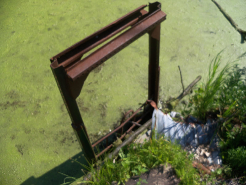
Inlet
Outlet
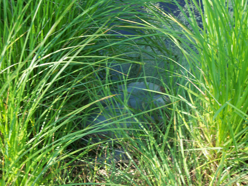
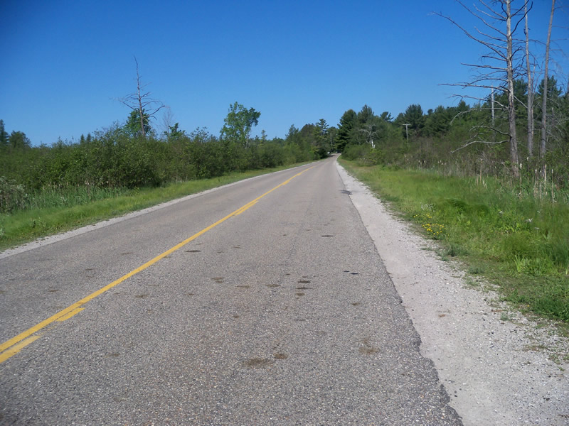
Upstream Conditions
Downstream Conditions
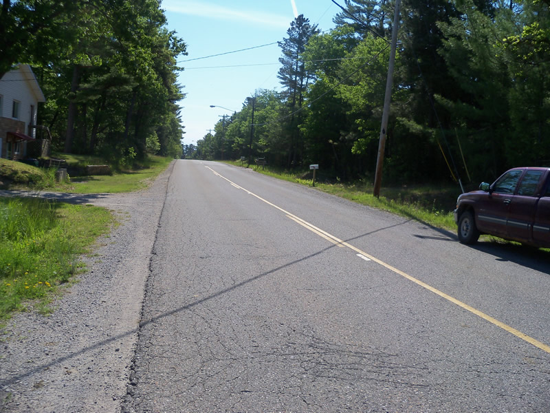
Road Approach - Left
Road Approach - Right
Crossing Information
Type of Crossing: culvert(s)
Number of Structures: 1
Structure Shape: Round
Inlet Type: Trash Rack
Outlet Type: At Stream Grade
Structure Material: Metal
Structure Substrate: Mixture
General Conditions: Poor
Structure Interior: corrugated
Dimensions of Structure: Length 45 ft.
, Width 2 ft.
, Height 2 ft.
Percentage Plugged:
Inlet: 0%
Outlet: 0%
In Pipe: 26% to 50%
Percentage Crushed:
Inlet: 26% to 50%
Outlet: 0%
In Pipe: 0%
Structure is NOT Perched
Structure Inlet
Water Depth: 1 ft.
Embedded Depth of Structure: 0 ft.
Water Velocity*: 0.1 ft./sec.
Structure Outlet
Water Depth: 1.5 ft.
Embedded Depth of Structure: 0 ft.
Water Velocity*: 0 ft./sec.
*Water Velocities were measured at the Surface
(with Meter)
Additional Comments
Resident nearby told us that the culvert is often plugged and is blocking flow in lower parts of the stream, causing negative impacts.
Stream Information
Stream Flow: Less than 1/2 Bankfull
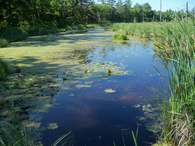
Scour Pool: Length 85 ft.
, Width 80.8 ft.
, Depth 2 ft.
Upstream Pond: Length 83 ft.
, Width 71.5 ft.
, Depth 1.5 ft.
Road Information
Paved
County Road
Road Condition: Good
Road Width at Culvert: 29 ft.
Location of Low Point: Other
Runoff Path: Roadway
Embankments
Upstream
Fill Depth: 1 ft.
Slope: More than 1:2
Downstream
Fill Depth: 2.1 ft.
Slope: More than 1:2
Approaches
Left Approach
Length: 350.1 ft.
Slope: 1% to 5%
Vegetation: Heavy
LS Factor: 0.47
Erosion: 0.1578 tons/year
Right Approach
Length: 0 ft.
Slope: Less Than 1%
Vegetation: Heavy
LS Factor: 0.05
Erosion: 0 tons/year
Erosion Information
Total Erosion at Crossing: 0.1584 tons/year
Extent of Erosion: Minor
Erosion is occurring and corrective actions can be installed to address the problem.
Location of Erosion | Erosion Dimensions | Eroded Material | Material Eroded | Total Erosion | ||
facing downstream | Length | Width | Depth | Reaching Stream? | (tons/year) | |
Right Upstream Ditch |
3 ft. |
6 ft. |
0.2 ft. |
yes |
Gravel |
0.0006 |
Summary Information
Fish Passage is an area of concern for this site.
Yes, the culvert is in poor shape, very crushed, is small and partly plugged. There is a large scour pool and an upstream pond.
A future visit to this site is recommended. Because of the poor condition of the crossing described above.
These non-native species were observerd at this site: Sweet Clover, Mullein, Spotted Knapweed
�