Road Stream Crossing Site AUS_IS012
Au Sable River Watershed, Inlet to Grass Lake
Grass Lake Rd
AuSable Twp,
Iosco County
Information collected by:
Site Location
GPS Coordinates: 44.40281
, -83.35997
T23N
R09E
Sec 8,9
Owned by Private
Fish Passability 0.9
Structure is NOT Perched
Total Erosion: 0.4547 tons/year
Severity: Moderate
Year Inventoried: 2012
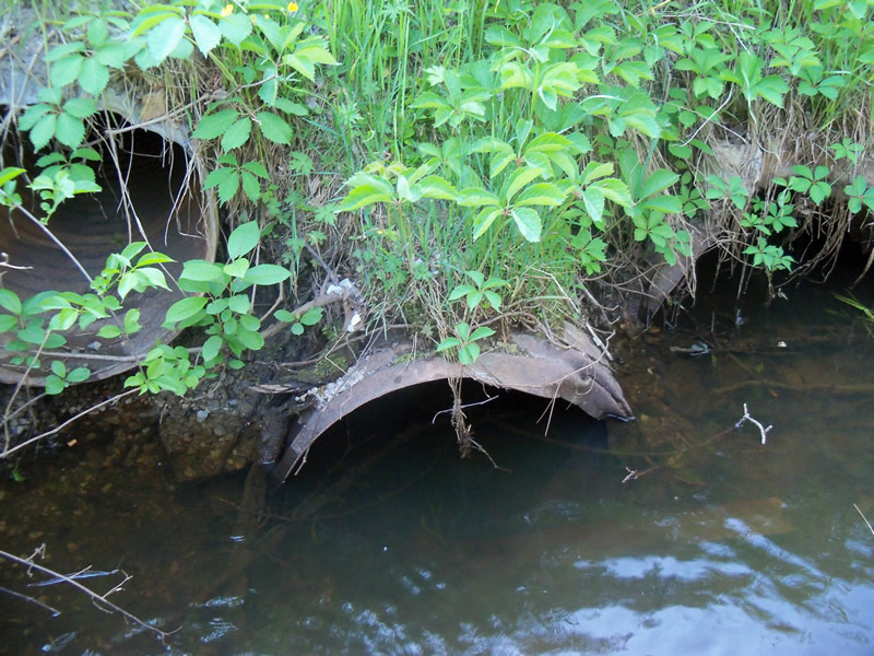
Inlet
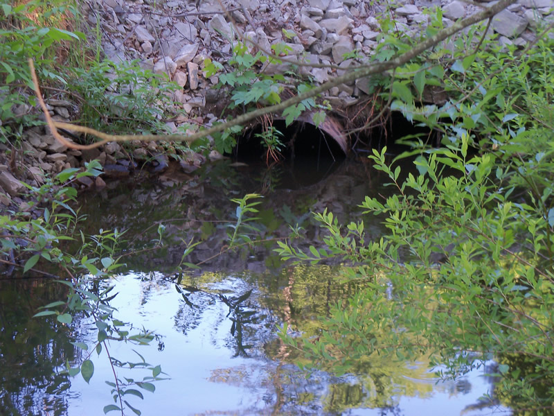
Outlet
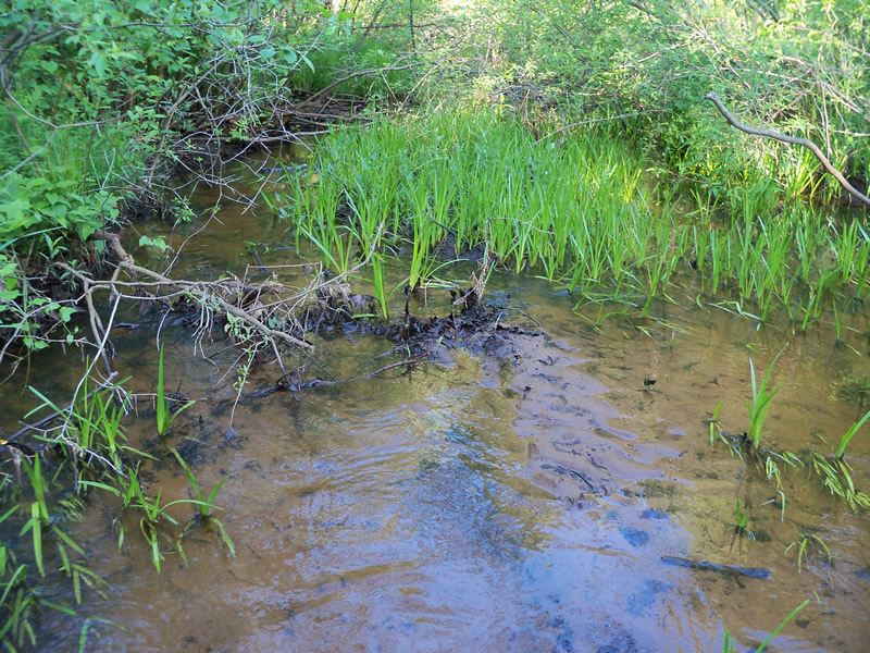
Upstream Conditions
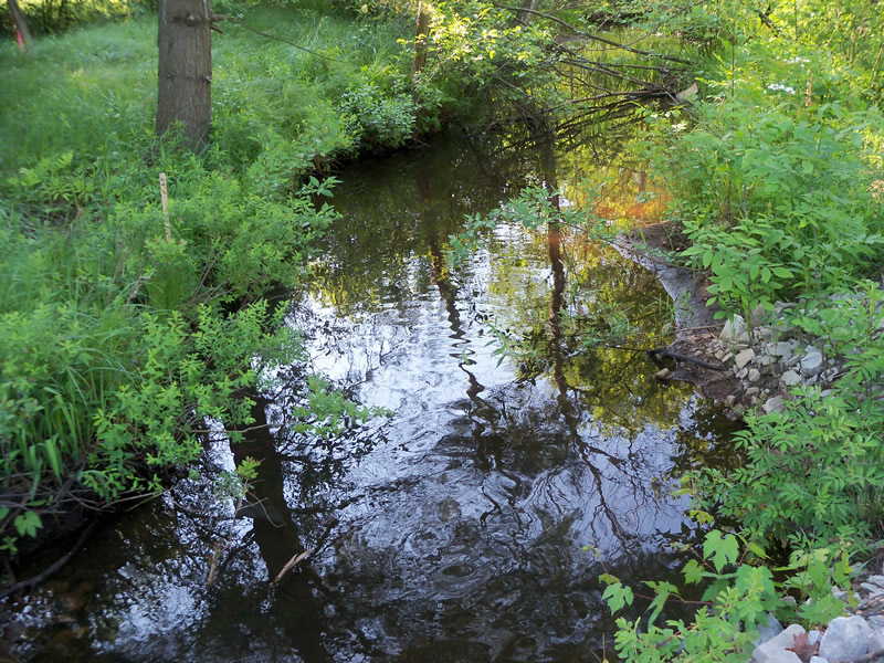
Downstream Conditions
Road Approach - Left
Road Approach - Right
Crossing Information
Type of Crossing: culvert(s)
Number of Structures: 3
Structure Shape: Round
Inlet Type: Projecting
Outlet Type: At Stream Grade
Structure Material: Metal
Structure Substrate: None
General Conditions: Poor
Multiple Culverts/Spans | ||||
Culvert/Span | Width | Length | Height | Material |
1 |
2 ft. |
22.5 ft. |
2 ft. |
Metal |
2 |
2 ft. |
22.5 ft. |
2 ft. |
Metal |
3 |
2 ft. |
22.5 ft. |
2 ft. |
Metal |
Structure Interior: corrugated
Dimensions of Structure: Length 22.5 ft.
, Width 2 ft.
, Height 2 ft.
Percentage Crushed:
Inlet: 26% to 50%
Outlet: 0%
In Pipe: 0%
Structure is NOT Perched
Structure Inlet
Water Depth: 1.8 ft.
Embedded Depth of Structure: 0 ft.
Water Velocity*: 0.8 ft./sec.
Structure Outlet
Water Depth: 1.2 ft.
Embedded Depth of Structure: 0 ft.
Water Velocity*: 0.4 ft./sec.
*Water Velocities were measured at the Surface
(with Meter)
Additional Comments
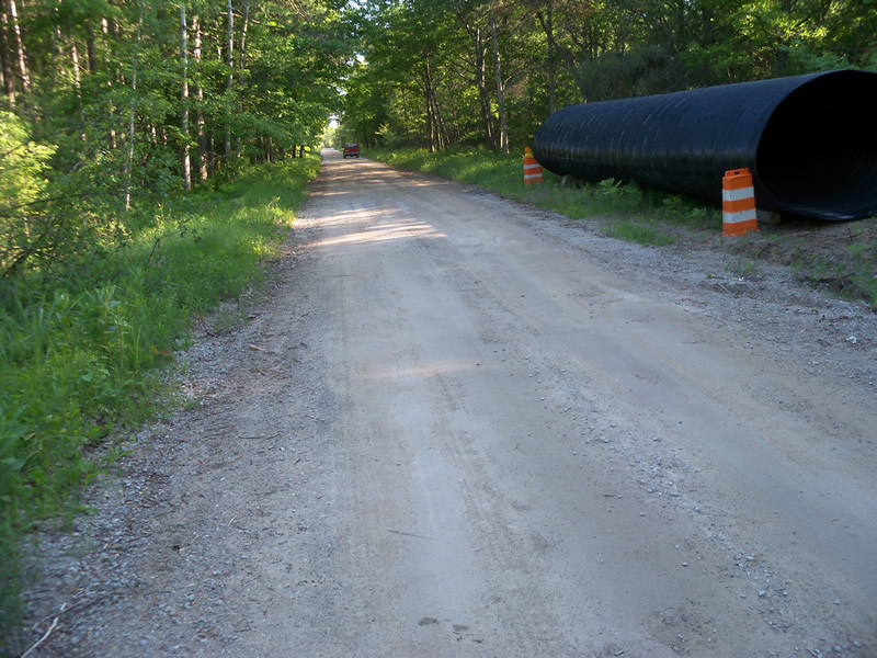
There is a very large, plastic culvert sitting along the road near the culvert-it appears that there may be preparations to replace the three culverts currently in the crossing with this one. Culvert 1 is set higher than the others and isn't carrying any water.
Stream Information
Stream Flow: Less than Bankfull
Scour Pool: Length 9.5 ft.
, Width 14.5 ft.
, Depth 1.9 ft.
Upstream Pond: Length 10 ft.
, Width 11 ft.
, Depth 1.6 ft.
Riffle Information
Water Depth: 0.5 ft.
Bankfull Width: 21.5 ft.
Wetted Width: 14 ft.
Water Velocity: 0.6 ft./sec.
(Measured with Meter)
Dominant Substrate: Sand
Road Information
Gravel
County Road
Road Condition: Fair
Road Width at Culvert: 15 ft.
Location of Low Point: At Stream
Runoff Path: Roadway
Embankments
Upstream
Fill Depth: 3.2 ft.
Slope: Vertical
Downstream
Fill Depth: 2.3 ft.
Slope: 1:1.5
Approaches
Left Approach
Length: 1000 ft.
Slope: Less Than 1%
Vegetation: Partial
LS Factor: 0.06
Erosion: 0.2479 tons/year
Right Approach
Length: 1000 ft.
Slope: Less Than 1%
Vegetation: Heavy
LS Factor: 0.05
Erosion: 0.2066 tons/year
Erosion Information
Total Erosion at Crossing: 0.4547 tons/year
Extent of Erosion: Minor
Erosion is occurring and corrective actions can be installed to address the problem.
Notes: It looks like rocks and gravel have been put over the erosion, along edges of culvert to help stabilize the erosion.
Location of Erosion | Erosion Dimensions | Eroded Material | Material Eroded | Total Erosion | ||
facing downstream | Length | Width | Depth | Reaching Stream? | (tons/year) | |
Right Downstream Streambank |
2.4 ft. |
0.7 ft. |
0.1 ft. |
no |
Gravel |
0.0002 |
Summary Information
Fish Passability 0.9
A future visit to this site is recommended. To see if the culverts are replaced with the new culvert and if this improves the crossing.
These non-native species were observerd at this site: Japanese barberry, shrubby honeysuckle, oriental bittersweet?
�