Road Stream Crossing Site AUS_IS005
Au Sable River Watershed, Surface Drain
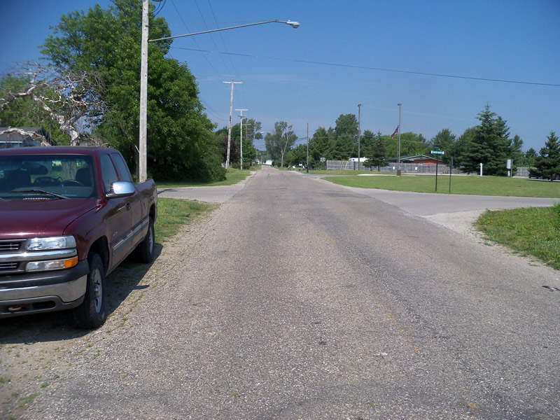
Second Street
AuSable Twp,
Iosco County
Information collected by:
Site Location
GPS Coordinates: 44.450637
, -83.32689
T23N
R09E
Sec 10
Owned by Private
Perch Height: 1.7 ft.
Total Erosion: 0.0257 tons/year
Severity: Minor
Year Inventoried: 2012
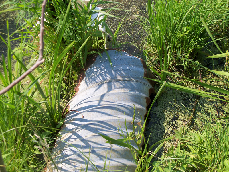
Inlet
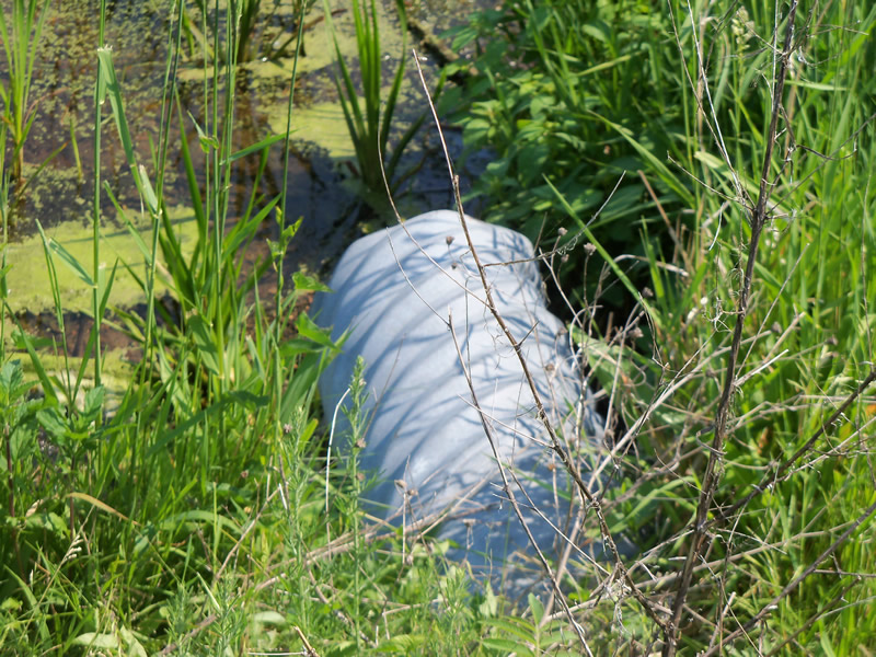
Outlet
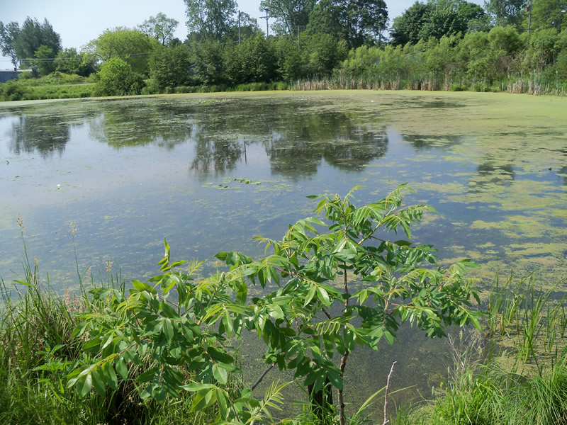
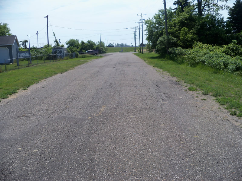
Upstream Conditions
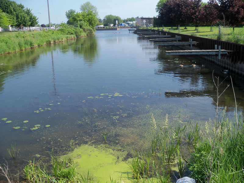
Downstream Conditions
Road Approach - Left
Road Approach - Right
Crossing Information
Type of Crossing: culvert(s)
Number of Structures: 1
Structure Shape: Round
Inlet Type: Projecting
Outlet Type: Freefall into Pool
Structure Material: Metal
Structure Substrate: None
General Conditions: Poor
Structure Interior: corrugated
Structure is Rusted through
Dimensions of Structure: Length 70 ft.
, Width 1.5 ft.
, Height 1.5 ft.
Percentage Plugged:
Inlet: 1% to 25%
Outlet: 1% to 25%
In Pipe: 0%
Perch Height: 1.7 ft.
Structure Inlet
Water Depth: 0.6 ft.
Embedded Depth of Structure: 0 ft.
Water Velocity*: 0.3 ft./sec.
Structure Outlet
Water Depth: 0.1 ft.
Embedded Depth of Structure: 0 ft.
Water Velocity*: 3 ft./sec.
*Water Velocities were measured at the Surface
(with Meter)
Additional Comments
Culvert inlet is very rusty-the sides are rusted through along the entire length that is sticking into the water. Culvert is between a pond and a man made channel for a marina-not really a stream. No riffle because the channel enters the Au Sable River shortly beyond the outlet. The upstream pond was to deep to measure the depth in.
Stream Information
Stream Flow: Less than Bankfull
Scour Pool: Length 0 ft.
, Width 0 ft.
, Depth 0 ft.
Upstream Pond: Length 204.6 ft.
, Width 128 ft.
Road Information
Paved
Town Road
Road Condition: Poor
Road Width at Culvert: 24.1 ft.
Location of Low Point: At Stream
Runoff Path: Roadway
Embankments
Upstream
Fill Depth: 2.9 ft.
Slope: More than 1:2
Downstream
Fill Depth: 3.9 ft.
Slope: More than 1:2
Approaches
Left Approach
Length: 304.1 ft.
Slope: Less Than 1%
Vegetation: Heavy
LS Factor: 0.05
Erosion: 0.0121 tons/year
Right Approach
Length: 341.1 ft.
Slope: Less Than 1%
Vegetation: Heavy
LS Factor: 0.05
Erosion: 0.0136 tons/year
Erosion Information
Total Erosion at Crossing: 0.0257 tons/year
Summary Information
Fish Passage is an area of concern for this site.
Yes, because the outlet is perched and is a barrier to fish passage.
A future visit to this site is recommended. Because the culvert is very rusty and there is a large upstream pond and because the outlet is perched.
These non-native species were observerd at this site: Spotted Knapweed
�