Road Stream Crossing Site AUS_PR018
Au Sable River Watershed, Tributary of Van Etten Creek
Barlow Rd
Mikado Twp,
Alcona County
Information collected by:
Site Location
GPS Coordinates: 44.55471
, -83.40179
T25N
R08E
Sec 13
Owned by Private
Fish Passability 0
Perch Height: 0.1 ft.
Total Erosion: 0 tons/year
Severity: Severe
Year Inventoried: 2012
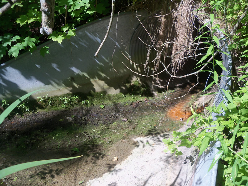
Inlet
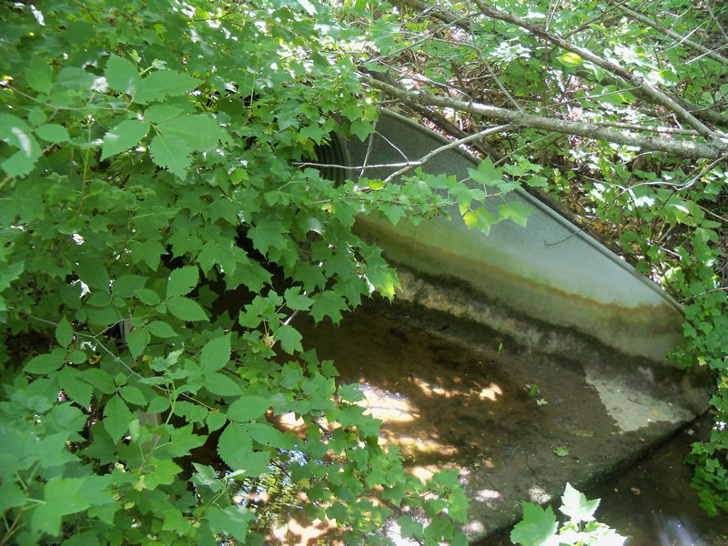
Outlet
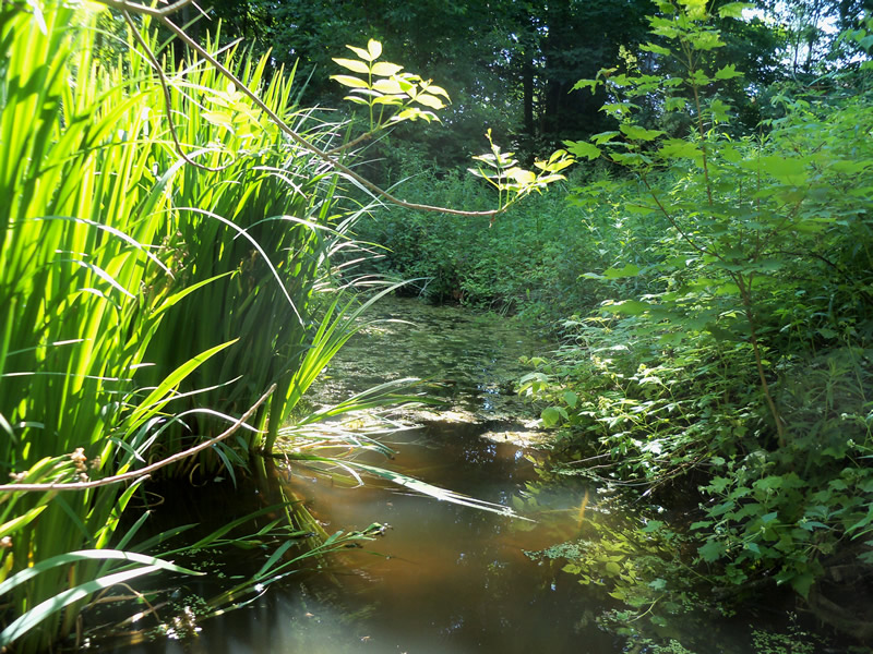
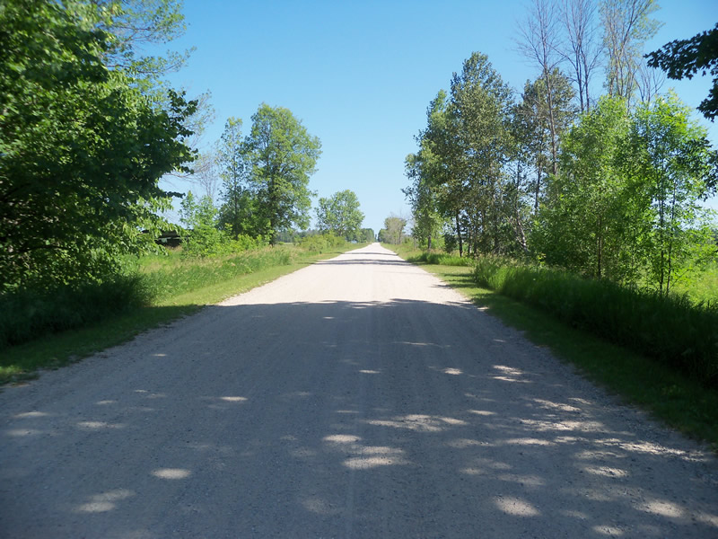
Upstream Conditions
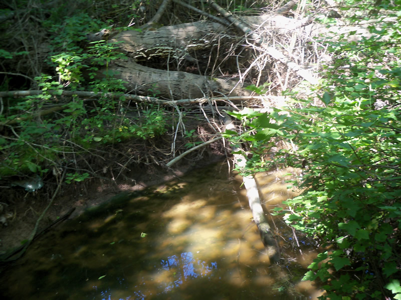
Downstream Conditions
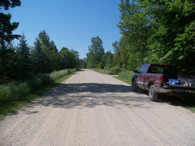
Road Approach - Left
Road Approach - Right
Crossing Information
Type of Crossing: culvert(s)
Number of Structures: 1
Structure Shape: Round
Inlet Type: Apron
Outlet Type: Outlet Apron
Structure Material: Metal
Structure Substrate: None
General Conditions: Fair
Structure Interior: corrugated
Dimensions of Structure: Length 72 ft.
, Width 4 ft.
, Height 4 ft.
Perch Height: 0.1 ft.
Water Depth: 0 ft.
Embedded Depth of Structure: 0 ft.
Water Velocity*: 0 ft./sec.
Structure Outlet
Water Depth: 0.2 ft.
Embedded Depth of Structure: 0 ft.
Water Velocity*: 0 ft./sec.
Additional Comments
Bottom of culvert on both inlet and outlet is not low enough. Water cannot move through culvert. Downstream is dried up.
Stream Information
Stream Flow: None
Scour Pool: Length 0 ft.
, Width 0 ft.
, Depth 0 ft.
Upstream Pond: Length 0 ft.
, Width 0 ft.
, Depth 0 ft.
Riffle Information
Water Depth: 0 ft.
Bankfull Width: 9.4 ft.
Wetted Width: 0 ft.
Water Velocity: 0 ft./sec.
Dominant Substrate: Gravel
Road Information
Gravel
County Road
Road Condition: Good
Road Width at Culvert: 10.5 ft.
Location of Low Point: Other
Runoff Path: Roadway
Embankments
Upstream
Fill Depth: 4.8 ft.
Slope: More than 1:2
Downstream
Fill Depth: 5 ft.
Slope: More than 1:2
Approaches
Left Approach
Length: 0 ft.
Slope: Less Than 1%
Vegetation: Heavy
LS Factor: 0.05
Erosion: 0 tons/year
Right Approach
Length: 0 ft.
Slope: Less Than 1%
Vegetation: Heavy
LS Factor: 0.05
Erosion: 0 tons/year
Erosion Information
Total Erosion at Crossing: 0 tons/year
Summary Information
Fish Passability 0
Fish Passage is an area of concern for this site.
Water is not moving through culvert-fish passage barrier.
A future visit to this site is recommended. To check if water levels are higher at other times. See above answer.
�