Road Stream Crossing Site AUS_PR017
Au Sable River Watershed, Tributary of Van Etten Creek
Wissmiller Rd
Mikado Twp,
Alcona County
Information collected by:
Site Location
GPS Coordinates: 44.56931
, -83.40868
T25N
R08E
Sec 12,13
Owned by Private
Fish Passability 0.5
Structure is NOT Perched
Total Erosion: 0.624 tons/year
Severity: Moderate
Year Inventoried: 2012
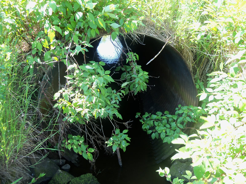
Inlet
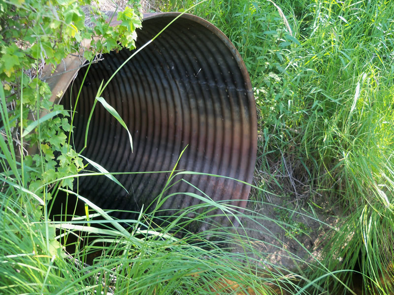
Outlet
Upstream Conditions
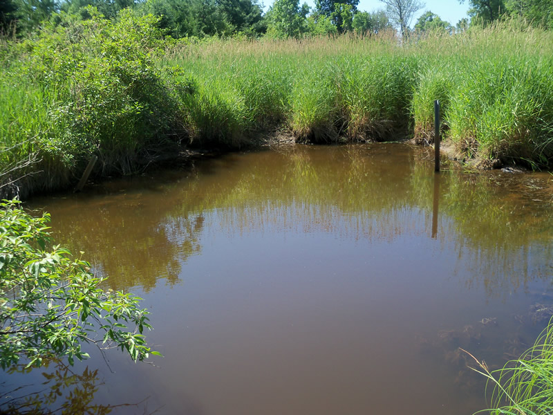
Downstream Conditions
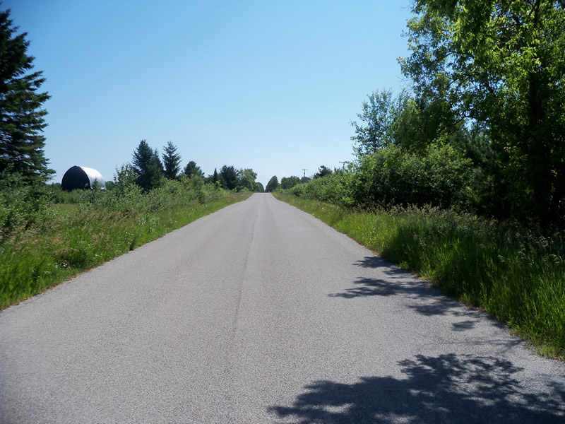
Road Approach - Left
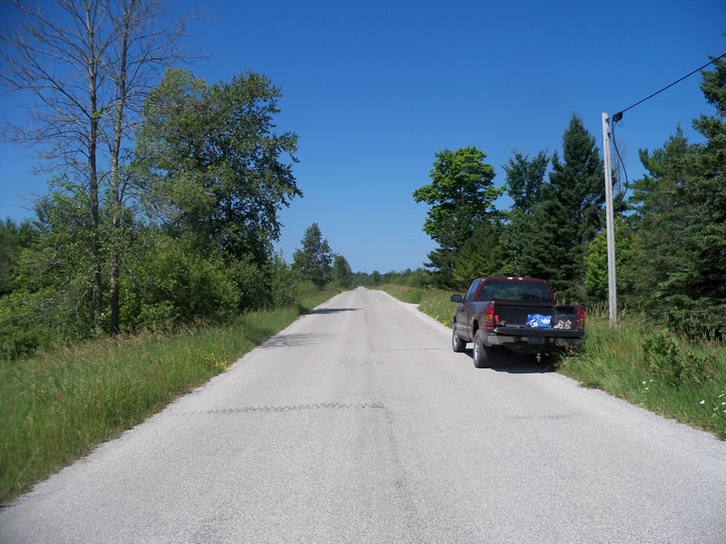
Road Approach - Right
Crossing Information
Type of Crossing: culvert(s)
Number of Structures: 1
Structure Shape: Round
Inlet Type: Projecting
Outlet Type: At Stream Grade
Structure Material: Metal
Structure Substrate: None
General Conditions: Fair
Structure Interior: corrugated
Structure is Rusted through
Dimensions of Structure: Length 40.5 ft.
, Width 5 ft.
, Height 5 ft.
Percentage Crushed:
Inlet: 0%
Outlet: 0%
In Pipe: 1% to 25%
Structure is NOT Perched
Structure Inlet
Water Depth: 0.4 ft.
Embedded Depth of Structure: 0 ft.
Water Velocity*: 0.1 ft./sec.
Structure Outlet
Water Depth: 0.2 ft.
Embedded Depth of Structure: 0 ft.
Water Velocity*: 0.1 ft./sec.
*Water Velocities were measured at the Surface
(with Meter)
Additional Comments
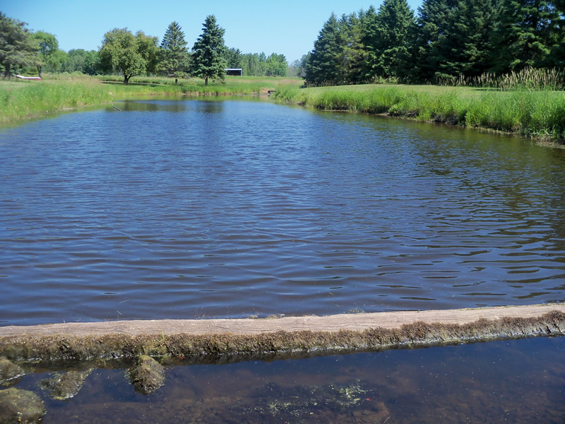
There is a dam above the inlet that is approximately 30 feet long, creating an approximately 200 foot long pond on the private property there. The dam is not letting much water through.
Stream Information
Stream Flow: Less than Bankfull
Scour Pool: Length 35 ft.
, Width 21 ft.
, Depth 1.6 ft.
Upstream Pond: Length 0 ft.
, Width 0 ft.
, Depth 0 ft.
Riffle Information
Water Depth: 0.2 ft.
Bankfull Width: 6.3 ft.
Wetted Width: 3.5 ft.
Water Velocity: 0.2 ft./sec.
(Measured with Meter)
Dominant Substrate: Gravel
Road Information
Paved
County Road
Road Condition: Good
Road Width at Culvert: 22 ft.
Location of Low Point: At Stream
Runoff Path: Roadway
Embankments
Upstream
Fill Depth: 3.3 ft.
Slope: More than 1:2
Downstream
Fill Depth: 2.7 ft.
Slope: More than 1:2
Approaches
Left Approach
Length: 1000 ft.
Slope: 1% to 5%
Vegetation: Heavy
LS Factor: 0.57
Erosion: 0.4145 tons/year
Right Approach
Length: 562 ft.
Slope: 1% to 5%
Vegetation: Heavy
LS Factor: 0.512
Erosion: 0.2094 tons/year
Erosion Information
Total Erosion at Crossing: 0.624 tons/year
Summary Information
Fish Passability 0.5
Fish Passage is an area of concern for this site.
Yes, the upstream has been dammed up by landowners, blocking stream flow.
A future visit to this site is recommended. To check on dam/remove dam.
These non-native species were observerd at this site: Sweet Clover, Spotted Knapweed, Autumn Olive, Reed Canarygrass?
�