Road Stream Crossing Site AUS_CR002
Au Sable River Watershed, Bradford Creek
Twin Peaks
Frederic Twp,
Crawford County
Information collected by:
Site Location
GPS Coordinates: 44.83222
, -84.75327
T28N
R04W
Sec 11
Owned by Private
Fish Passability 0.5
Structure is NOT Perched
Total Erosion: 4.2434 tons/year
Severity: Severe
Year Inventoried: 2013
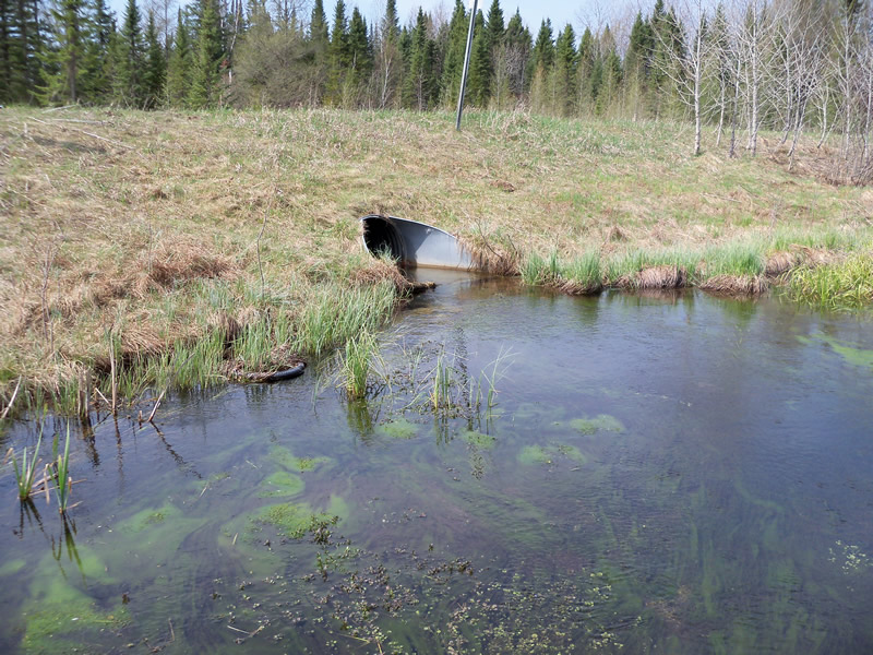
Inlet
Downstream Conditions
Crossing Information
Type of Crossing: culvert(s)
Number of Structures: 1
Structure Shape: Round
Inlet Type: Apron
Outlet Type: Outlet Apron
Structure Material: Metal
Structure Substrate: None
General Conditions: Good
Structure Interior: corrugated
Dimensions of Structure: Length 70 ft.
, Width 6 ft.
, Height 3 ft.
Percentage Plugged:
Inlet: 1% to 25%
Percentage Crushed:
In Pipe: 1% to 25%
Structure is NOT Perched
Structure Inlet
Water Depth: 1.1 ft.
Embedded Depth of Structure: 0 ft.
Water Velocity*: 1.148 ft./sec.
Structure Outlet
Water Depth: 0.8 ft.
Embedded Depth of Structure: 0 ft.
Water Velocity*: 1.64 ft./sec.
*Water Velocities were measured 0.4 ft. below Surface
(with Meter)
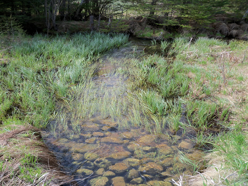
Stream Information
Stream Flow: Less than Bankfull
Scour Pool: Length 0 ft.
, Width 0 ft.
, Depth 0 ft.
Upstream Pond: Length 26 ft.
, Width 42 ft.
, Depth 1.1 ft.
Riffle Information
Water Depth: 0.7 ft.
Bankfull Width: 27 ft.
Wetted Width: 25 ft.
Water Velocity: 0.7216 ft./sec.
Dominant Substrate: Silt
Road Information
Sand
County Road
Road Condition: Good
Road Width at Culvert: 33.1 ft.
Location of Low Point: Other
Runoff Path: Roadway
Embankments
Upstream
Fill Depth: 4.1 ft.
Slope: More than 1:2
Downstream
Fill Depth: 4 ft.
Slope: More than 1:2
Approaches
Left Approach
Length: 840 ft.
Slope: 1% to 5%
Vegetation: Heavy
LS Factor: 0.554
Erosion: 4.2434 tons/year
Right Approach
Length: 0 ft.
Slope: 1% to 5%
Vegetation: Heavy
LS Factor: 0.26
Erosion: 0 tons/year
Erosion Information
Total Erosion at Crossing: 4.2434 tons/year
Extent of Erosion: Minor
Notes: Road Commision diversion outlet on downstream left approach.
Summary Information
Fish Passability 0.5
A future visit to this site is recommended. Slightly crushed in pipe, could cause problems in future.
�