Road Stream Crossing Site AUS_RO002
Au Sable River Watershed, Robinson Creek
Old 27
Higgins Twp,
Roscommon County
Information collected by:
Site Location
GPS Coordinates: 44.49738
, -84.59059
T24N
R02W
Sec 5
Owned by Private
Fish Passability 1
Structure is NOT Perched
Total Erosion: 0.8435 tons/year
Severity: Moderate
Year Inventoried: 2013
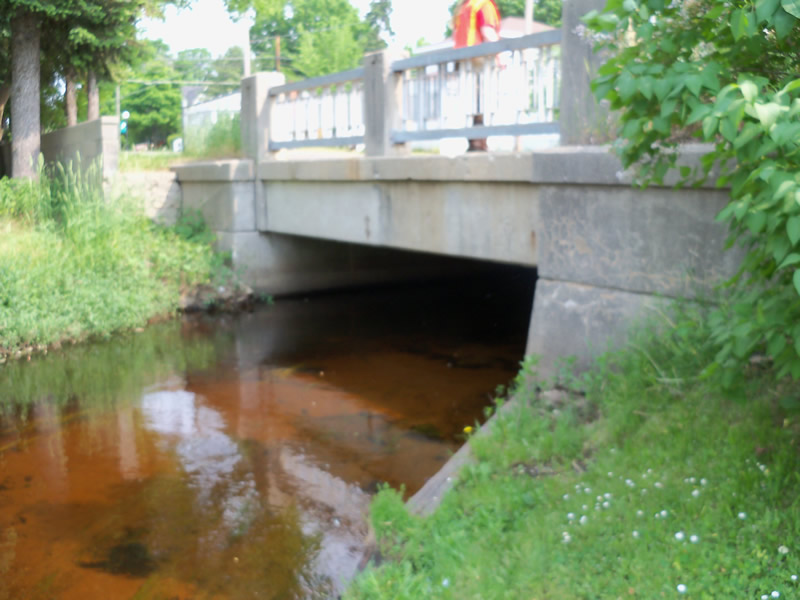
Inlet
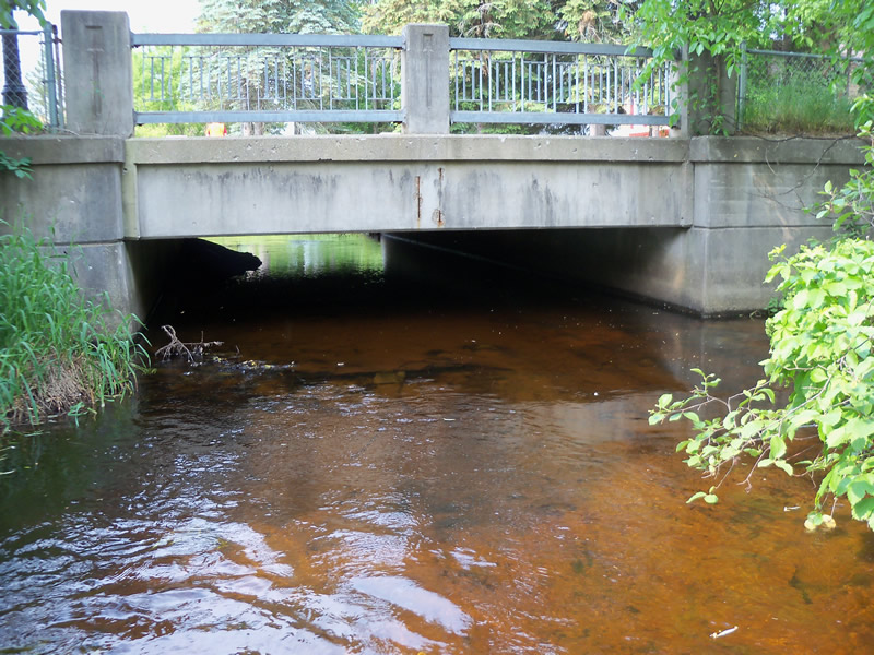
Outlet

Upstream Conditions
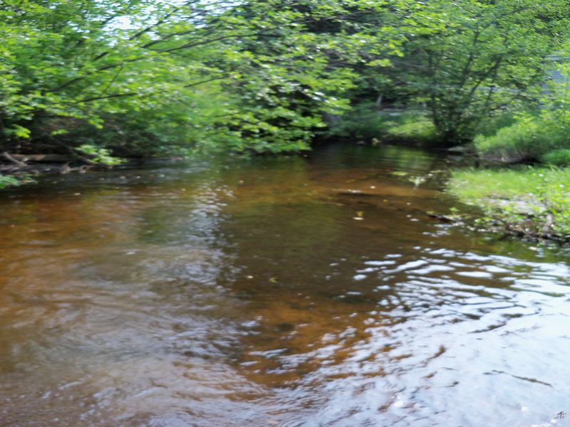
Downstream Conditions
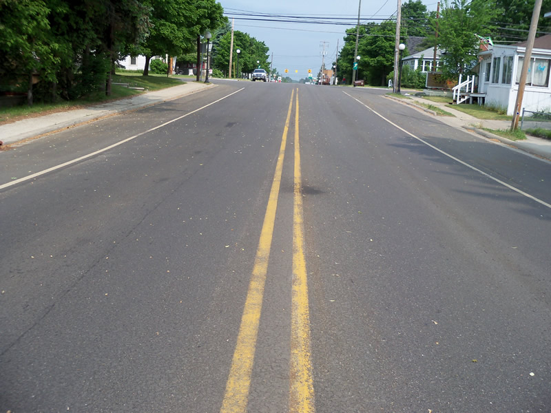
Road Approach - Left
Road Approach - Right
Crossing Information
Type of Crossing: Bridge
Structure Shape: Open Bottom Square/Rectangle
Inlet Type: Mitered
Outlet Type: At Stream Grade
Structure Material: Concrete
Structure Substrate: Sand
General Conditions: Fair
Structure Interior: smooth
Dimensions of Structure: Length 58 ft.
, Width 21 ft.
, Height 6.4 ft.
Structure is NOT Perched
Structure Inlet
Water Depth: 1.4 ft.
Embedded Depth of Structure: 0 ft.
Water Velocity*: 1.74 ft./sec.
Structure Outlet
Water Depth: 1.5 ft.
Embedded Depth of Structure: 0 ft.
Water Velocity*: 1.31 ft./sec.
*Water Velocities were measured at the Surface
(with Float Test)
Stream Information
Stream Flow: Less than Bankfull
Scour Pool: Length 0 ft.
, Width 0 ft.
, Depth 0 ft.
Upstream Pond: Length 0 ft.
, Width 0 ft.
, Depth 0 ft.
Riffle Information
Water Depth: 1.3 ft.
Bankfull Width: 33.5 ft.
Wetted Width: 27 ft.
Water Velocity: 1.38 ft./sec.
(Measured with Float Test)
Dominant Substrate: Sand
Road Information
Paved
County Road
Road Condition: Good
Road Width at Culvert: 41.2 ft.
Location of Low Point: At Stream
Runoff Path: Roadway
Fill Depth: 0 ft.
Slope: Vertical
Fill Depth: 0 ft.
Slope: Vertical
Approaches
Left Approach
Length: 237 ft.
Slope: 6% to 10%
Vegetation: Heavy
LS Factor: 1.297
Erosion: 0.4185 tons/year
Right Approach
Length: 600 ft.
Slope: 1% to 5%
Vegetation: Heavy
LS Factor: 0.52
Erosion: 0.4249 tons/year
Erosion Information
Total Erosion at Crossing: 0.8435 tons/year
Extent of Erosion: Minor
Notes: Minor bank erosion due to private property mowing/ lack of riparian vegetation.
Summary Information
Fish Passability 1
A future visit to this site is recommended. Some streambank erosion (undercut banks) along the private property area
These non-native species were observerd at this site: Spotted Knapweed
�