Road Stream Crossing Site AUS_OT105
Au Sable River Watershed, Crapo Creek
Little Crapo Lake Trail
Chester Twp,
Otsego County
Information collected by:
Site Location
GPS Coordinates: 44.89073
, -84.48485
T29N
R01W
Sec 19
Owned by State
Fish Passability 0.9
Total Erosion: 3.0166 tons/year
Severity: Severe
Year Inventoried: 2013
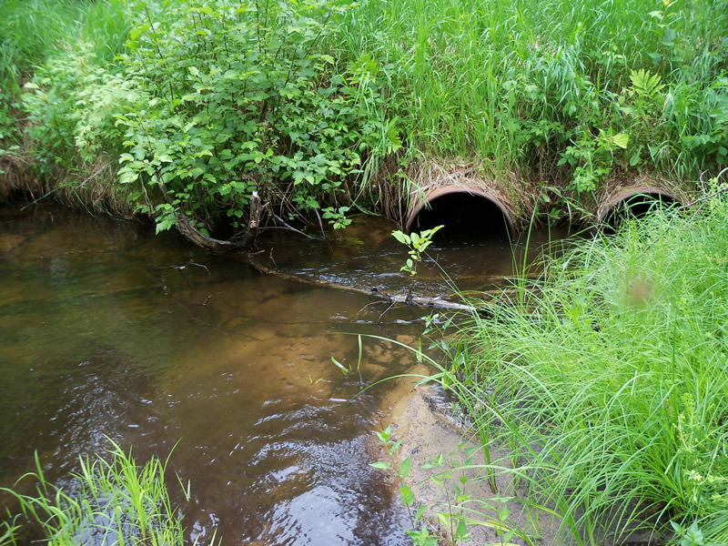
Inlet
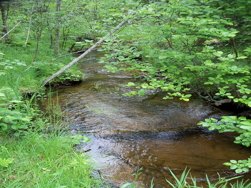
Downstream Conditions
Road Approach - Left
Crossing Information
Type of Crossing: culvert(s)
Number of Structures: 2
Structure Shape: Round
Inlet Type: Projecting
Outlet Type: At Stream Grade
Structure Material: Metal
Structure Substrate: None
General Conditions: Poor
Multiple Culverts/Spans | ||||
Culvert/Span | Width | Length | Height | Material |
2 |
2 ft. |
21 ft. |
2 ft. |
Metal |
Structure Interior: corrugated
Dimensions of Structure: Length 21 ft.
, Width 2 ft.
, Height 2.1 ft.
Percentage Plugged:
Outlet: 26% to 50%
Structure Inlet
Water Depth: 1.1 ft.
Embedded Depth of Structure: 0 ft.
Water Velocity*: 1.786 ft./sec.
Structure Outlet
Water Depth: 0.7 ft.
Embedded Depth of Structure: 0 ft.
Water Velocity*: 1.478 ft./sec.
*Water Velocities were measured at the Surface
(with Float Test)
Stream Information
Stream Flow: Less than Bankfull
Upstream Pond: Length 12 ft.
, Width 23 ft.
, Depth 3 ft.
Riffle Information
Water Depth: 1 ft.
Bankfull Width: 15 ft.
Wetted Width: 9.5 ft.
Water Velocity: 2.101 ft./sec.
(Measured with Float Test)
Dominant Substrate: Gravel
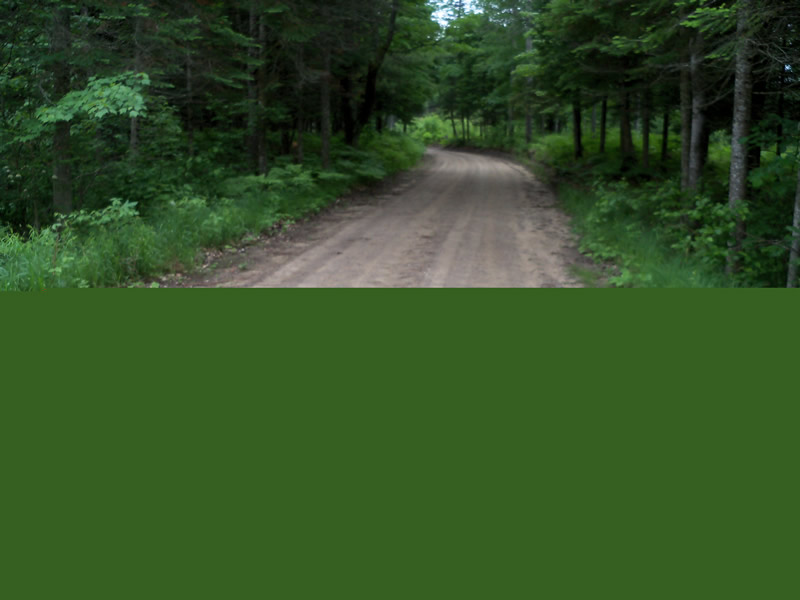
Road Information
Gravel
County Road
Road Condition: Fair
Road Width at Culvert: 15 ft.
Location of Low Point: At Stream
Runoff Path: Roadway
Embankments
Upstream
Fill Depth: 2.4 ft.
Slope: 1:2
Downstream
Fill Depth: 3 ft.
Slope: Vertical
Approaches
Left Approach
Length: 385 ft.
Slope: 1% to 5%
Vegetation: Heavy
LS Factor: 0.477
Erosion: 0.7589 tons/year
Right Approach
Length: 363 ft.
Slope: 6% to 10%
Vegetation: Heavy
LS Factor: 1.482
Erosion: 2.2229 tons/year
Erosion Information
Total Erosion at Crossing: 3.0166 tons/year
Extent of Erosion: Moderate
Erosion is occurring and corrective actions can be installed to address the problem.
Notes: Downstream embankment is not stabalized and is eroding over the outlets of both culverts.
Location of Erosion | Erosion Dimensions | Eroded Material | Material Eroded | Total Erosion | ||
facing downstream | Length | Width | Depth | Reaching Stream? | (tons/year) | |
Left Approach |
2 ft. |
10 ft. |
2.6 ft. |
yes |
Sandy Loam |
0.0349 |
Summary Information
Fish Passability 0.9
Erosion is an area of concern for this site.
Embankment downstream needs to have a more gentle slope and needs to revegetated with native plants good for erosion control. Culverts need to be aligned to where the stream has started to meander.
A future visit to this site is recommended. Culverts are in poor overall condition and placement needs to be adjusted because stream has meandered since the culverts were intitially placed.
These non-native species were observerd at this site: European Swamp Thistle
�