Road Stream Crossing Site AUS_AL011
Au Sable River Watershed, Surface Drain
Sunny Lake Rd
Mitchell Twp,
Alcona County
Information collected by:
Site Location
GPS Coordinates: 44.62397
, -83.77948
T26N
R05E
Sec 25
Owned by Federal
Fish Passability 0.5
Structure is NOT Perched
Total Erosion: 1.4868 tons/year
Severity: Moderate
Year Inventoried: 2013

Site ID
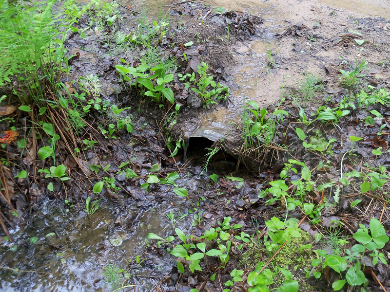
Outlet
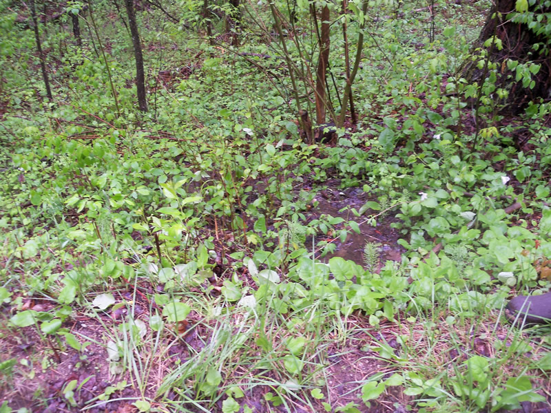
Upstream Conditions
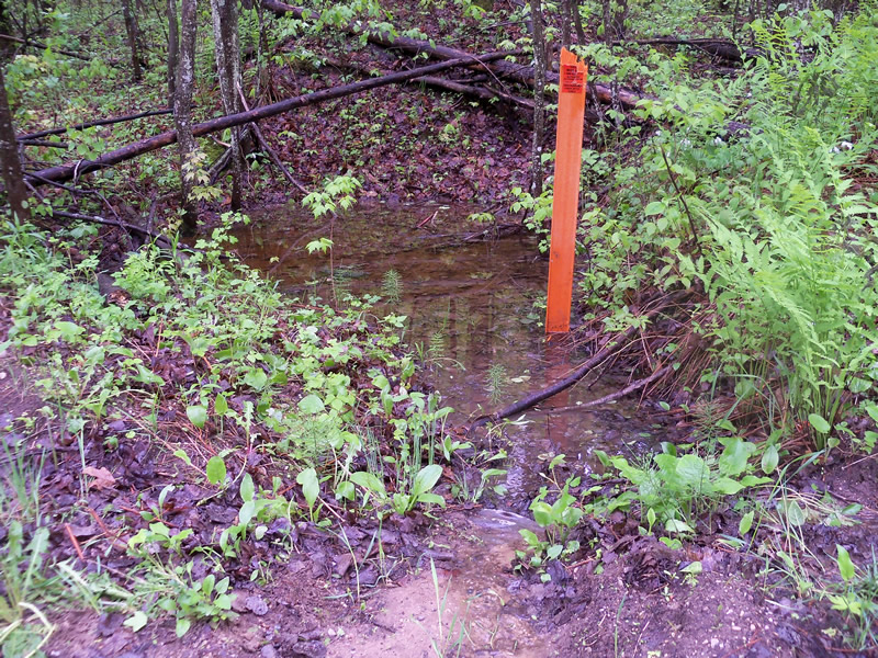
Downstream Conditions
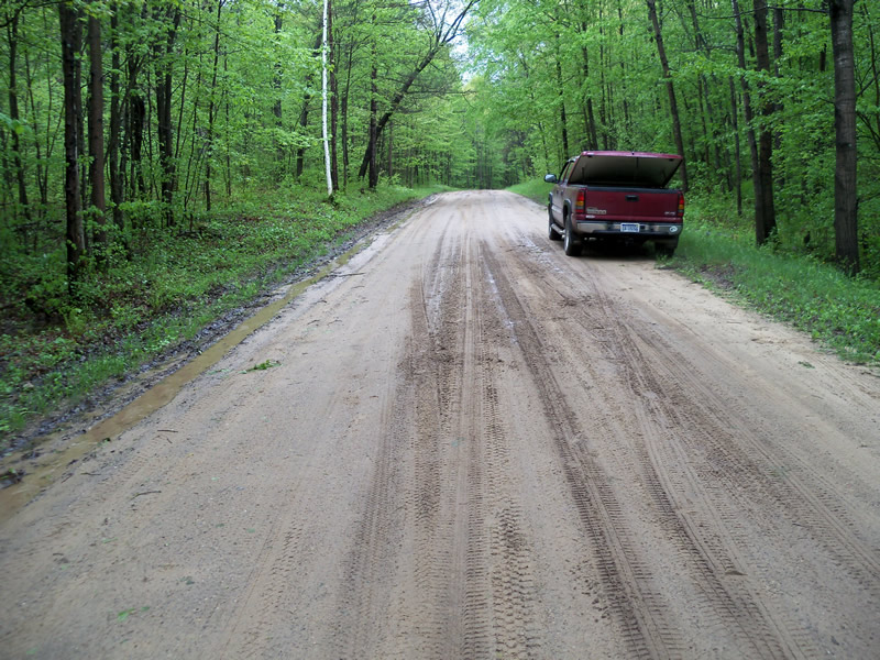
Road Approach - Left
Crossing Information
Type of Crossing: culvert(s)
Number of Structures: 1
Structure Shape: Round
Inlet Type: Projecting
Outlet Type: At Stream Grade
Structure Material: Metal
Structure Substrate: Sand
General Conditions: Poor
Structure Interior: corrugated
Dimensions of Structure: Length 28 ft.
, Width 1.2 ft.
, Height 1.2 ft.
Percentage Plugged:
Inlet: 26% to 50%
Outlet: 76% to 100%
In Pipe: 0%
Structure is NOT Perched
Structure Inlet
Water Depth: 0.1 ft.
Embedded Depth of Structure: 0.5 ft.
Water Velocity*: 0 ft./sec.
Structure Outlet
Water Depth: 0.2 ft.
Embedded Depth of Structure: 0.8 ft.
Water Velocity*: 0 ft./sec.
*Water Velocities were measured at the Surface
(with Float Test)
Stream Information
Stream Flow: None
Scour Pool: Length 0 ft.
, Width 0 ft.
, Depth 0 ft.
Upstream Pond: Length 0 ft.
, Width 0 ft.
, Depth 0 ft.
Riffle Information
Water Depth: 0 ft.
Bankfull Width: 0 ft.
Wetted Width: 0 ft.
Water Velocity: 0 ft./sec.
(Measured with Float Test)
Dominant Substrate: Organics
Road Information
Sand
Federal Road
Road Condition: Fair
Road Width at Culvert: 22 ft.
Location of Low Point: At Stream
Runoff Path: Roadway
Fill Depth: 0 ft.
Slope: More than 1:2
Fill Depth: 1.7 ft.
Slope: More than 1:2
Approaches
Left Approach
Length: 180 ft.
Slope: 1% to 5%
Vegetation: Heavy
LS Factor: 0.418
Erosion: 0.456 tons/year
Right Approach
Length: 360 ft.
Slope: 1% to 5%
Vegetation: Heavy
LS Factor: 0.472
Erosion: 1.0298 tons/year
Erosion Information
Total Erosion at Crossing: 1.4868 tons/year
Extent of Erosion: Minor
Erosion is occurring and corrective actions can be installed to address the problem.
Notes: Sand from road entering over culvert edge and plugging culvert
Location of Erosion | Erosion Dimensions | Eroded Material | Material Eroded | Total Erosion | ||
facing downstream | Length | Width | Depth | Reaching Stream? | (tons/year) | |
Right Upstream Embankment |
3 ft. |
2 ft. |
0.3 ft. |
yes |
Sand |
0.001 |
Summary Information
Fish Passability 0.5
A future visit to this site is recommended. Check condition and unplug culvert
�