Road Stream Crossing Site AUS_PR101
Au Sable River Watershed, Duval Creek
Goddard Rd
Mikado Twp,
Alcona County
Information collected by:
Site Location
GPS Coordinates: 44.54033
, -83.43696
T25N
R08E
Sec 23,26
Fish Passability 0
Structure is NOT Perched
Total Erosion: 0.8504 tons/year
1.7 Upstream Miles
Severity: Severe
Year Inventoried: 2013

Site ID
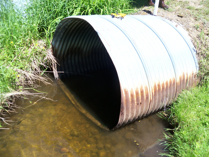
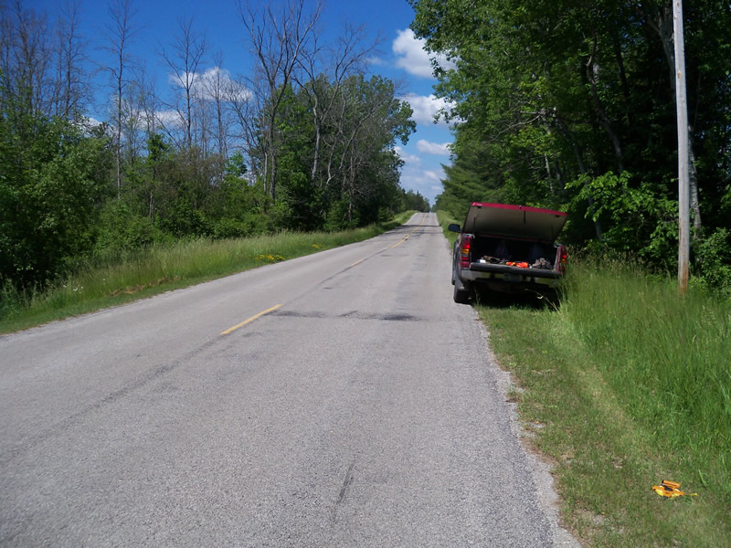
Inlet
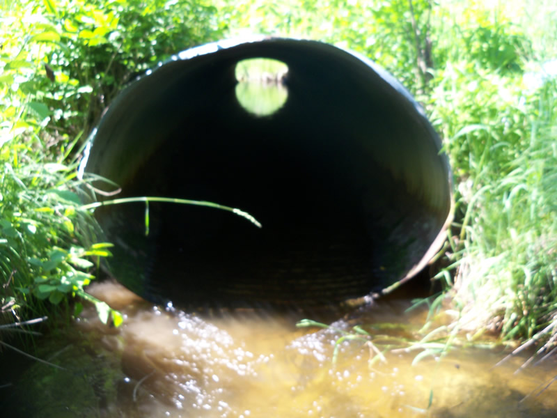
Outlet
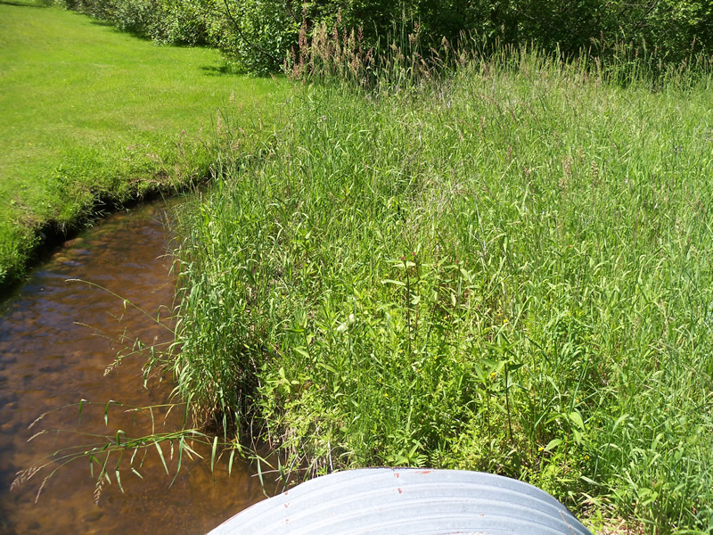
Upstream Conditions
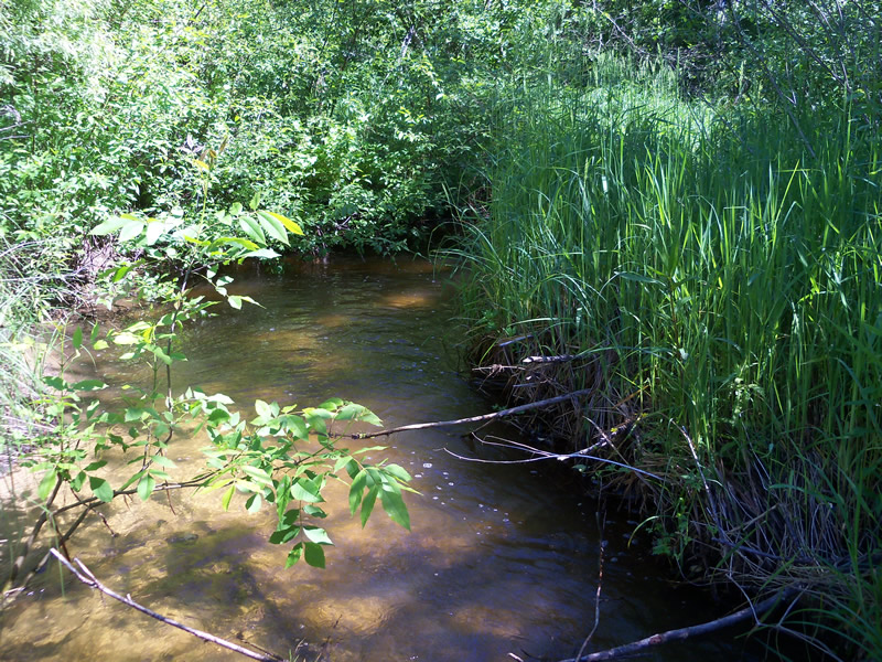
Downstream Conditions
Road Approach - Left
Road Approach - Right
Crossing Information
Type of Crossing: culvert(s)
Number of Structures: 4
Structure Shape: Round
Inlet Type: Projecting
Outlet Type: At Stream Grade
Structure Material: Metal
Structure Substrate: None
General Conditions: Good
Multiple Culverts/Spans | ||||
Culvert/Span | Width | Length | Height | Material |
2 |
6 ft. |
62 ft. |
3.7 ft. |
Metal |
3 |
5.4 ft. |
64 ft. |
3.7 ft. |
Metal |
4 |
5.6 ft. |
62 ft. |
3.7 ft. |
Metal |
Structure Interior: corrugated
Dimensions of Structure: Length 62 ft.
, Width 6 ft.
, Height 4.7 ft.
Structure is NOT Perched
Structure Inlet
Water Depth: 0.9 ft.
Embedded Depth of Structure: 0 ft.
Water Velocity*: 1.1 ft./sec.
Structure Outlet
Water Depth: 0.5 ft.
Embedded Depth of Structure: 0 ft.
Water Velocity*: 3.1 ft./sec.
*Water Velocities were measured at the Surface
(with Meter)
Additional Comments
4 culverts: 1 transporting water and other 3 embedded with soil and grasses approx. 1ft
Stream Information
Stream Flow: Less than Bankfull
Scour Pool: Length 0 ft.
, Width 0 ft.
, Depth 0 ft.
Upstream Pond: Length 0 ft.
, Width 0 ft.
, Depth 0 ft.
Riffle Information
Water Depth: 0.7 ft.
Bankfull Width: 12 ft.
Wetted Width: 9.3 ft.
Water Velocity: 0.3 ft./sec.
(Measured with Meter)
Dominant Substrate: Sand
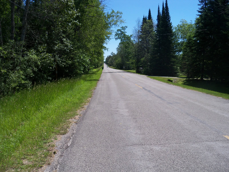
Road Information
Paved
County Road
Road Condition: Good
Road Width at Culvert: 25 ft.
Location of Low Point: At Stream
Runoff Path: Ditch
Embankments
Upstream
Fill Depth: 2.5 ft.
Slope: More than 1:2
Downstream
Fill Depth: 1.5 ft.
Slope: More than 1:2
Approaches
Left Approach
Length: 830 ft.
Slope: 1% to 5%
Vegetation: Heavy
LS Factor: 0.553
Erosion: 0.3793 tons/year
Right Approach
Length: 1000 ft.
Slope: 1% to 5%
Vegetation: Heavy
LS Factor: 0.57
Erosion: 0.4711 tons/year
Erosion Information
Total Erosion at Crossing: 0.8504 tons/year
Notes: Large cutbank located near riffle
Summary Information
Fish Passability 0
1.7 Upstream Miles
Fish Passage is an area of concern for this site.
water velocity at outlet is 3.1.
A future visit to this site is recommended. Only one culvert needed, and stream seems flashy.
�