Road Stream Crossing Site AUS_PR111
Au Sable River Watershed, Tributary of Gimlet Creek
Hubbard Lake Rd
Gustin Twp,
Alcona County
Information collected by:
Site Location
GPS Coordinates: 44.59868
, -83.52373
T26N
R08E
Sec 31
Owned by Private
Fish Passability 0.5
Total Erosion: 0.3495 tons/year
Severity: Moderate
Year Inventoried: 2013
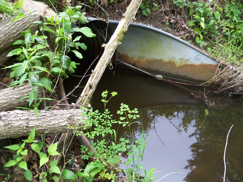
Inlet
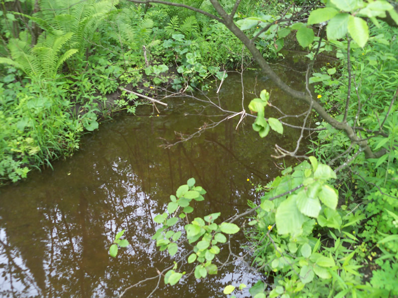
Upstream Conditions
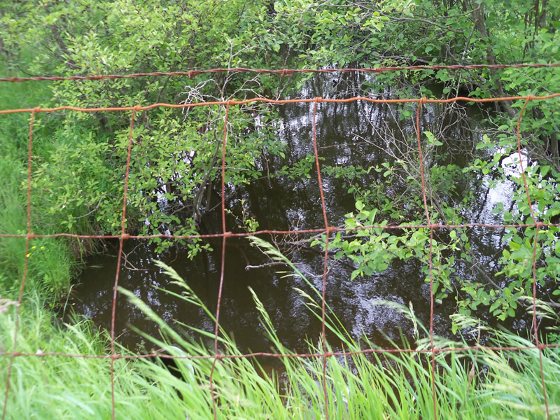
Downstream Conditions
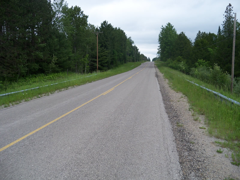
Road Approach - Left
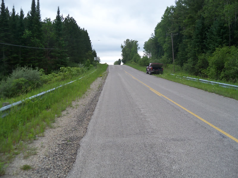
Road Approach - Right
Crossing Information
Type of Crossing: culvert(s)
Structure Shape: Round
Inlet Type: Projecting
Outlet Type: At Stream Grade
Structure Material: Metal
Structure Substrate: None
General Conditions: Poor
Structure Interior: corrugated
Structure is Rusted through
Dimensions of Structure: Length 98 ft.
, Width 2 ft.
, Height 2 ft.
Percentage Plugged:
In Pipe: 51% to 75%
Percentage Crushed:
In Pipe: 51% to 75%
Structure Inlet
Water Depth: 0.1 ft.
Embedded Depth of Structure: 0 ft.
Water Velocity*: 0 ft./sec.
Structure Outlet
Water Depth: 0.1 ft.
Embedded Depth of Structure: 0 ft.
Water Velocity*: 0 ft./sec.
*Water Velocities were measured at the Surface
(with Float Test)
Additional Comments
Sinkhole like erosion on upstream embankment due to culvert rusting through. Ribbon marking erosion before we got there.
Stream Information
Stream Flow: None
Scour Pool: Length 0 ft.
, Width 0 ft.
, Depth 0 ft.
Upstream Pond: Length 0 ft.
, Width 0 ft.
, Depth 0 ft.
Riffle Information
Water Depth: 0 ft.
Bankfull Width: 0 ft.
Wetted Width: 0 ft.
Water Velocity: 0 ft./sec.
Road Information
Paved
County Road
Road Condition: Good
Road Width at Culvert: 31 ft.
Location of Low Point: At Stream
Runoff Path: Roadway
Embankments
Upstream
Fill Depth: 9 ft.
Slope: More than 1:2
Downstream
Fill Depth: 8.5 ft.
Slope: More than 1:2
Approaches
Left Approach
Length: 150 ft.
Slope: Less Than 1%
Vegetation: Heavy
LS Factor: 0.05
Erosion: 0.0077 tons/year
Right Approach
Length: 635 ft.
Slope: 1% to 5%
Vegetation: Heavy
LS Factor: 0.525
Erosion: 0.3418 tons/year
Erosion Information
Total Erosion at Crossing: 0.3495 tons/year
Extent of Erosion: Moderate
Notes: Sinkhole like erosion caused by rusted through culvert. Does not seem to be loading sediment into stream since streamflow is very minimal and abundant plant life.
Summary Information
Fish Passability 0.5
Erosion is an area of concern for this site.
culvert pugged by eroded soil.
A future visit to this site is recommended. Culvert is rusted through, crushed, and blocked by sinkhole.
These non-native species were observerd at this site: Autumn Olive
�