Road Stream Crossing Site EBIO004
Au Gres River Watershed, Hale Creek
Putnam Rd
Plainfield Twp,
Iosco County
Information collected by:
Site Location
GPS Coordinates: 44.37896
, -83.82491
T23N
R5E
Sec 15 & 16
Owned by Private
Fish Passability 1
Structure is NOT Perched
Total Erosion: 1.0307 tons/year
Severity: Moderate
Year Inventoried: 2014
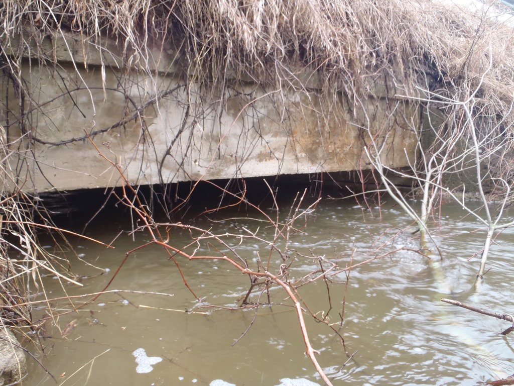
Inlet
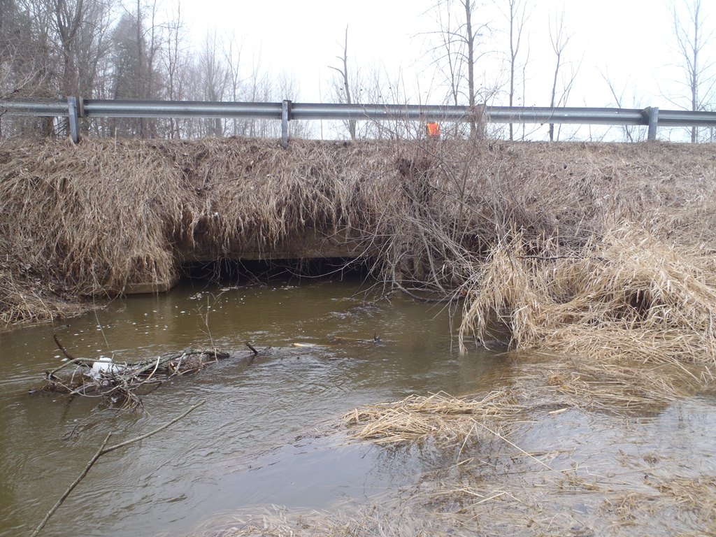
Outlet
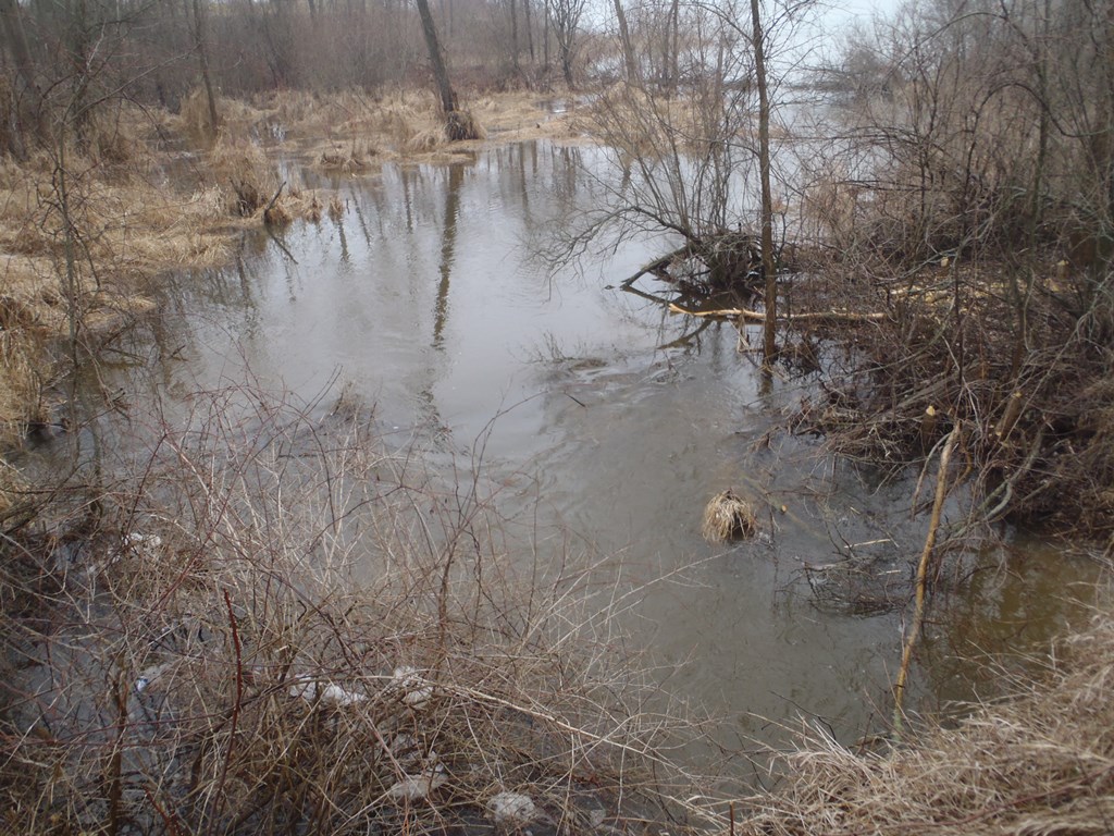
Upstream Conditions
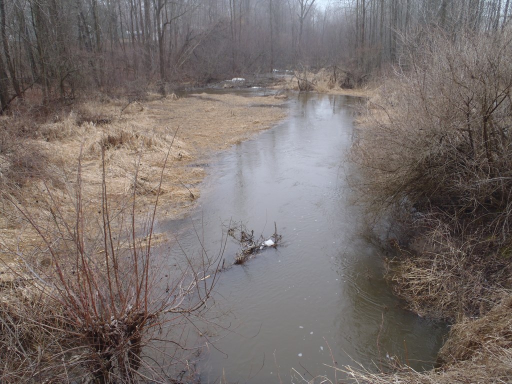
Downstream Conditions
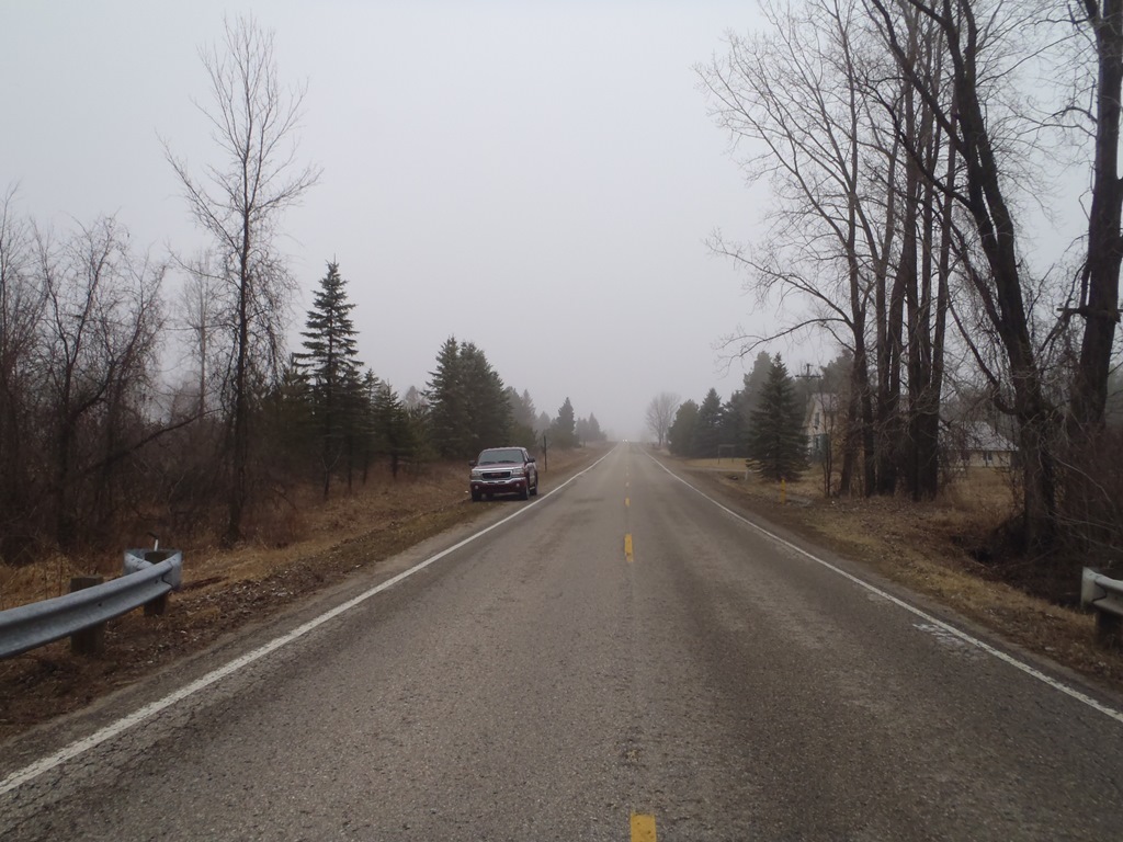
Road Approach - Left
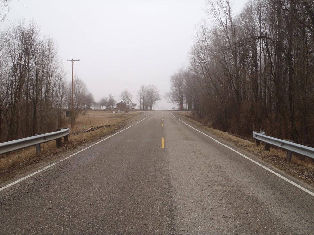
Road Approach - Right
Crossing Information
Type of Crossing: culvert(s)
Number of Structures: 1
Structure Shape: Open Bottom Square/Rectangle
Inlet Type: Wingwall 30-70 Degree
Outlet Type: At Stream Grade
Structure Material: Concrete
Structure Substrate: Mixture
General Conditions: Fair
Structure Interior: smooth
Dimensions of Structure: Length 40 ft.
, Width 20 ft.
, Height 4.9 ft.
Structure is NOT Perched
Structure Inlet
Water Depth: 4 ft.
Embedded Depth of Structure: 0 ft.
Water Velocity*: 0.4 ft./sec.
Structure Outlet
Water Depth: 3.4 ft.
Embedded Depth of Structure: 0 ft.
Water Velocity*: 0.7 ft./sec.
*Water Velocities were measured at the Surface
(with Float Test)
Stream Information
Stream Flow: More than Bankfull
Scour Pool: Length 0 ft.
, Width 0 ft.
, Depth 0 ft.
Upstream Pond: Length 0 ft.
, Width 0 ft.
, Depth 0 ft.
Riffle Information
Water Depth: 4.2 ft.
Bankfull Width: 14 ft.
Wetted Width: 70 ft.
Water Velocity: 0.7 ft./sec.
(Measured with Float Test)
Dominant Substrate: Silt
Road Information
Paved
County Road
Road Condition: Good
Road Width at Culvert: 22 ft.
Location of Low Point: At Stream
Runoff Path: Ditch
Embankments
Upstream
Fill Depth: 4.2 ft.
Slope: 1:1.5
Downstream
Fill Depth: 5.5 ft.
Slope: 1:1.5
Approaches
Left Approach
Length: 1000 ft.
Slope: 1% to 5%
Vegetation: Heavy
LS Factor: 0.57
Erosion: 0.4145 tons/year
Right Approach
Length: 1000 ft.
Slope: 1% to 5%
Vegetation: Heavy
LS Factor: 0.57
Erosion: 0.4145 tons/year
Erosion Information
Total Erosion at Crossing: 1.0307 tons/year
Extent of Erosion: Moderate
Notes: Left downstream embankment erosion occuring, apparently due to high flow events.
Location of Erosion | Erosion Dimensions | Eroded Material | Material Eroded | Total Erosion | ||
facing downstream | Length | Width | Depth | Reaching Stream? | (tons/year) | |
Left Downstream Embankment |
10 ft. |
4 ft. |
3 ft. |
yes |
Sandy Loam |
0.2016 |
Summary Information
Fish Passability 1
�