Road Stream Crossing Site EBIO081
Au Gres River Watershed, East Branch Au Gres River
Carpenter Rd
Grant Twp,
Iosco County
Information collected by:
Site Location
GPS Coordinates: 44.28519
, -83.72012
T22N
R6E
Sec 21
Owned by Private
Fish Passability 0
Structure is NOT Perched
Total Erosion: 1.8584 tons/year
Severity: Severe
Year Inventoried: 2014
Site ID
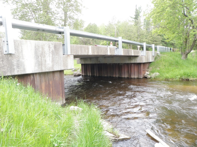
Inlet
Outlet
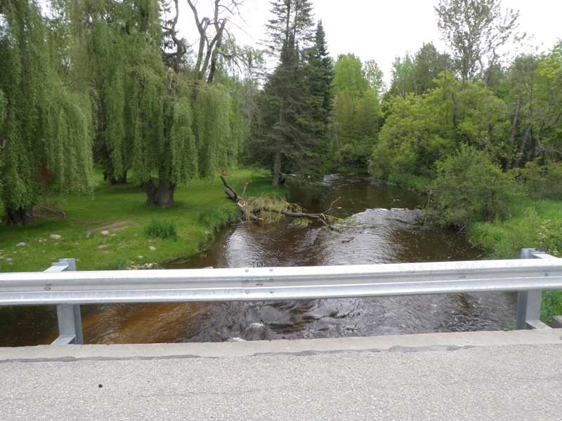
Upstream Conditions
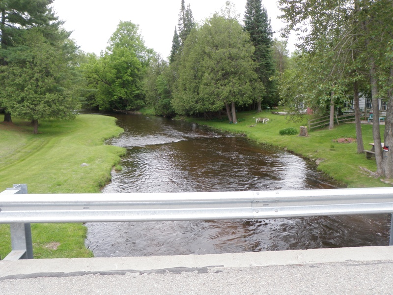
Downstream Conditions
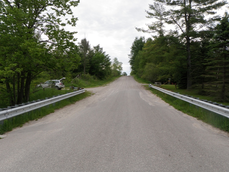
Road Approach - Left
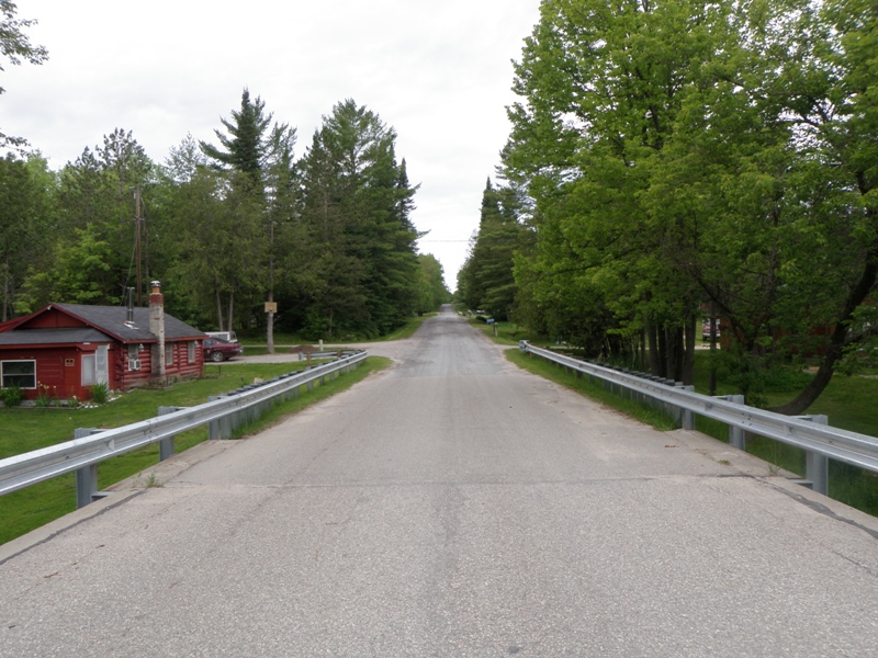
Road Approach - Right
Crossing Information
Type of Crossing: Bridge
Structure Shape: Open Bottom Square/Rectangle
Inlet Type: Other
Outlet Type: At Stream Grade
Structure Material: Metal
Structure Substrate: Mixture
General Conditions: Good
Structure Interior: smooth
Dimensions of Structure: Length 25 ft.
, Width 32 ft.
, Height 8.4 ft.
Structure is NOT Perched
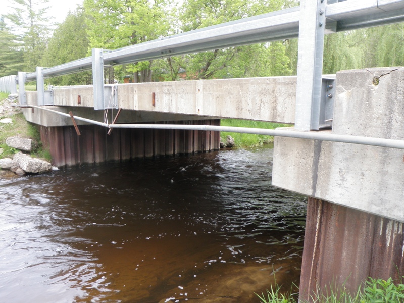
Structure Inlet
Water Depth: 2.1 ft.
Embedded Depth of Structure: 0 ft.
Water Velocity*: 4.6 ft./sec.
Structure Outlet
Water Depth: 2.8 ft.
Embedded Depth of Structure: 0 ft.
Water Velocity*: 2.3 ft./sec.
*Water Velocities were measured 0.5 ft. below Surface
(with Meter)
Stream Information
Stream Flow: Less than Bankfull
Scour Pool: Length 0 ft.
, Width 0 ft.
, Depth 0 ft.
Upstream Pond: Length 0 ft.
, Width 0 ft.
, Depth 0 ft.
Riffle Information
Water Depth: 1 ft.
Bankfull Width: 70 ft.
Wetted Width: 44 ft.
Water Velocity: 1.9 ft./sec.
(Measured with Meter)
Dominant Substrate: Cobble
Road Information
Paved
County Road
Road Condition: Good
Road Width at Culvert: 25 ft.
Location of Low Point: At Stream
Runoff Path: Ditch
Fill Depth: 0 ft.
Slope: Vertical
Fill Depth: 0 ft.
Slope: Vertical
Approaches
Left Approach
Length: 860 ft.
Slope: 6% to 10%
Vegetation: Heavy
LS Factor: 1.952
Erosion: 1.3874 tons/year
Right Approach
Length: 1000 ft.
Slope: 1% to 5%
Vegetation: Heavy
LS Factor: 0.57
Erosion: 0.4711 tons/year
Erosion Information
Total Erosion at Crossing: 1.8584 tons/year
Notes: None.
Summary Information
Fish Passability 0
�