Road Stream Crossing Site EBIO010
Au Gres River Watershed, Tributary of Smith Creek
Ponderosa Dr
Plainfield Twp,
Iosco County
Information collected by:
Site Location
GPS Coordinates: 44.427
, -83.80479
T24N
R5E
Sec 34 & 35
Owned by Private
Fish Passability 0.5
Structure is NOT Perched
Total Erosion: 0.6917 tons/year
Severity: Moderate
Year Inventoried: 2014
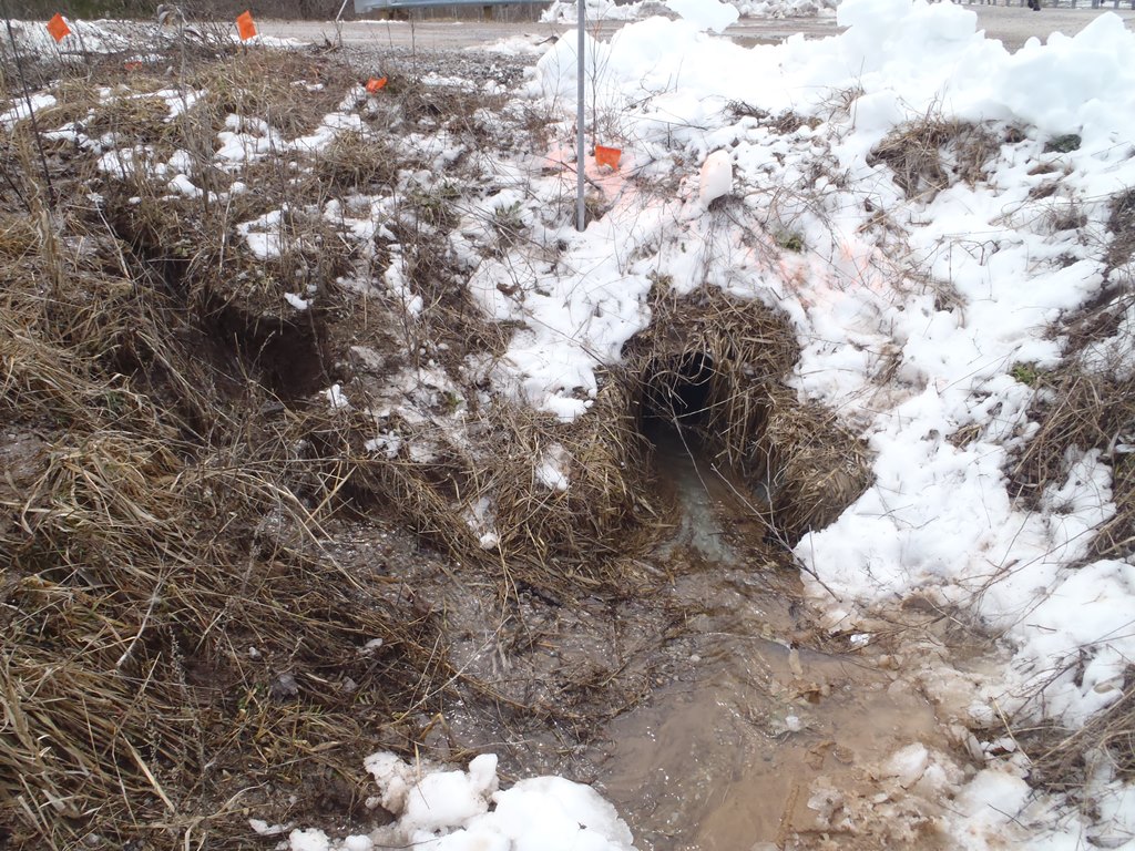
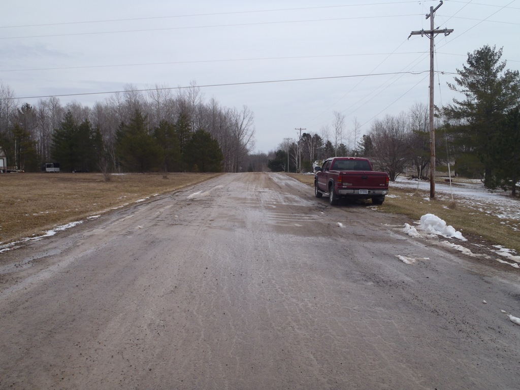
Inlet
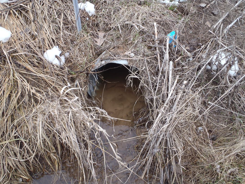
Outlet
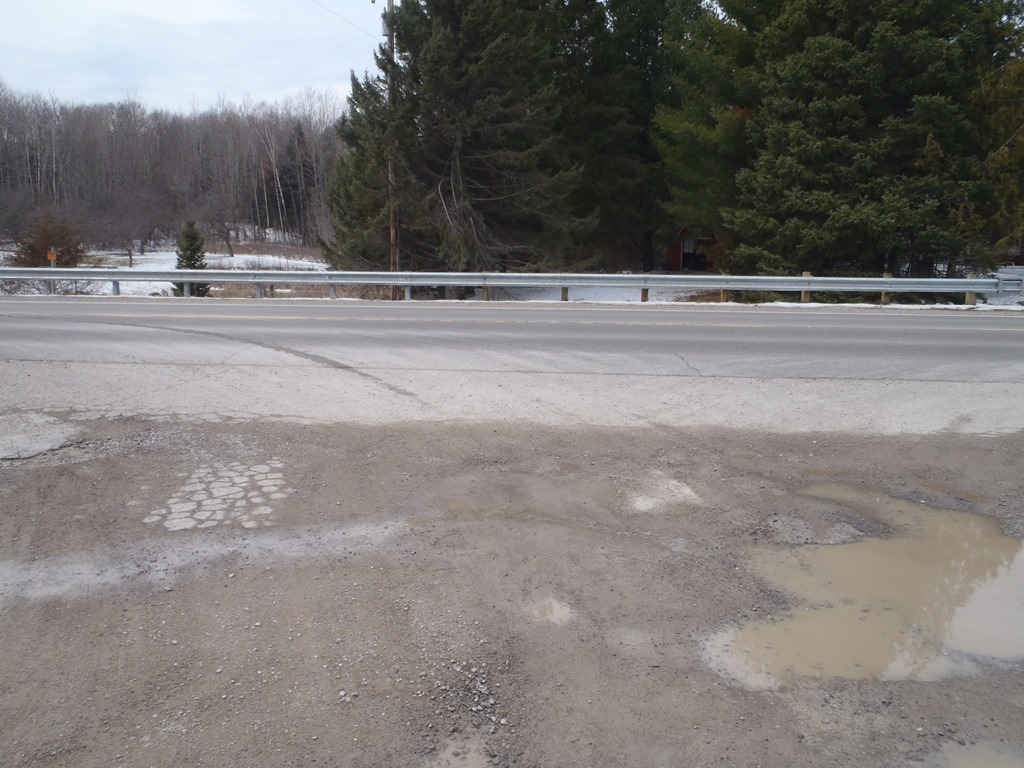
Upstream Conditions
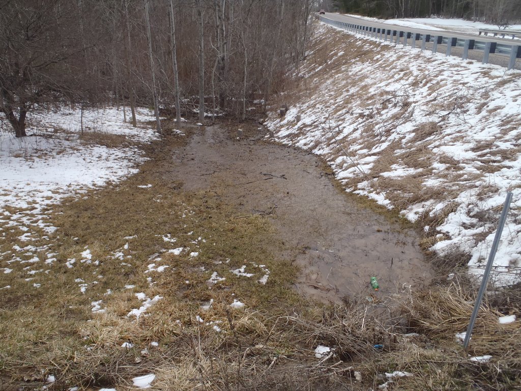
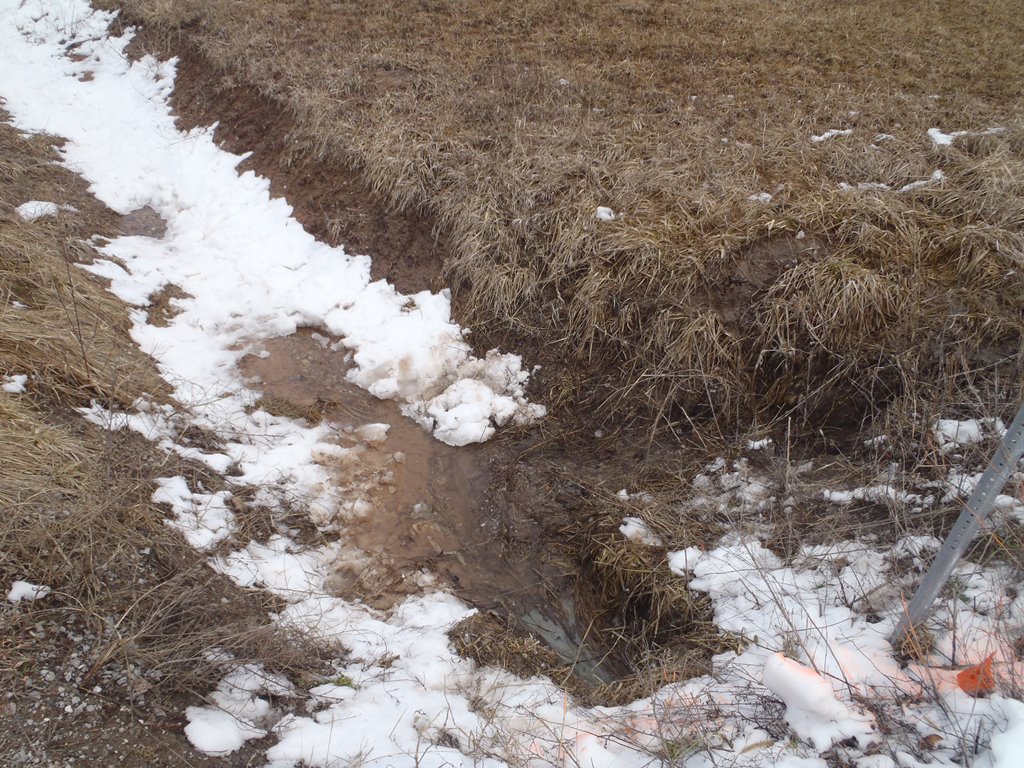
Downstream Conditions
Road Approach - Left
Road Approach - Right
Crossing Information
Type of Crossing: culvert(s)
Number of Structures: 1
Structure Shape: Round
Inlet Type: Apron
Outlet Type: At Stream Grade
Structure Material: Metal
Structure Substrate: Sand
General Conditions: Good
Structure Interior: corrugated
Dimensions of Structure: Length 6 ft.
, Width 1.6 ft.
, Height 1.6 ft.
Structure is NOT Perched
Structure Inlet
Water Depth: 0.1 ft.
Embedded Depth of Structure: 0.1 ft.
Water Velocity*: 1 ft./sec.
Structure Outlet
Water Depth: 0.2 ft.
Embedded Depth of Structure: 0.3 ft.
Water Velocity*: 0.5 ft./sec.
*Water Velocities were measured 0.1 ft. below Surface
(with Meter)
Additional Comments
Drains roadside ditch (yard runoff), but erosion significant and outlet drains directly into Smith Creek tributary (site EBIO011).
Stream Information
Stream Flow: Less than Bankfull
Scour Pool: Length 0 ft.
, Width 0 ft.
, Depth 0 ft.
Upstream Pond: Length 0 ft.
, Width 0 ft.
, Depth 0 ft.
Riffle Information
Water Depth: 0.1 ft.
Bankfull Width: 10 ft.
Wetted Width: 8 ft.
Water Velocity: 0.5 ft./sec.
(Measured with Meter)
Dominant Substrate: Organics
Road Information
Gravel
County Road
Road Condition: Good
Road Width at Culvert: 30 ft.
Location of Low Point: At Stream
Runoff Path: Ditch
Embankments
Upstream
Fill Depth: 3 ft.
Slope: More than 1:2
Downstream
Fill Depth: 2.3 ft.
Slope: More than 1:2
Approaches
Left Approach
Length: 250 ft.
Slope: Less Than 1%
Vegetation: Heavy
LS Factor: 0.05
Erosion: 0.1033 tons/year
Right Approach
Length: 40 ft.
Slope: Less Than 1%
Vegetation: Heavy
LS Factor: 0.05
Erosion: 0.0165 tons/year
Erosion Information
Total Erosion at Crossing: 0.6917 tons/year
Extent of Erosion: Moderate
Notes: Large amount of bare soil eroding above culvert outlet; erosion apparent at left and right upstream embankments as well.
Location of Erosion | Erosion Dimensions | Eroded Material | Material Eroded | Total Erosion | ||
facing downstream | Length | Width | Depth | Reaching Stream? | (tons/year) | |
Left Upstream Embankment |
7 ft. |
2.3 ft. |
1.3 ft. |
yes |
Sandy Loam |
0.0612 |
Right Upstream Embankment |
8 ft. |
5 ft. |
0.3 ft. |
yes |
Sandy Loam |
0.0161 |
Right Downstream Embankment |
32 ft. |
8 ft. |
2.3 ft. |
yes |
Sandy Loam |
0.4946 |
Summary Information
Fish Passability 0.5
�