Road Stream Crossing Site EBIO056
Au Gres River Watershed, Smith Creek
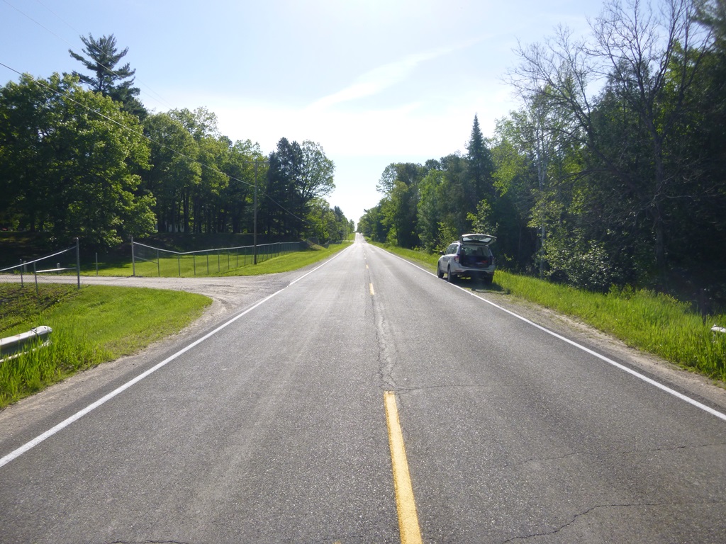
Esmond Rd
Plainfield Twp,
Iosco County
Information collected by:
Site Location
GPS Coordinates: 44.37793
, -83.77353
T23N
R5E
Sec 13 & 24
Owned by Private
Fish Passability 0
Structure is NOT Perched
Total Erosion: 0.4899 tons/year
Severity: Severe
Year Inventoried: 2014

Site ID
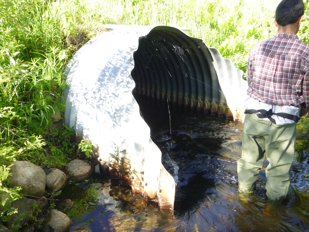
Inlet
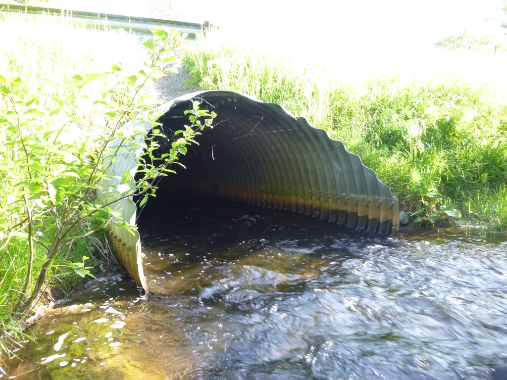
Outlet

Upstream Conditions
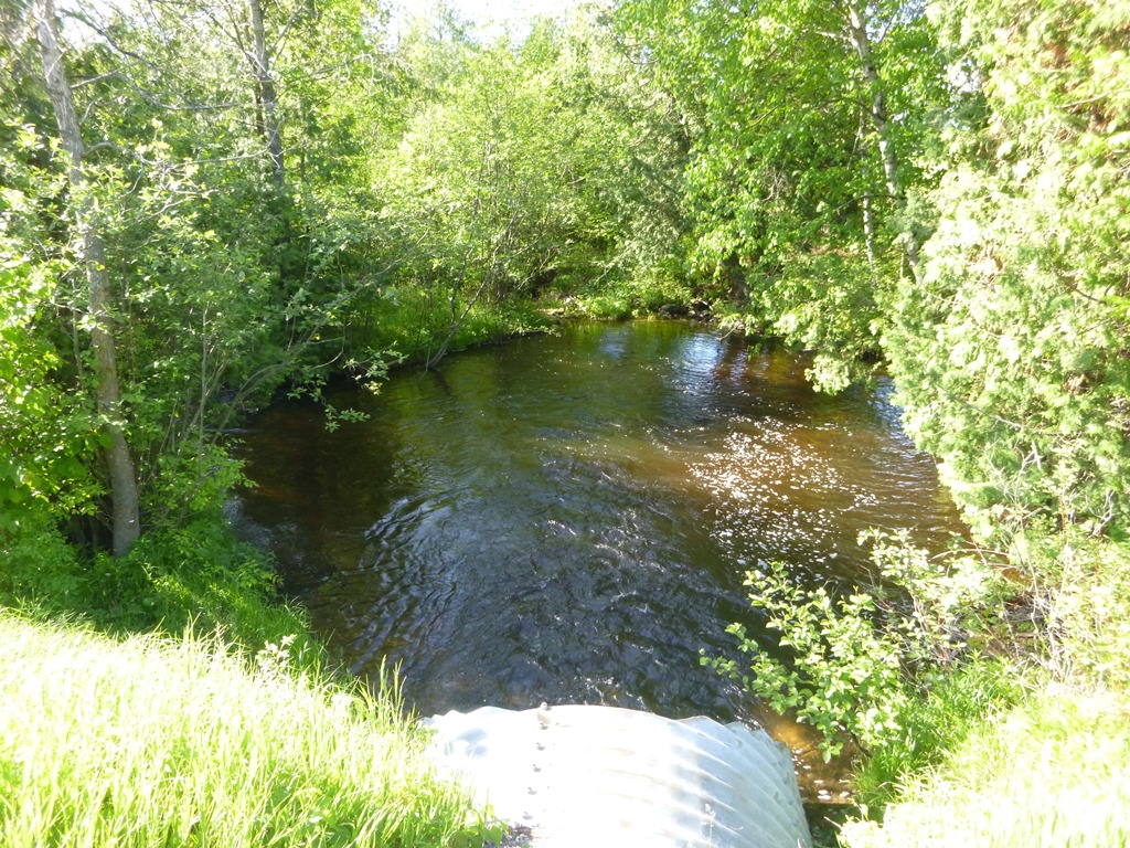
Downstream Conditions
Road Approach - Left

Road Approach - Right
Crossing Information
Type of Crossing: culvert(s)
Number of Structures: 1
Structure Shape: Pipe Arch
Inlet Type: Mitered
Outlet Type: At Stream Grade
Structure Material: Metal
Structure Substrate: Rock
General Conditions: Good
Structure Interior: corrugated
Dimensions of Structure: Length 50 ft.
, Width 8.3 ft.
, Height 5.9 ft.
Structure is NOT Perched
Structure Inlet
Water Depth: 1.2 ft.
Embedded Depth of Structure: 0.5 ft.
Water Velocity*: 2.2 ft./sec.
Structure Outlet
Water Depth: 1.1 ft.
Embedded Depth of Structure: 0.2 ft.
Water Velocity*: 4 ft./sec.
*Water Velocities were measured 0.5 ft. below Surface
(with Meter)
Stream Information
Stream Flow: Less than Bankfull
Scour Pool: Length 55 ft.
, Width 42 ft.
, Depth 5.3 ft.
Upstream Pond: Length 0 ft.
, Width 0 ft.
, Depth 0 ft.
Riffle Information
Water Depth: 1.6 ft.
Bankfull Width: 13 ft.
Wetted Width: 9.7 ft.
Water Velocity: 1.3 ft./sec.
(Measured with Meter)
Dominant Substrate: Gravel
Road Information
Paved
County Road
Road Condition: Good
Road Width at Culvert: 26 ft.
Location of Low Point: Other
Runoff Path: Ditch
Embankments
Upstream
Fill Depth: 5.1 ft.
Slope: 1:1.5
Downstream
Fill Depth: 3.3 ft.
Slope: More than 1:2
Approaches
Left Approach
Length: 0 ft.
Slope: Less Than 1%
Vegetation: Heavy
LS Factor: 0.05
Erosion: 0 tons/year
Right Approach
Length: 1000 ft.
Slope: 1% to 5%
Vegetation: Heavy
LS Factor: 0.57
Erosion: 0.4899 tons/year
Erosion Information
Total Erosion at Crossing: 0.4899 tons/year
Notes: None.
Summary Information
Fish Passability 0
A future visit to this site is recommended. Culvert is misaligned and undersized, creating a big scour pool and likely acting as a velocity barrier for some aquatic organisms.
�