Road Stream Crossing Site EBIO026
Au Gres River Watershed, Hale Creek
Curtis Rd
Plainfield Twp,
Iosco County
Information collected by:
Site Location
GPS Coordinates: 44.363583
, -83.805972
T23N
R5E
Sec 22 & 27
Owned by Private
Fish Passability 1
Structure is NOT Perched
Total Erosion: 0.3507 tons/year
Severity: Minor
Year Inventoried: 2014
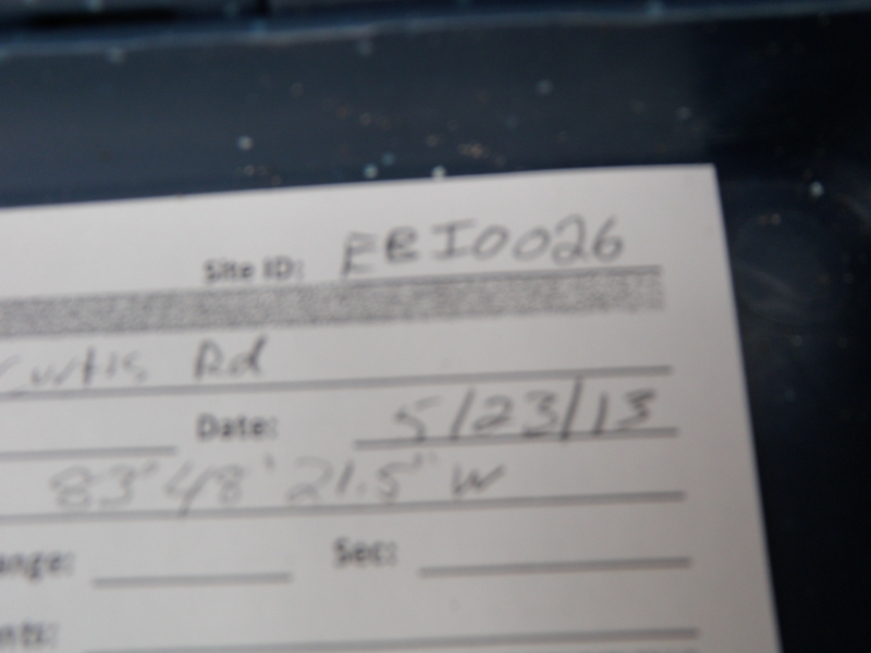
Site ID
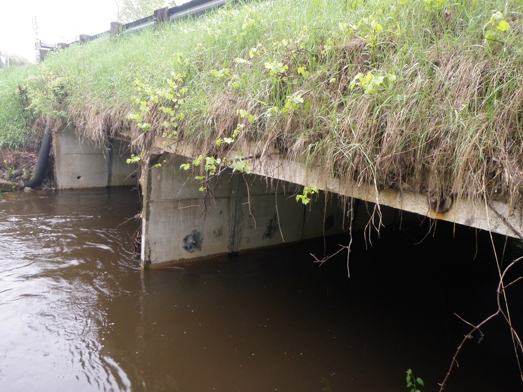
Inlet
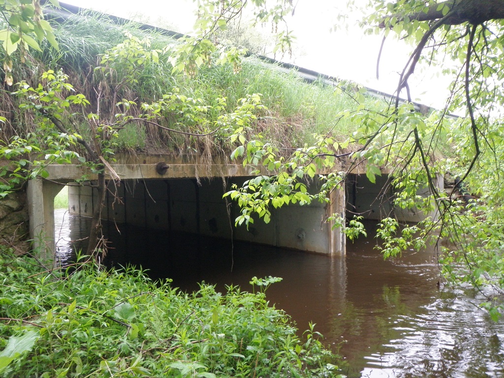
Outlet
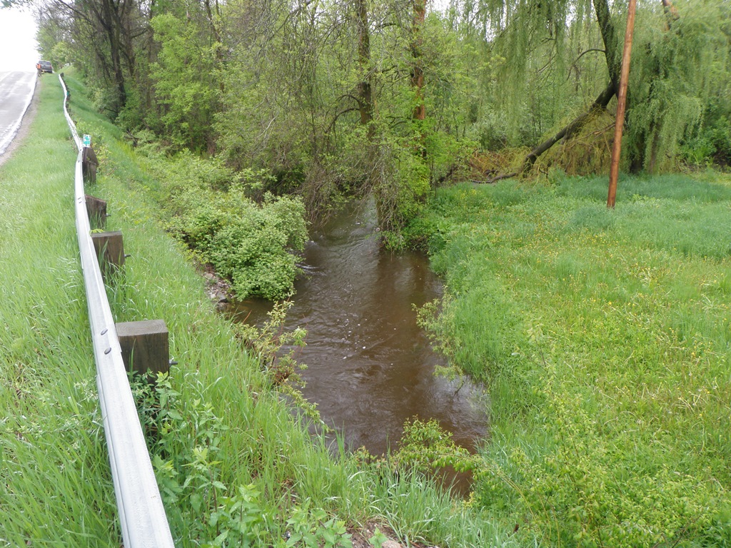
Upstream Conditions
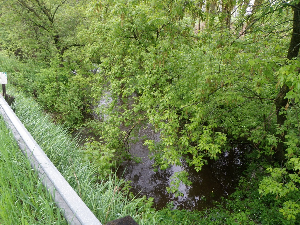
Downstream Conditions
Road Approach - Left
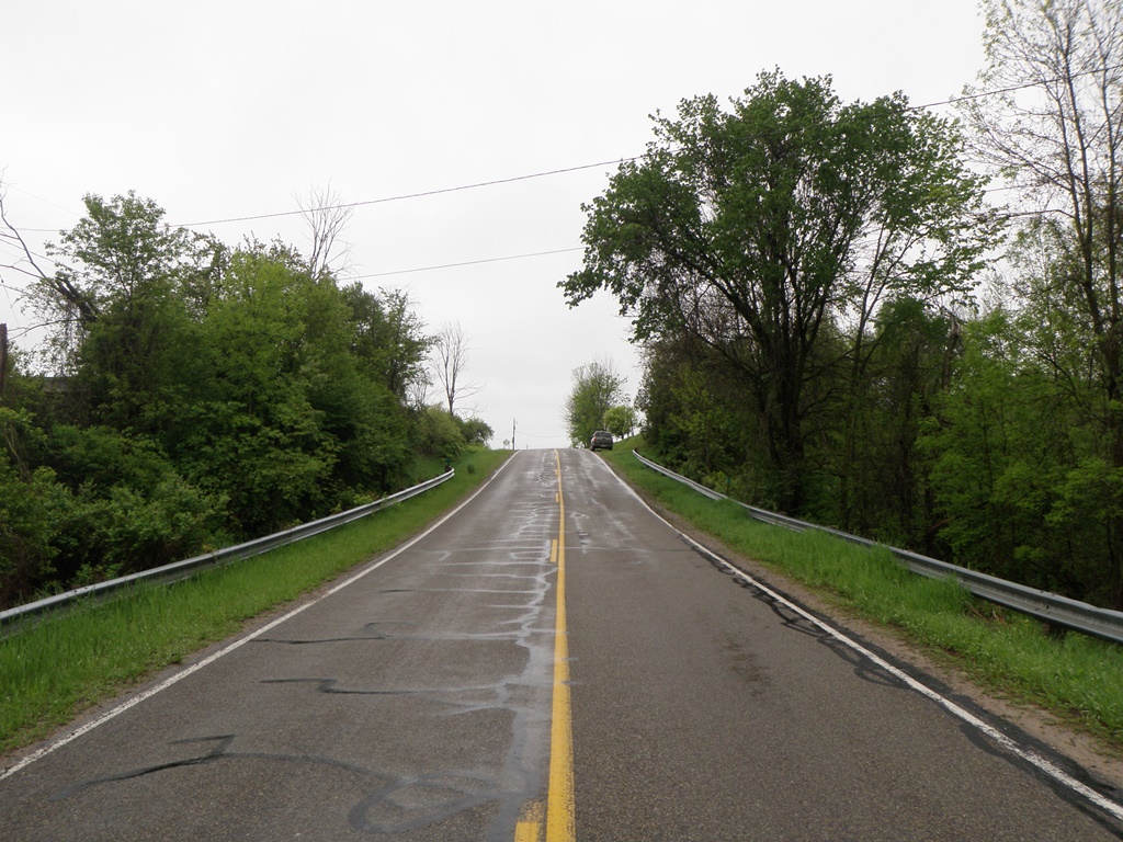
Road Approach - Right
Crossing Information
Type of Crossing: culvert(s)
Number of Structures: 2
Structure Shape: Square/Rectangle
Inlet Type: Headwall
Outlet Type: At Stream Grade
Structure Material: Concrete
Structure Substrate: Mixture
General Conditions: Good
Multiple Culverts/Spans | ||||
Culvert/Span | Width | Length | Height | Material |
1 |
15.6 ft. |
38 ft. |
7 ft. |
Concrete |
2 |
15.6 ft. |
38 ft. |
7 ft. |
Concrete |
Structure Interior: smooth
Dimensions of Structure: Length 38 ft.
, Width 15.6 ft.
, Height 7 ft.
Structure is NOT Perched
Structure Inlet
Water Depth: 2.8 ft.
Embedded Depth of Structure: 0 ft.
Water Velocity*: 1.2 ft./sec.
Structure Outlet
Water Depth: 2.8 ft.
Embedded Depth of Structure: 0.7 ft.
Water Velocity*: 1.9 ft./sec.
*Water Velocities were measured 0.5 ft. below Surface
(with Meter)
Stream Information
Stream Flow: Less than Bankfull
Scour Pool: Length 0 ft.
, Width 0 ft.
, Depth 0 ft.
Upstream Pond: Length 0 ft.
, Width 0 ft.
, Depth 0 ft.
Riffle Information
Water Depth: 2.4 ft.
Bankfull Width: 22 ft.
Wetted Width: 21 ft.
Water Velocity: 1.7 ft./sec.
(Measured with Meter)
Dominant Substrate: Gravel
Road Information
Paved
County Road
Road Condition: Good
Road Width at Culvert: 22 ft.
Location of Low Point: At Stream
Runoff Path: Ditch
Embankments
Upstream
Fill Depth: 3.4 ft.
Slope: More than 1:2
Downstream
Fill Depth: 3 ft.
Slope: More than 1:2
Approaches
Left Approach
Length: 395 ft.
Slope: 1% to 5%
Vegetation: Heavy
LS Factor: 0.479
Erosion: 0.1376 tons/year
Right Approach
Length: 570 ft.
Slope: 1% to 5%
Vegetation: Heavy
LS Factor: 0.514
Erosion: 0.2131 tons/year
Erosion Information
Total Erosion at Crossing: 0.3507 tons/year
Notes: No erosion apparent.
Summary Information
Fish Passability 1
�