Road Stream Crossing Site EBIO057
Au Gres River Watershed, Vaughn Creek
Esmond Rd
Plainfield Twp,
Iosco County
Information collected by:
Site Location
GPS Coordinates: 44.37249
, -83.70566
T23N
R6E
Sec 21
Owned by Private
Fish Passability 0.5
Structure is NOT Perched
Total Erosion: 1.1898 tons/year
Severity: Severe
Year Inventoried: 2014

Site ID
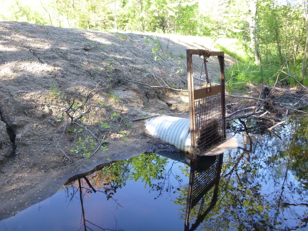
Inlet

Outlet
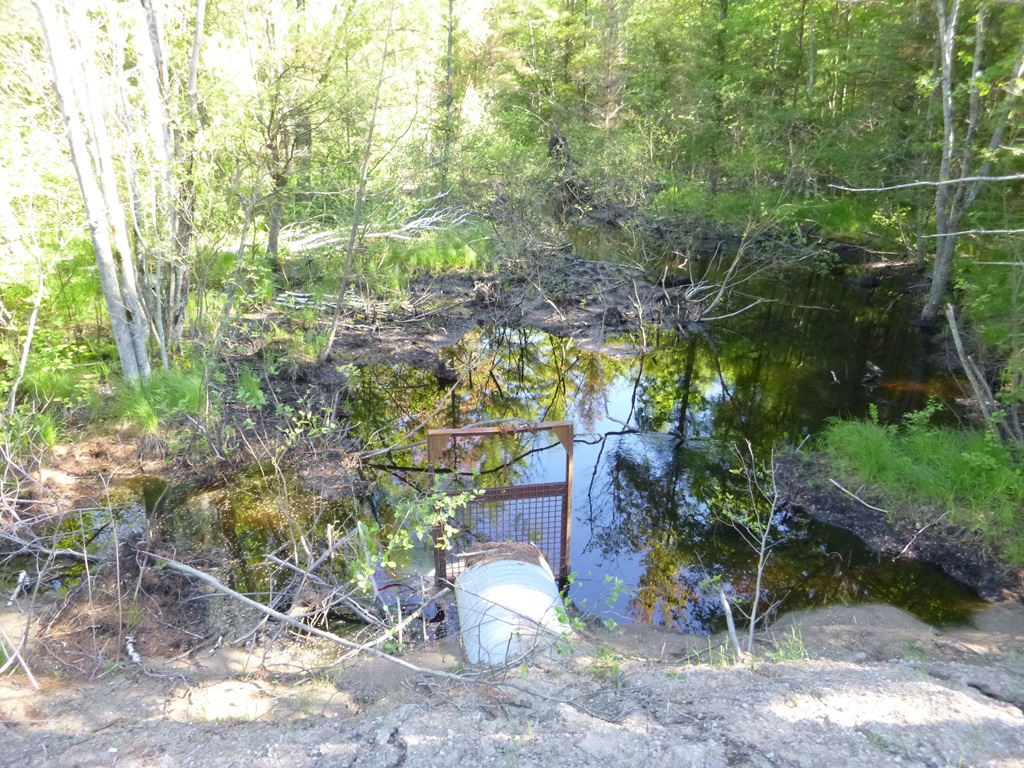
Upstream Conditions
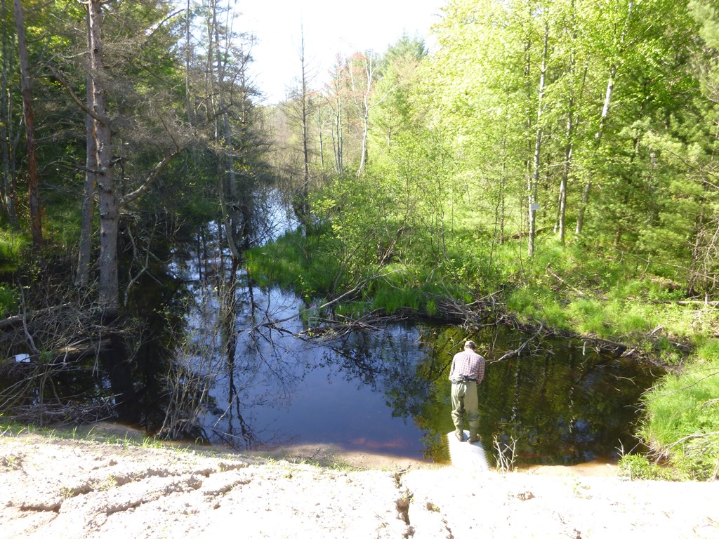
Downstream Conditions
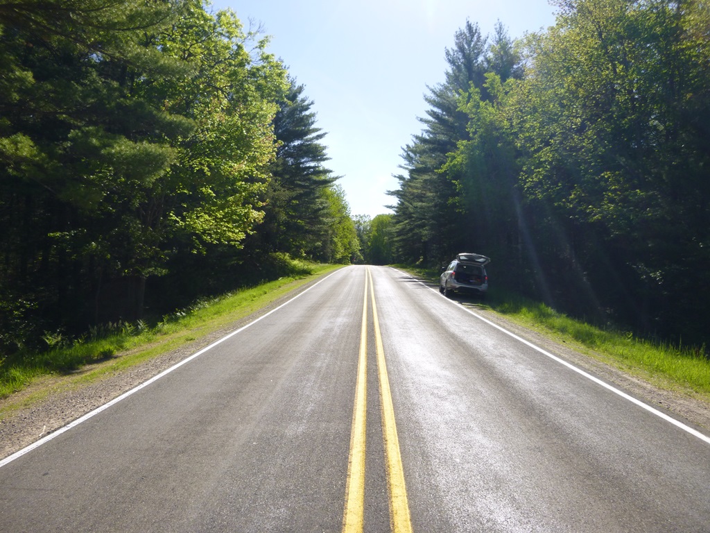
Road Approach - Left
Road Approach - Right
Crossing Information
Type of Crossing: culvert(s)
Number of Structures: 1
Structure Shape: Round
Inlet Type: Trash Rack
Outlet Type: At Stream Grade
Structure Material: Metal
Structure Substrate: None
General Conditions: Good
Structure Interior: corrugated
Dimensions of Structure: Length 90 ft.
, Width 3 ft.
, Height 3 ft.
Structure is NOT Perched
Structure Inlet
Water Depth: 3 ft.
Embedded Depth of Structure: 0.5 ft.
Water Velocity*: 0.4 ft./sec.
Structure Outlet
Water Depth: 2.9 ft.
Embedded Depth of Structure: 0 ft.
Water Velocity*: 2.6 ft./sec.
*Water Velocities were measured 0.5 ft. below Surface
(with Meter)
Stream Information
Stream Flow: Less than Bankfull
Scour Pool: Length 21 ft.
, Width 55 ft.
, Depth 4.4 ft.
Upstream Pond: Length 25 ft.
, Width 20 ft.
, Depth 1.6 ft.
Riffle Information
Water Depth: 0 ft.
Bankfull Width: 0 ft.
Wetted Width: 0 ft.
Water Velocity: 0 ft./sec.
Road Information
Paved
County Road
Road Condition: Good
Road Width at Culvert: 22 ft.
Location of Low Point: At Stream
Runoff Path: Ditch
Embankments
Upstream
Fill Depth: 8 ft.
Slope: 1:2
Downstream
Fill Depth: 7 ft.
Slope: 1:2
Approaches
Left Approach
Length: 575 ft.
Slope: 1% to 5%
Vegetation: Partial
LS Factor: 0.67
Erosion: 0.2802 tons/year
Right Approach
Length: 1000 ft.
Slope: 1% to 5%
Vegetation: Partial
LS Factor: 0.8
Erosion: 0.5818 tons/year
Erosion Information
Total Erosion at Crossing: 1.1898 tons/year
Extent of Erosion: Severe
Notes: Steep sandy embankments on both upstream and downstream sides lack vegetation and material is reaching the stream.
Location of Erosion | Erosion Dimensions | Eroded Material | Material Eroded | Total Erosion | ||
facing downstream | Length | Width | Depth | Reaching Stream? | (tons/year) | |
Left Upstream Embankment |
75 ft. |
16 ft. |
0.1 ft. |
yes |
Sand |
0.165 |
Left Downstream Embankment |
74 ft. |
18 ft. |
0.1 ft. |
yes |
Sand |
0.1628 |
Summary Information
Fish Passability 0.5
Erosion is an area of concern for this site.
Large unvegetated embankments appear to be contributing substantial material to Vaughn Creek.
A future visit to this site is recommended. Recommend establishing vegetation on embankments. Also, culvert probably somewhat undersized and a larger structure would be more appropriate.
�