Road Stream Crossing Site AGOG002
Au Gres River Watershed, Nester Creek
Sage Lake Rd
Logan Twp,
Ogemaw County
Information collected by:
Site Location
GPS Coordinates: 44.28047
, -83.92347
T22N
R4E
Sec 22 & 23
Owned by Private
Fish Passability 0
Perch Height: 1.3 ft.
Total Erosion: 0.4305 tons/year
Severity: Severe
Year Inventoried: 2014
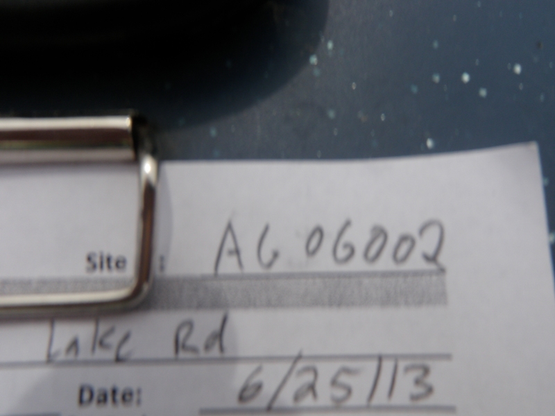
Site ID
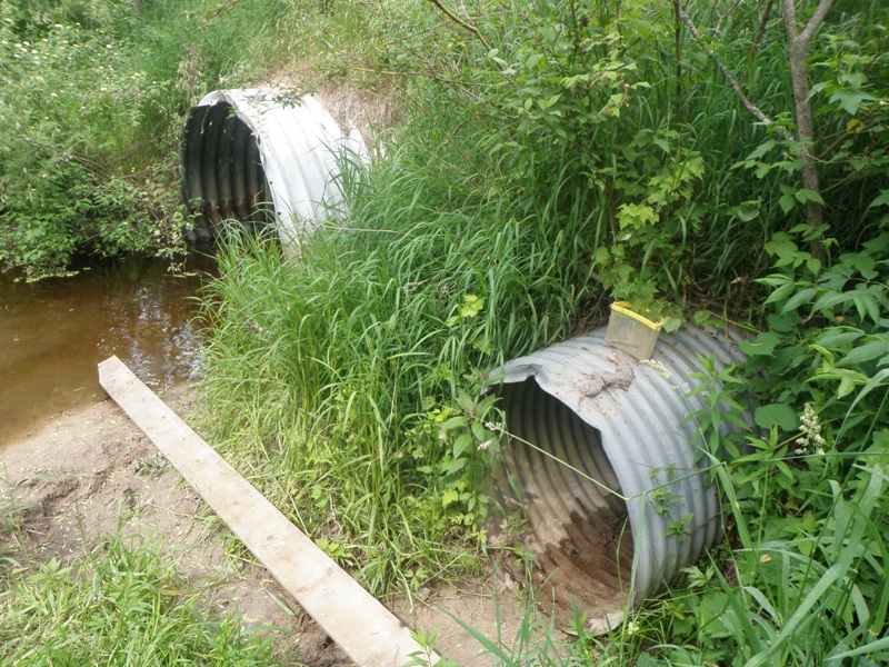
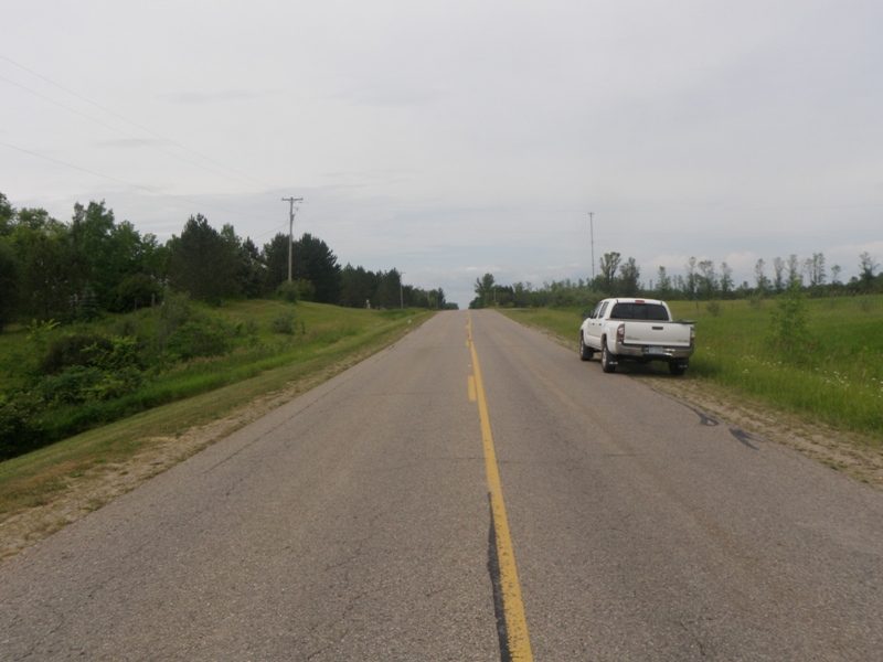
Inlet
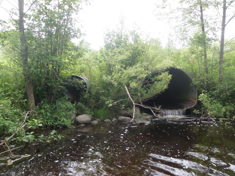
Outlet
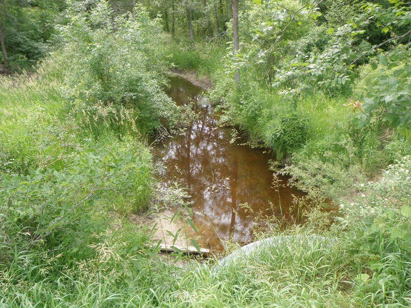
Upstream Conditions

Downstream Conditions
Road Approach - Left
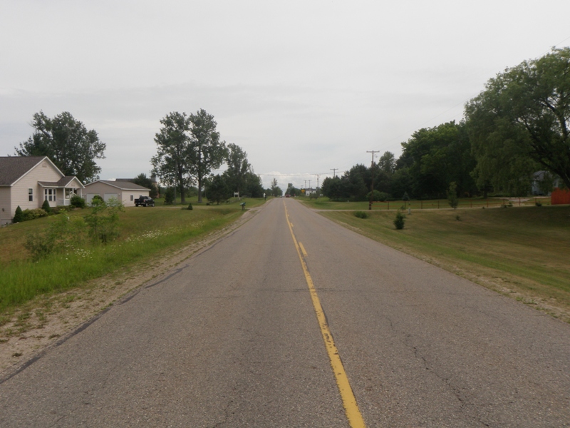
Road Approach - Right
Crossing Information
Type of Crossing: culvert(s)
Number of Structures: 2
Structure Shape: Pipe Arch
Inlet Type: Projecting
Outlet Type: Freefall into Pool
Structure Material: Metal
Structure Substrate: None
General Conditions: Good
Multiple Culverts/Spans | ||||
Culvert/Span | Width | Length | Height | Material |
1 |
7.7 ft. |
162 ft. |
6 ft. |
Metal |
2 |
2.8 ft. |
162 ft. |
3.1 ft. |
Metal |
Structure Interior: corrugated
Dimensions of Structure: Length 162 ft.
, Width 7.7 ft.
, Height 6 ft.
Perch Height: 1.3 ft.
Structure Inlet
Water Depth: 0.8 ft.
Embedded Depth of Structure: 0 ft.
Water Velocity*: 0.1 ft./sec.
Structure Outlet
Water Depth: 0.4 ft.
Embedded Depth of Structure: 0 ft.
Water Velocity*: 2 ft./sec.
*Water Velocities were measured 0.5 ft. below Surface
(with Meter)
Stream Information
Stream Flow: Less than Bankfull
Scour Pool: Length 51 ft.
, Width 36 ft.
, Depth 4 ft.
Upstream Pond: Length 0 ft.
, Width 0 ft.
, Depth 0 ft.
Riffle Information
Water Depth: 0.2 ft.
Bankfull Width: 13 ft.
Wetted Width: 9.5 ft.
Water Velocity: 1.7 ft./sec.
(Measured with Meter)
Dominant Substrate: Gravel
Road Information
Paved
County Road
Road Condition: Good
Road Width at Culvert: 26 ft.
Location of Low Point: At Stream
Runoff Path: Ditch
Embankments
Upstream
Fill Depth: 10.1 ft.
Slope: More than 1:2
Downstream
Fill Depth: 10.7 ft.
Slope: More than 1:2
Approaches
Left Approach
Length: 400 ft.
Slope: 1% to 5%
Vegetation: Heavy
LS Factor: 0.48
Erosion: 0.165 tons/year
Right Approach
Length: 575 ft.
Slope: 1% to 5%
Vegetation: Heavy
LS Factor: 0.515
Erosion: 0.2545 tons/year
Erosion Information
Total Erosion at Crossing: 0.4305 tons/year
Extent of Erosion: Minor
Notes: Stormwater drainage pipe adjacent to upstream culvert is contributing some sand to stream.
Location of Erosion | Erosion Dimensions | Eroded Material | Material Eroded | Total Erosion | ||
facing downstream | Length | Width | Depth | Reaching Stream? | (tons/year) | |
Right Upstream Ditch |
10 ft. |
2 ft. |
1 ft. |
yes |
Sand |
0.011 |
Summary Information
Fish Passability 0
Fish Passage is an area of concern for this site.
This is a good-sized stream and the structure is perched, preventing fish passage. This structure is not far from where Nester Creek joins the Au Gres River mainstem.
These non-native species were observerd at this site: Spotted Knapweed, Mullien, Autumn Olive
�