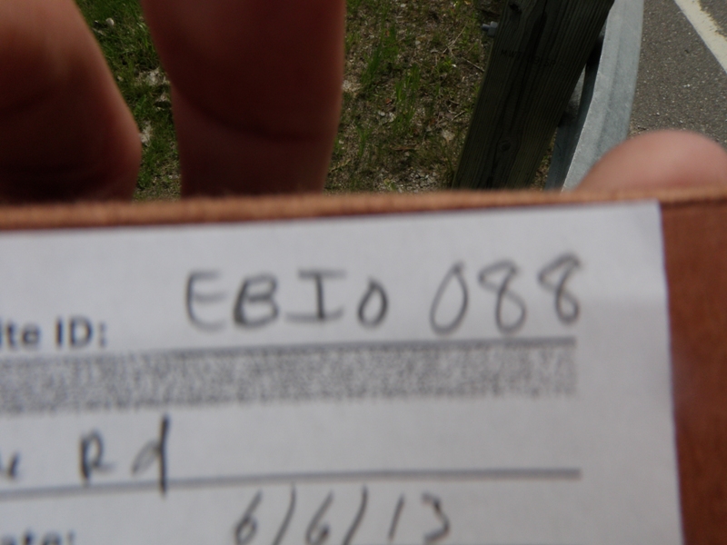
Road Stream Crossing Site EBIO088
Au Gres River Watershed, East Branch Au Gres River
Whittemore Rd
Sherman Twp,
Iosco County
Information collected by:
Site Location
GPS Coordinates: 44.23445
, -83.70126
T21N
R6E
Sec 3 & 10
Owned by Private
Fish Passability 1
Structure is NOT Perched
Total Erosion: 1.201 tons/year
Severity: Moderate
Year Inventoried: 2014
Site ID
Inlet
Outlet
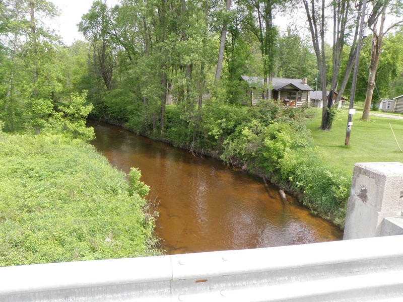
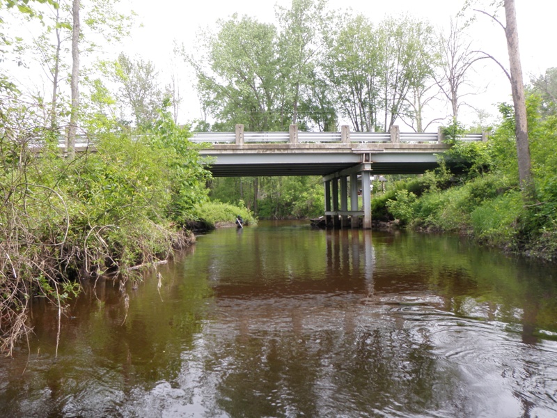
Upstream Conditions
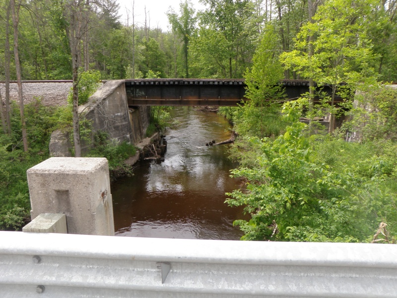
Downstream Conditions
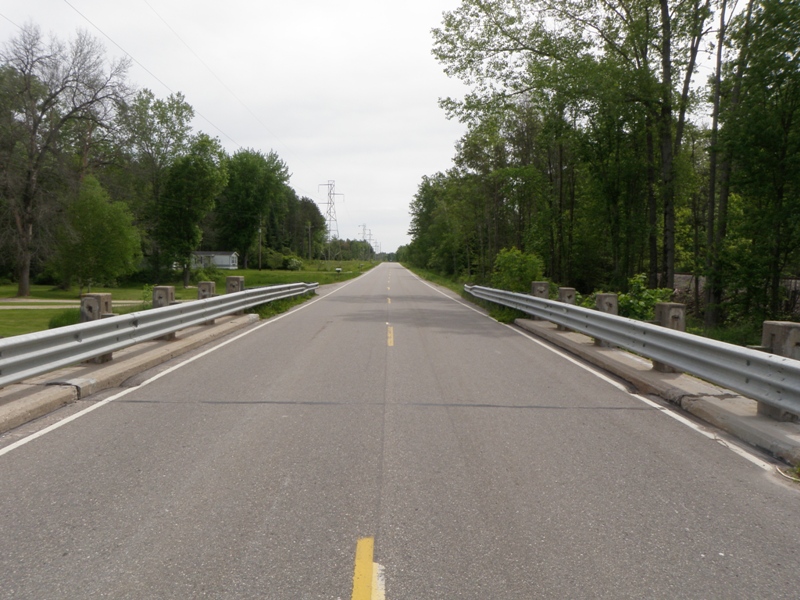
Road Approach - Left
Road Approach - Right
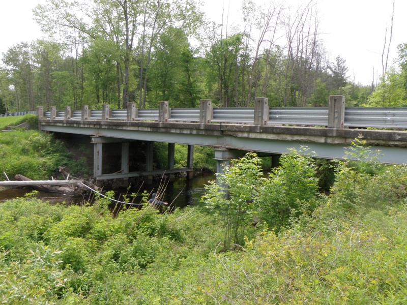
Crossing Information
Type of Crossing: Bridge
Structure Shape: Open Bottom Square/Rectangle
Inlet Type: Other
Outlet Type: At Stream Grade
Structure Material: Metal
Structure Substrate: Mixture
General Conditions: Fair
Structure Interior: smooth
Dimensions of Structure: Length 29 ft.
, Width 31 ft.
, Height 15 ft.
Structure is NOT Perched
Structure Inlet
Water Depth: 3 ft.
Embedded Depth of Structure: 0 ft.
Water Velocity*: 1.4 ft./sec.
Structure Outlet
Water Depth: 3 ft.
Embedded Depth of Structure: 0 ft.
Water Velocity*: 1.4 ft./sec.
*Water Velocities were measured 0.5 ft. below Surface
(with Meter)
Stream Information
Stream Flow: Less than Bankfull
Scour Pool: Length 0 ft.
, Width 0 ft.
, Depth 0 ft.
Upstream Pond: Length 0 ft.
, Width 0 ft.
, Depth 0 ft.
Riffle Information
Water Depth: 0.8 ft.
Bankfull Width: 52 ft.
Wetted Width: 40.5 ft.
Water Velocity: 2.9 ft./sec.
(Measured with Meter)
Dominant Substrate: Gravel
Road Information
Paved
Private Road
Road Condition: Good
Road Width at Culvert: 23 ft.
Location of Low Point: At Stream
Runoff Path: Roadway
Fill Depth: 0 ft.
Slope: Vertical
Fill Depth: 0 ft.
Slope: Vertical
Approaches
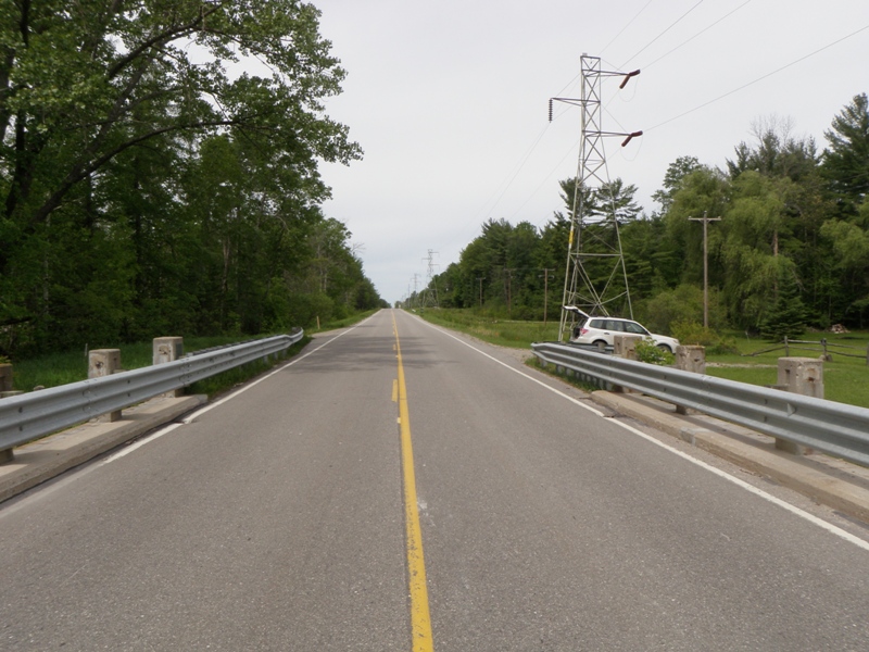
Left Approach
Length: 1000 ft.
Slope: 1% to 5%
Vegetation: Heavy
LS Factor: 0.57
Erosion: 0.4334 tons/year
Right Approach
Length: 1000 ft.
Slope: 1% to 5%
Vegetation: Heavy
LS Factor: 0.57
Erosion: 0.4334 tons/year
Erosion Information
Total Erosion at Crossing: 1.201 tons/year
Extent of Erosion: Moderate
Notes: Significant amount of material eroding from both streambanks underneath this bridge.
Location of Erosion | Erosion Dimensions | Eroded Material | Material Eroded | Total Erosion | ||
facing downstream | Length | Width | Depth | Reaching Stream? | (tons/year) | |
Right Downstream Streambank |
21 ft. |
32 ft. |
0.8 ft. |
yes |
Sand |
0.1294 |
Left Downstream Streambank |
19 ft. |
29 ft. |
1.4 ft. |
yes |
Sand |
0.2048 |
Summary Information
Fish Passability 1
Erosion is an area of concern for this site.
Yes, relatively large erosion site under the bridge appears to be contributing significant sediment to the East Branch Au Gres River.
A future visit to this site is recommended. Control erosion under bridge. It appears that water draining off road through drains in the bridge are causing much of the erosion.
�