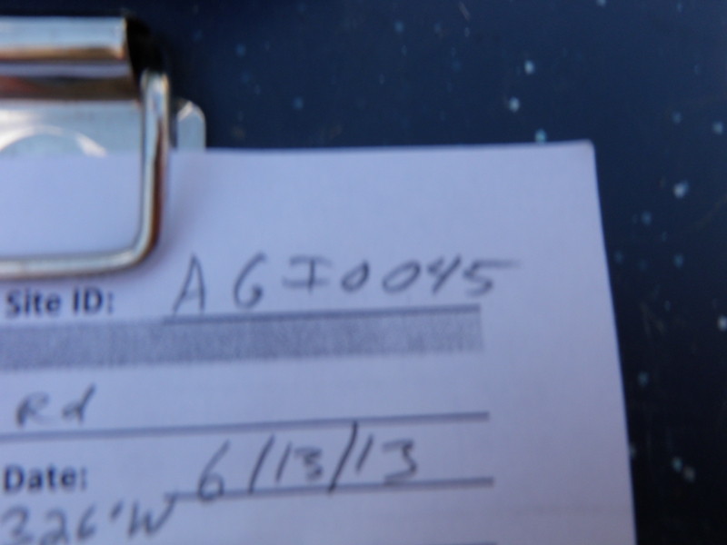
Road Stream Crossing Site AGIO045
Au Gres River Watershed, Whitney Creek
Hottis Rd
Burleigh Twp,
Iosco County
Information collected by:
Site Location
GPS Coordinates: 44.19241
, -83.85326
T21N
R5E
Sec 20
Owned by Private
Fish Passability 1
Structure is NOT Perched
Total Erosion: 34.5334 tons/year
Severity: Severe
Year Inventoried: 2014
Site ID
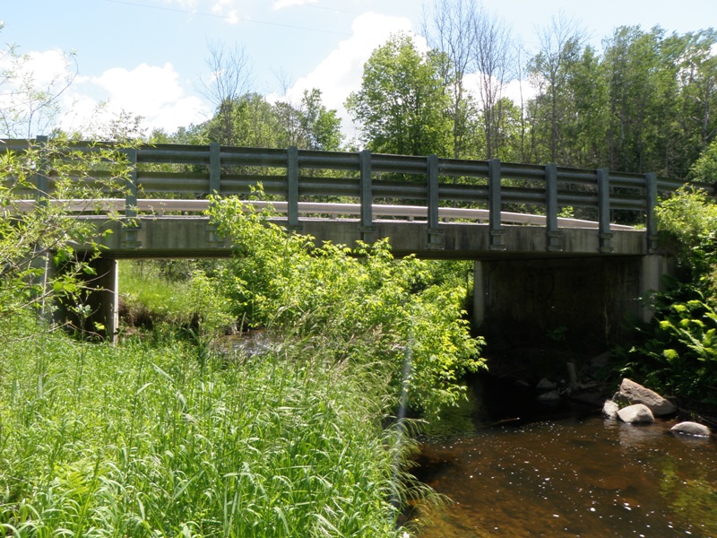
Inlet
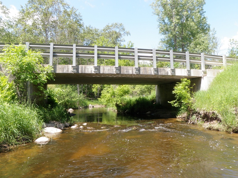
Outlet
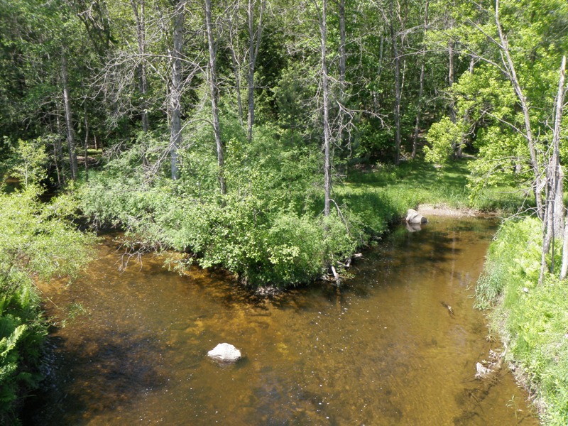
Upstream Conditions
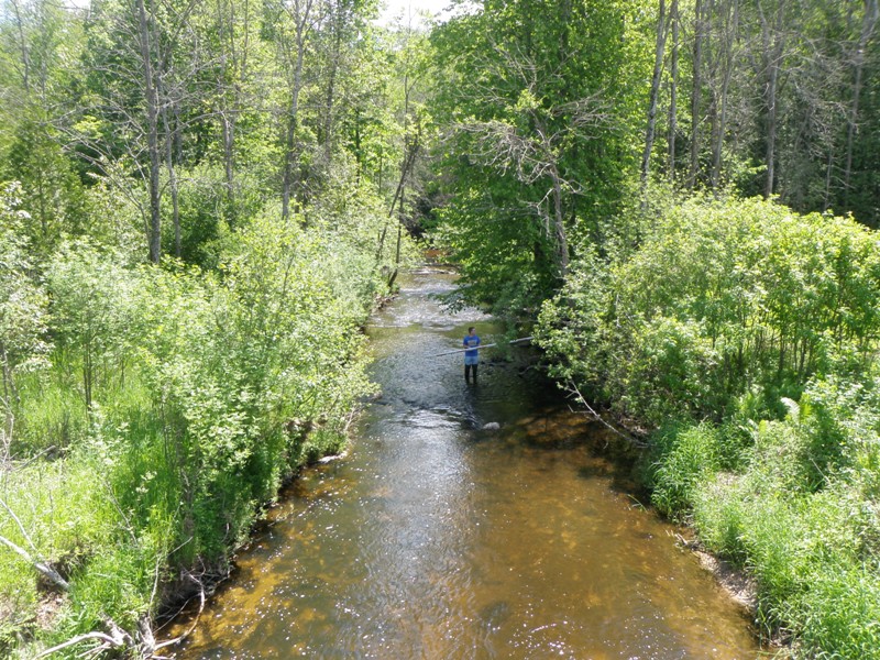
Downstream Conditions
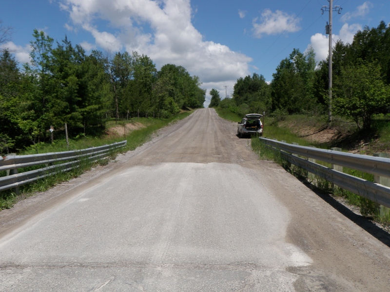
Road Approach - Left
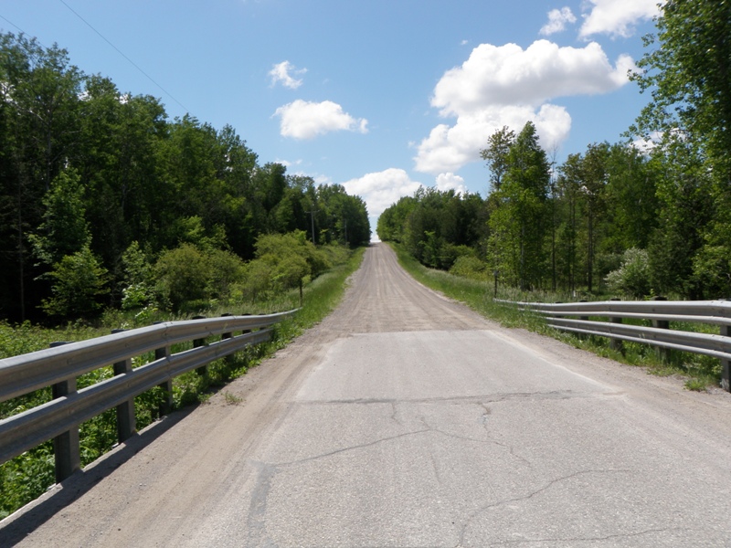
Road Approach - Right
Crossing Information
Type of Crossing: Bridge
Structure Shape: Open Bottom Square/Rectangle
Inlet Type: Other
Outlet Type: At Stream Grade
Structure Material: Concrete
Structure Substrate: Mixture
General Conditions: Good
Structure Interior: smooth
Dimensions of Structure: Length 24 ft.
, Width 36 ft.
, Height 10.5 ft.
Structure is NOT Perched
Structure Inlet
Water Depth: 1 ft.
Embedded Depth of Structure: 0 ft.
Water Velocity*: 1.2 ft./sec.
Structure Outlet
Water Depth: 1.1 ft.
Embedded Depth of Structure: 0 ft.
Water Velocity*: 1.4 ft./sec.
*Water Velocities were measured 0.5 ft. below Surface
(with Meter)
Stream Information
Stream Flow: Less than Bankfull
Scour Pool: Length 0 ft.
, Width 0 ft.
, Depth 0 ft.
Upstream Pond: Length 0 ft.
, Width 0 ft.
, Depth 0 ft.
Riffle Information
Water Depth: 0.6 ft.
Bankfull Width: 41 ft.
Wetted Width: 25.8 ft.
Water Velocity: 1.7 ft./sec.
(Measured with Meter)
Dominant Substrate: Gravel
Road Information
Gravel
County Road
Road Condition: Good
Road Width at Culvert: 24 ft.
Location of Low Point: At Stream
Runoff Path: Ditch
Fill Depth: 0 ft.
Slope: Vertical
Fill Depth: 0 ft.
Slope: Vertical
Approaches
Left Approach
Length: 1000 ft.
Slope: 6% to 10%
Vegetation: Partial
LS Factor: 3.15
Erosion: 20.8264 tons/year
Right Approach
Length: 1000 ft.
Slope: 6% to 10%
Vegetation: Heavy
LS Factor: 2.05
Erosion: 13.5537 tons/year
Erosion Information
Total Erosion at Crossing: 34.5334 tons/year
Extent of Erosion: Moderate
Notes: Erosion at left downstream bank behind bridge pillar.
Location of Erosion | Erosion Dimensions | Eroded Material | Material Eroded | Total Erosion | ||
facing downstream | Length | Width | Depth | Reaching Stream? | (tons/year) | |
Left Downstream Streambank |
2.8 ft. |
22 ft. |
2 ft. |
yes |
Sandy Loam |
0.0376 |
Left Downstream Embankment |
8.6 ft. |
5 ft. |
2 ft. |
yes |
Sandy Loam |
0.1156 |
Summary Information
Fish Passability 1
A future visit to this site is recommended. Install erosion control measures on eroding banks.
These non-native species were observerd at this site: Autumn Olive
�