Road Stream Crossing Site AGIO051
Au Gres River Watershed, Elm Creek
National City Rd
Sherman Twp,
Iosco County
Information collected by:
Site Location
GPS Coordinates: 44.22246
, -83.72291
T21N
R6E
Sec 8 & 9
Owned by Private
Fish Passability 0
Perch Height: 1.2 ft.
Total Erosion: 1.9379 tons/year
Severity: Severe
Year Inventoried: 2014

Site ID
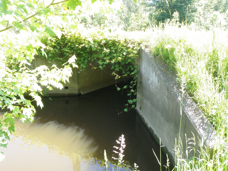
Inlet
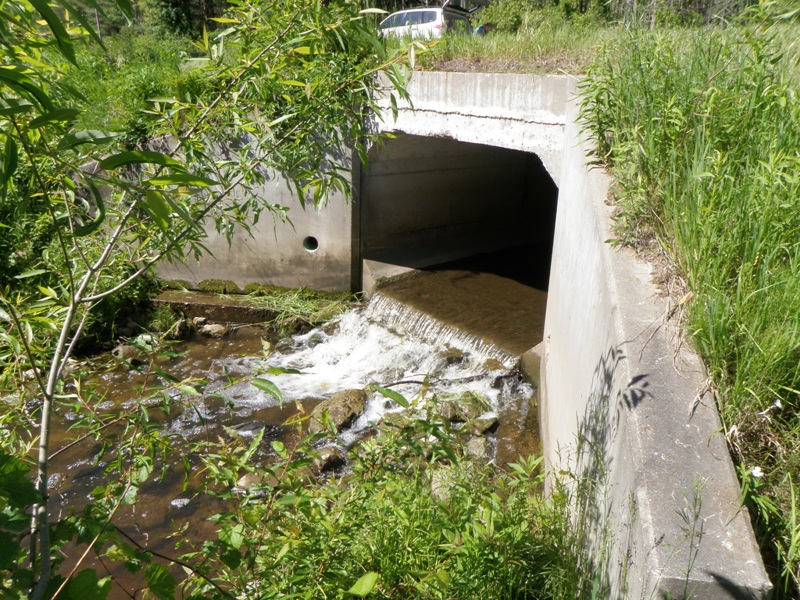
Outlet
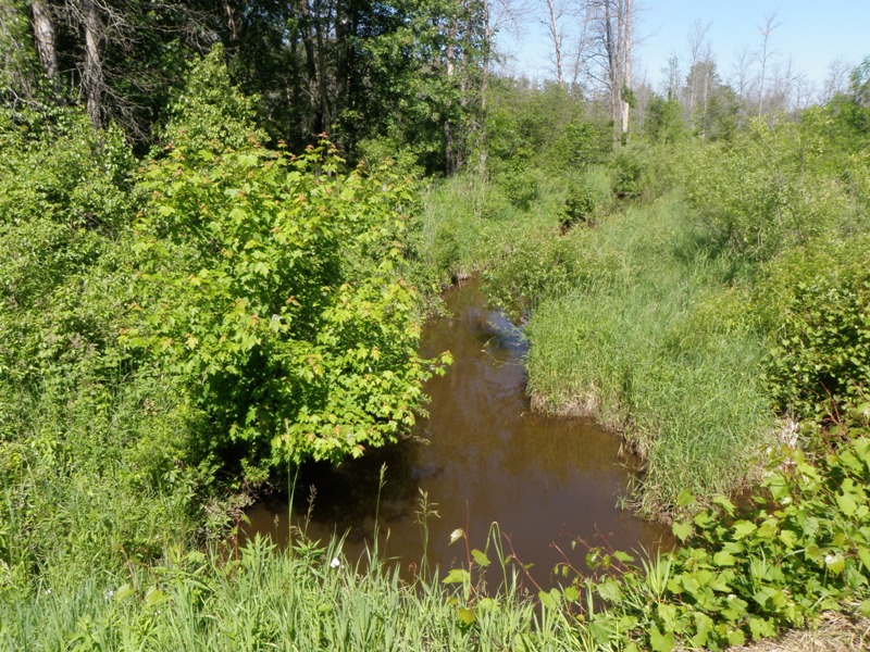
Upstream Conditions
Downstream Conditions
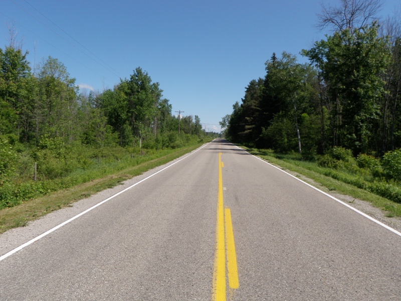
Road Approach - Left
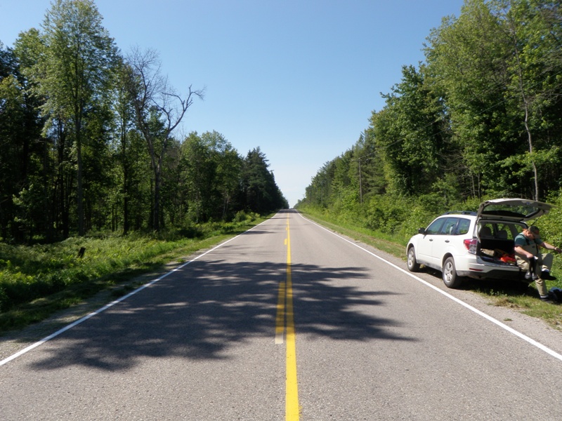
Road Approach - Right
Crossing Information
Type of Crossing: culvert(s)
Number of Structures: 1
Structure Shape: Square/Rectangle
Inlet Type: Wingwall 30-70 Degree
Outlet Type: Freefall onto Riprap
Structure Material: Concrete
Structure Substrate: None
General Conditions: Good
Structure Interior: smooth
Dimensions of Structure: Length 41 ft.
, Width 8 ft.
, Height 5 ft.
Perch Height: 1.2 ft.
Structure Inlet
Water Depth: 0.5 ft.
Embedded Depth of Structure: 0 ft.
Water Velocity*: 0.7 ft./sec.
Structure Outlet
Water Depth: 0.2 ft.
Embedded Depth of Structure: 0 ft.
Water Velocity*: 2.5 ft./sec.
*Water Velocities were measured at the Surface
(with Float Test)
Stream Information
Stream Flow: Less than Bankfull
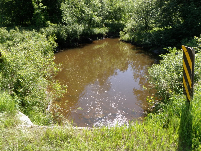
Scour Pool: Length 72 ft.
, Width 50 ft.
, Depth 5.1 ft.
Upstream Pond: Length 22.5 ft.
, Width 17 ft.
, Depth 3.8 ft.
Riffle Information
Water Depth: 0.8 ft.
Bankfull Width: 16 ft.
Wetted Width: 10.2 ft.
Water Velocity: 0.9 ft./sec.
(Measured with Float Test)
Dominant Substrate: Gravel
Road Information
Paved
County Road
Road Condition: Good
Road Width at Culvert: 22 ft.
Location of Low Point: At Stream
Runoff Path: Ditch
Embankments
Upstream
Fill Depth: 0.7 ft.
Slope: More than 1:2
Downstream
Fill Depth: 0.6 ft.
Slope: More than 1:2
Approaches
Left Approach
Length: 1000 ft.
Slope: 1% to 5%
Vegetation: Heavy
LS Factor: 0.57
Erosion: 0.4145 tons/year
Right Approach
Length: 1000 ft.
Slope: 1% to 5%
Vegetation: Heavy
LS Factor: 0.57
Erosion: 0.4145 tons/year
Erosion Information
Total Erosion at Crossing: 1.9379 tons/year
Extent of Erosion: Moderate
Notes: Significant streambank erosion on left side of scour pool.
Location of Erosion | Erosion Dimensions | Eroded Material | Material Eroded | Total Erosion | ||
facing downstream | Length | Width | Depth | Reaching Stream? | (tons/year) | |
Left Downstream Streambank |
60 ft. |
1 ft. |
3 ft. |
yes |
Loam |
1.1088 |
Summary Information
Fish Passability 0
Fish Passage is an area of concern for this site.
This is a decent sized stream and this structure is a significant fish passage barrier. The erosion at this site is also notable.
A future visit to this site is recommended. Replace culvert with an appropriately sized structure.
�