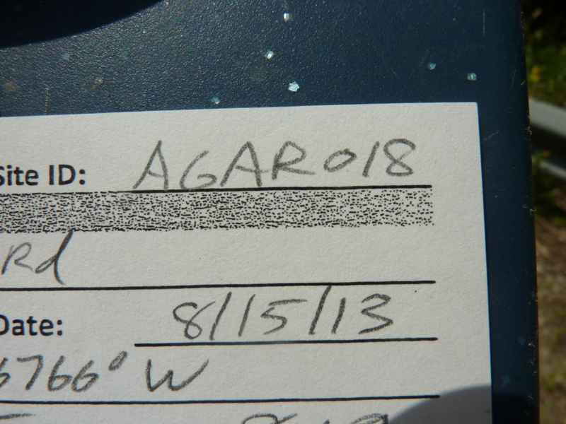
Road Stream Crossing Site AGAR018
Au Gres River Watershed, Scott Drain
Lentner Rd
Turner Twp,
Arenac County
Information collected by:
Site Location
GPS Coordinates: 44.14959
, -83.76766
T20N
R6E
Sec 8 & 9
Owned by Private
Fish Passability 1
Structure is NOT Perched
Total Erosion: 0.5259 tons/year
Severity: Moderate
Year Inventoried: 2014
Site ID
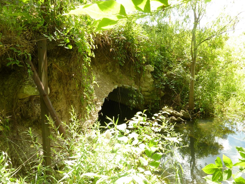
Inlet
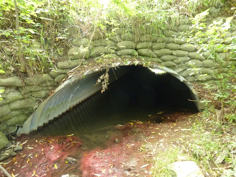
Outlet
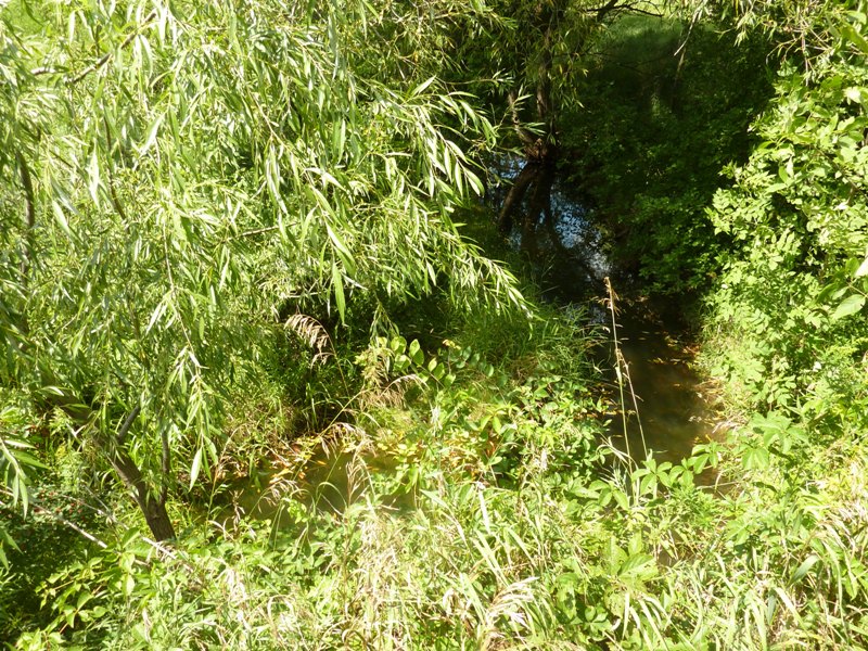
Upstream Conditions
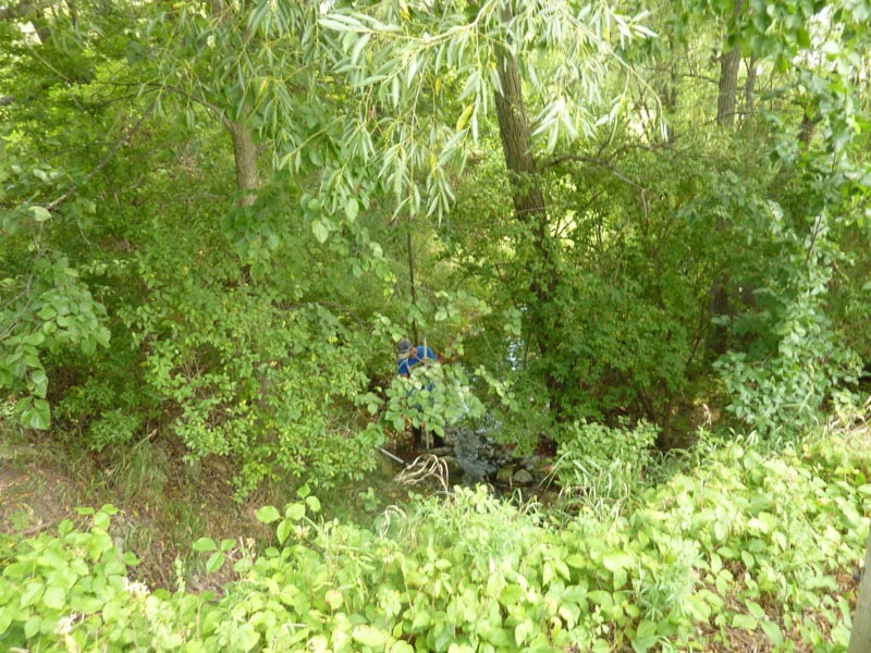
Downstream Conditions
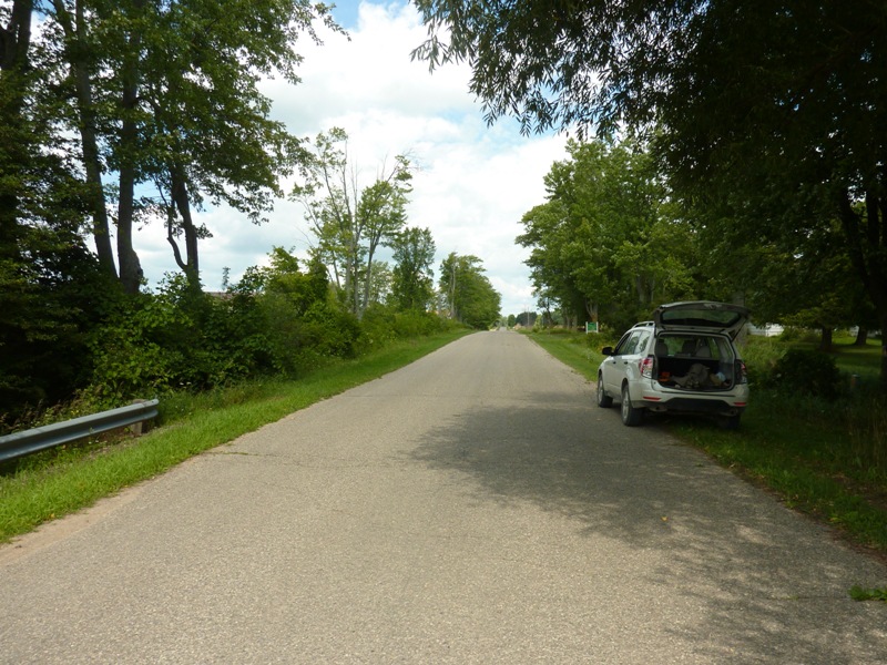
Road Approach - Left
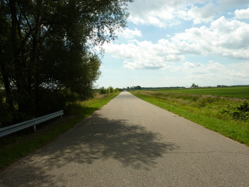
Road Approach - Right
Crossing Information
Type of Crossing: culvert(s)
Number of Structures: 1
Structure Shape: Ellipse
Inlet Type: Headwall
Outlet Type: At Stream Grade
Structure Material: Metal
Structure Substrate: Rock
General Conditions: Poor
Structure Interior: corrugated
Dimensions of Structure: Length 45 ft.
, Width 12 ft.
, Height 6 ft.
Percentage Plugged:
Inlet: 0%
Outlet: 26% to 50%
In Pipe: 0%
Structure is NOT Perched
Structure Inlet
Water Depth: 1.3 ft.
Embedded Depth of Structure: 0.2 ft.
Water Velocity*: 0.1 ft./sec.
Structure Outlet
Water Depth: 0.6 ft.
Embedded Depth of Structure: 2 ft.
Water Velocity*: 0.1 ft./sec.
*Water Velocities were measured 0.2 ft. below Surface
(with Meter)
Stream Information
Stream Flow: Less than 1/2 Bankfull
Scour Pool: Length 0 ft.
, Width 0 ft.
, Depth 0 ft.
Upstream Pond: Length 0 ft.
, Width 0 ft.
, Depth 0 ft.
Riffle Information
Water Depth: 0.1 ft.
Bankfull Width: 18.5 ft.
Wetted Width: 5.5 ft.
Water Velocity: 1.4 ft./sec.
(Measured with Meter)
Dominant Substrate: Cobble
Road Information
Paved
County Road
Road Condition: Good
Road Width at Culvert: 21 ft.
Location of Low Point: Other
Runoff Path: Ditch
Embankments
Upstream
Fill Depth: 3 ft.
Slope: 1:2
Downstream
Fill Depth: 3.5 ft.
Slope: 1:2
Approaches
Left Approach
Length: 275 ft.
Slope: 1% to 5%
Vegetation: Heavy
LS Factor: 0.45
Erosion: 0.0859 tons/year
Right Approach
Length: 0 ft.
Slope: Less Than 1%
Vegetation: Heavy
LS Factor: 0.05
Erosion: 0 tons/year
Erosion Information
Total Erosion at Crossing: 0.5259 tons/year
Extent of Erosion: Severe
Notes: Headwall and fill above headwall are eroding severely, threatening to erode road shoulder.
Location of Erosion | Erosion Dimensions | Eroded Material | Material Eroded | Total Erosion | ||
facing downstream | Length | Width | Depth | Reaching Stream? | (tons/year) | |
Right Upstream Embankment |
20 ft. |
3 ft. |
1 ft. |
yes |
Sand |
0.44 |
Summary Information
Fish Passability 1
Erosion is an area of concern for this site.
Upstream headwall is eroding severely. Probably more of a potential road damage / safety issue than an environmental issue.
�