Road Stream Crossing Site LTB-027
Little Traverse Bay Watershed, Five Mile Creek
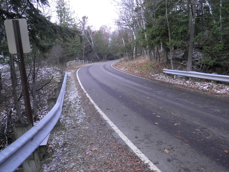
Lower Shore Dr
West Traverse Twp,
Emmet County
Information collected by:
Site Location
GPS Coordinates: 45.46570914
, -85.07517534
Perch Height: 0.25 ft.
Total Erosion: 6.3339 tons/year
Severity: Severe
Year Inventoried: 2014
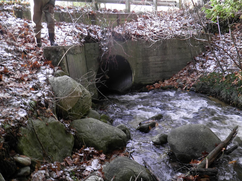
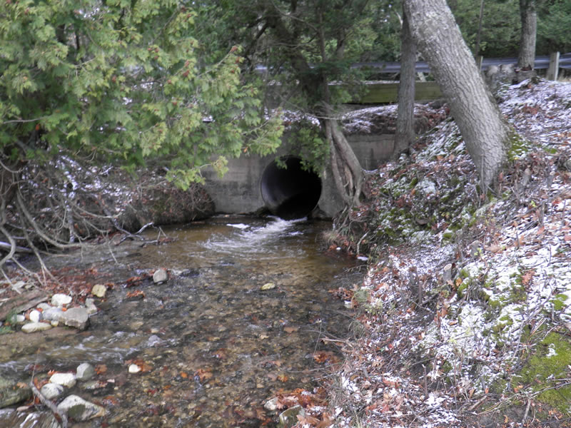
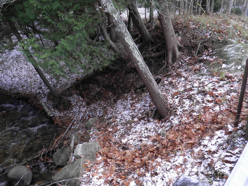
Inlet
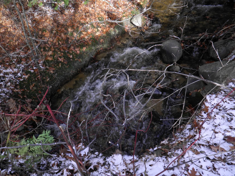
Upstream Conditions
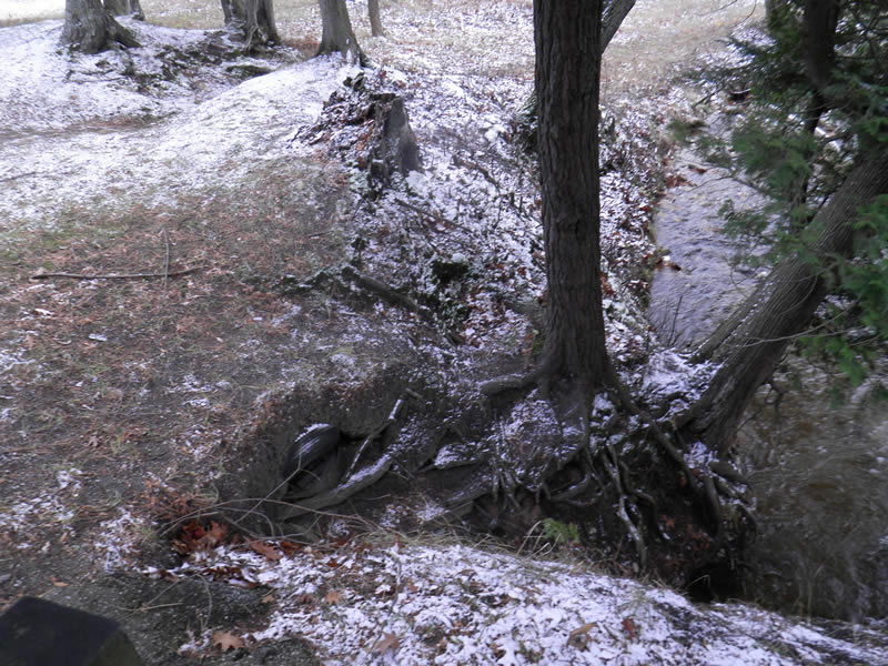
Outlet
Road Approach - Right
Road Approach - Left
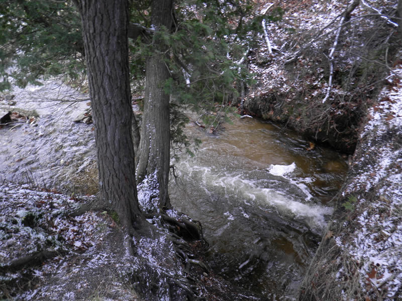
Downstream Conditions
Other
Other
Crossing Information
Type of Crossing: culvert(s)
Number of Structures: 1
Structure Shape: Round
Inlet Type: Projecting
Outlet Type: Freefall into Pool
Structure Material: Metal
Structure Substrate: None
General Conditions: Fair
Structure Interior: corrugated
Dimensions of Structure: Length 33 ft.
, Width 6 ft.
, Height 6 ft.
Perch Height: 0.25 ft.
Structure Inlet
Water Depth: 0.25 ft.
Embedded Depth of Structure: 0 ft.
Water Velocity*: 3.8 ft./sec.
Structure Outlet
Water Depth: 0.25 ft.
Embedded Depth of Structure: 0 ft.
Water Velocity*: 9.2 ft./sec.
*Water Velocities were measured at the Surface
(with Meter)
Additional Comments
Old site ID: FM-3.
Stream Information
Stream Flow: Less than Bankfull
Scour Pool: Length 15 ft.
, Width 15 ft.
, Depth 2.66 ft.
Riffle Information
Water Depth: 0.66 ft.
Bankfull Width: 6.17 ft.
Wetted Width: 6.17 ft.
Water Velocity: 3.42 ft./sec.
(Measured with Meter)
Dominant Substrate: Cobble
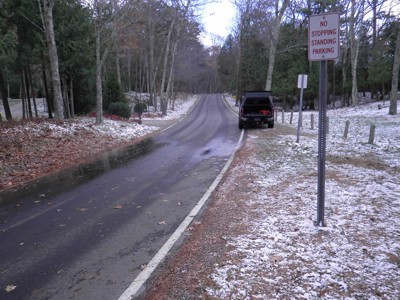
Road Information
Paved
County Road
Road Condition: Good
Road Width at Culvert: 25 ft.
Location of Low Point: At Stream
Runoff Path: Roadway
Embankments
Upstream
Fill Depth: 7 ft.
Slope: 1:1
Downstream
Fill Depth: 10 ft.
Slope: Vertical
Approaches
Left Approach
Length: 350 ft.
Slope: More Than 10%
Vegetation: None
LS Factor: 6.29
Erosion: 1.8194 tons/year
Right Approach
Length: 200 ft.
Slope: 6% to 10%
Vegetation: None
LS Factor: 1.72
Erosion: 0.2843 tons/year
Erosion Information
Total Erosion at Crossing: 6.3339 tons/year
Extent of Erosion: Moderate
Erosion is occurring and corrective actions can be installed to address the problem.
Notes: Bank stabilization can mitigate further erosion of embankments. Stream bank vegetation cut on downstream side. Streambank vegetation cut on downstream side.
Location of Erosion | Erosion Dimensions | Eroded Material | Material Eroded | Total Erosion | ||
facing downstream | Length | Width | Depth | Reaching Stream? | (tons/year) | |
Left Downstream Embankment |
70 ft. |
10 ft. |
6.17 ft. |
yes |
Silt |
2.5698 |
Right Downstream Embankment |
70 ft. |
10 ft. |
6.17 ft. |
yes |
Silt |
2.5698 |
Left Upstream Embankment |
60 ft. |
12.5 ft. |
6.25 ft. |
no |
||
Left Upstream Embankment |
60 ft. |
12.5 ft. |
6.25 ft. |
no |
||
Summary Information
Erosion is an area of concern for this site.
Perched culvert prevents fish passage; severe erosion.
A future visit to this site is recommended. Erosion
�