Road Stream Crossing Site LTB-030
Little Traverse Bay Watershed, Birchwood Creek
Lower Shore Dr
West Traverse Twp,
Emmet County
Information collected by:
Site Location
GPS Coordinates: 45.45274754
, -85.05686713
Fish Passability 0
Perch Height: 1 ft.
Total Erosion: 0 tons/year
Severity: Severe
Year Inventoried: 2014
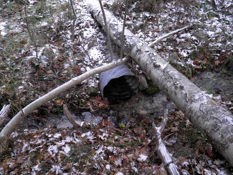
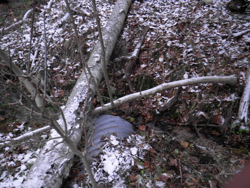
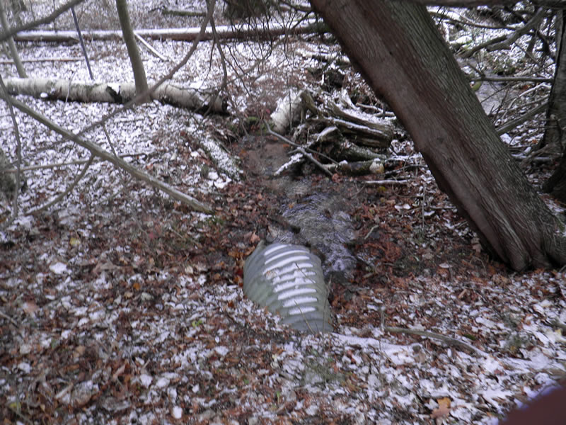
Inlet
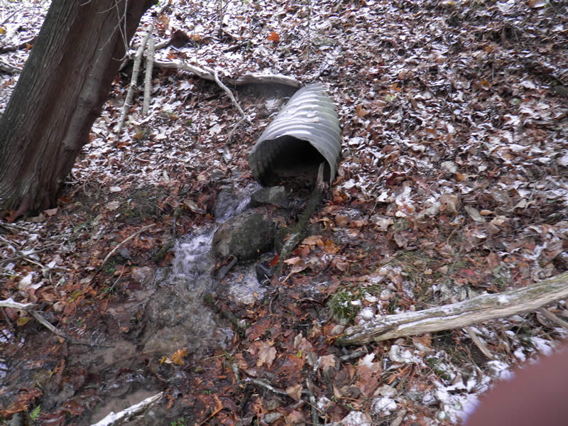
Outlet
Upstream Conditions
Downstream Conditions
Road Approach - Left
Road Approach - Right
Crossing Information
Type of Crossing: culvert(s)
Number of Structures: 1
Structure Shape: Round
Inlet Type: Projecting
Outlet Type: Cascade over Riprap
Structure Material: Metal
Structure Substrate: Sand
General Conditions: Good
Structure Interior: corrugated
Dimensions of Structure: Length 40.5 ft.
, Width 1.58 ft.
, Height 1.58 ft.
Percentage Plugged:
Inlet: 1% to 25%
Outlet: 1% to 25%
In Pipe: 0%
Perch Height: 1 ft.
Structure Inlet
Water Depth: 0.17 ft.
Embedded Depth of Structure: 0.07 ft.
Water Velocity*: 1.25 ft./sec.
Structure Outlet
Water Depth: 1.42 ft.
Embedded Depth of Structure: 0.17 ft.
Water Velocity*: 1.17 ft./sec.
*Water Velocities were measured at the Surface
(with Meter)
Additional Comments
Old site ID: UT-28.
Stream Information
Stream Flow: Less than Bankfull
Riffle Information
Water Depth: 0.25 ft.
Bankfull Width: 2.08 ft.
Wetted Width: 1.42 ft.
Water Velocity: 1 ft./sec.
(Measured with Meter)
Dominant Substrate: Gravel
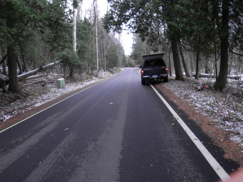
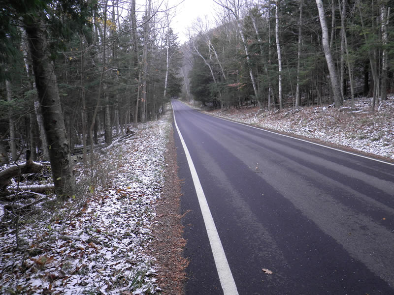
Road Information
Paved
County Road
Road Condition: Good
Road Width at Culvert: 23 ft.
Location of Low Point: Other
Runoff Path: Roadway
Embankments
Upstream
Fill Depth: 0.5 ft.
Slope: More than 1:2
Downstream
Fill Depth: 2.5 ft.
Slope: More than 1:2
Length: 500 ft.
Slope: 6% to 10%
Length: 5 ft.
Slope: Less Than 1%
Erosion Information
Total Erosion at Crossing: 0 tons/year
Extent of Erosion: Stabilized
Notes: None.
Summary Information
Fish Passability 0
�