Road Stream Crossing Site LTB-077
Little Traverse Bay Watershed, Tannery Creek
Mitchell Rd and Creekside
Bear Creek Twp,
Emmet County
Information collected by:
Site Location
GPS Coordinates: 45.37386113
, -84.91850408
Fish Passability 0.9
Total Erosion: 0.0752 tons/year
Severity: Minor
Year Inventoried: 2014
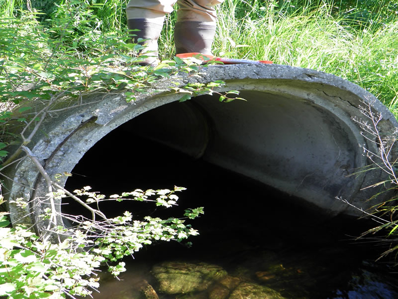
Outlet
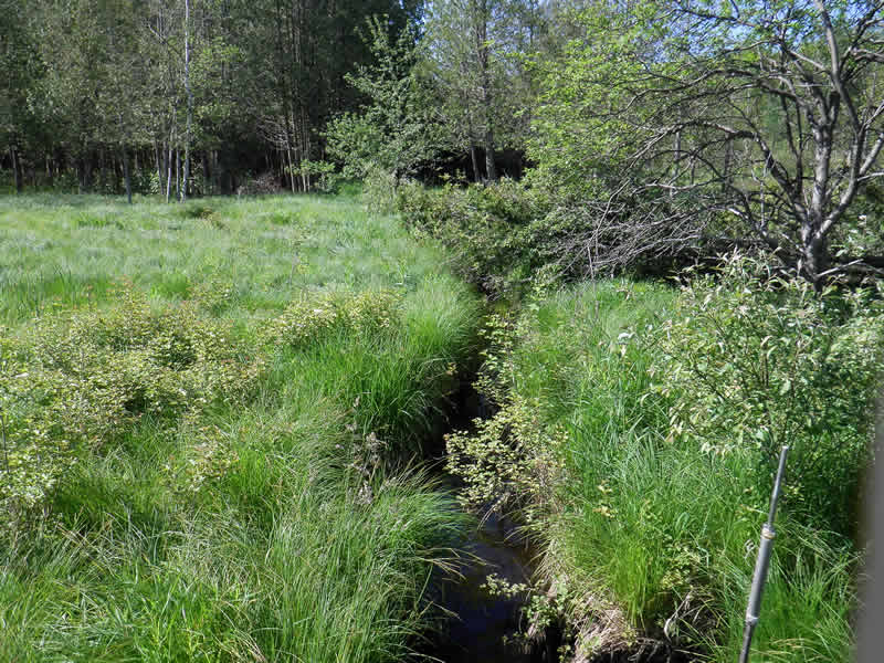
Upstream Conditions

Downstream Conditions
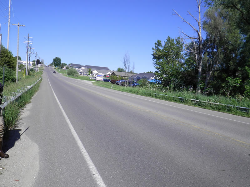
Road Approach - Left
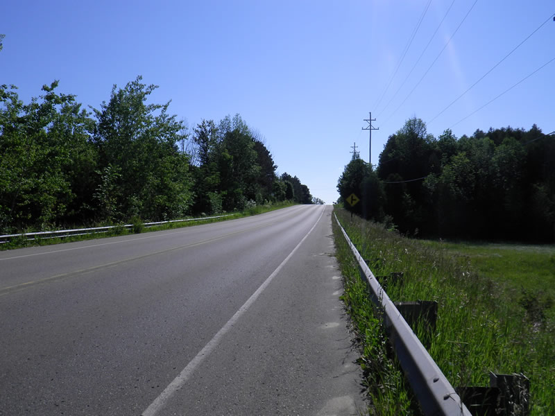
Road Approach - Right
Crossing Information
Type of Crossing: culvert(s)
Number of Structures: 1
Structure Shape: Round
Inlet Type: Projecting
Outlet Type: At Stream Grade
Structure Material: Concrete
Structure Substrate: Sand
General Conditions: Good
Dimensions of Structure: Length 75 ft.
, Width 4 ft.
, Height 4 ft.
Structure Inlet
Water Depth: 0.75 ft.
Embedded Depth of Structure: 0.33 ft.
Water Velocity*: 0.25 ft./sec.
Structure Outlet
Water Depth: 1 ft.
Embedded Depth of Structure: 3.42 ft.
Water Velocity*: 0.02 ft./sec.
*Water Velocities were measured 0.45 ft. below Surface
(with Meter)
Additional Comments
Old site ID: TC-10.
Stream Information
Stream Flow: Less than 1/2 Bankfull
Riffle Information
Water Depth: 0.167 ft.
Bankfull Width: 4.25 ft.
Wetted Width: 3.75 ft.
Water Velocity: 0.7 ft./sec.
(Measured with Meter)
Dominant Substrate: Sand
Road Information
Paved
State Road
Road Condition: Good
Road Width at Culvert: 35 ft.
Location of Low Point: Other
Runoff Path: Ditch
Embankments
Upstream
Fill Depth: 15 ft.
Slope: Vertical
Downstream
Fill Depth: 15 ft.
Slope: Vertical
Approaches
Left Approach
Length: 100 ft.
Slope: Less Than 1%
Vegetation: Heavy
LS Factor: 0.05
Erosion: 0.0058 tons/year
Right Approach
Length: 150 ft.
Slope: 1% to 5%
Vegetation: Heavy
LS Factor: 0.4
Erosion: 0.0694 tons/year
Erosion Information
Total Erosion at Crossing: 0.0752 tons/year
Extent of Erosion: Stabilized
Summary Information
Fish Passability 0.9
These non-native species were observerd at this site: Reed Canary Grass
�