Road Stream Crossing Site LTB-117
Little Traverse Bay Watershed, Unknown tributary of Bear River
Click Rd
Bear Creek Twp,
Emmet County
Information collected by:
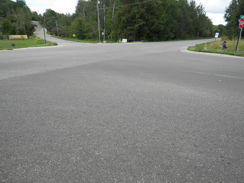
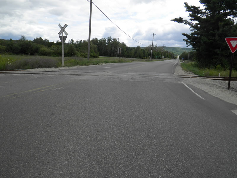
Site Location
GPS Coordinates: 45.33392185
, -84.93717291
Fish Passability 0.5
Total Erosion: 0.0557 tons/year
Severity: Moderate
Year Inventoried: 2014
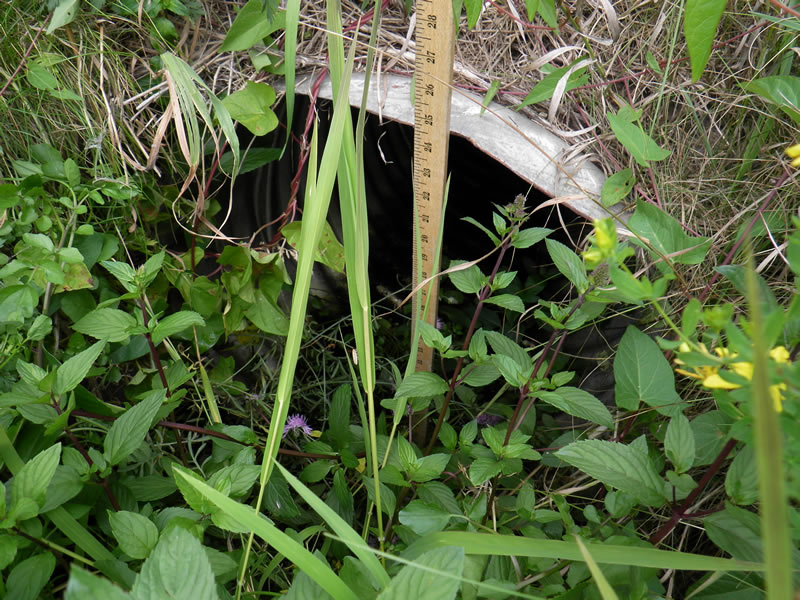
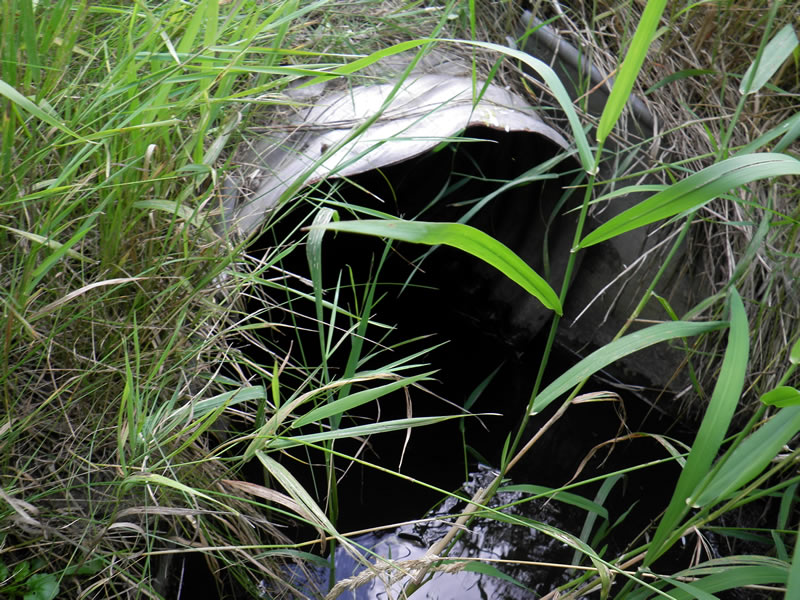
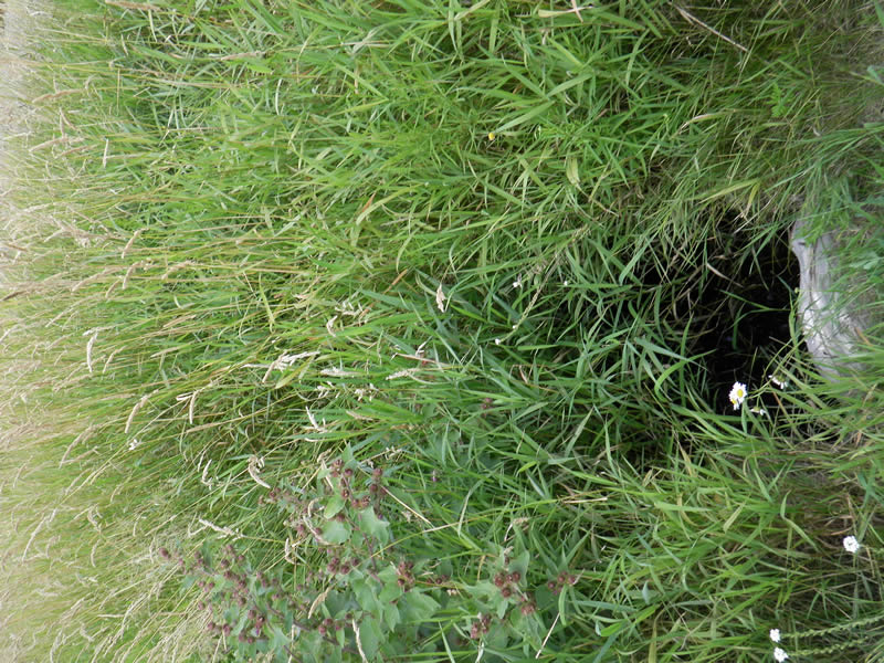
Inlet
Upstream Conditions
Downstream Conditions
Road Approach - Left
Road Approach - Right
Road Approach - Right
Crossing Information
Type of Crossing: culvert(s)
Number of Structures: 1
Structure Shape: Round
Inlet Type: Projecting
Outlet Type: Other
Structure Material: Metal
Structure Substrate: Mixture
General Conditions: Fair
Structure Interior: corrugated
Dimensions of Structure: Length 93 ft.
, Width 2 ft.
, Height 2 ft.
Percentage Plugged:
Inlet: 26% to 50%
Outlet: 26% to 50%
Structure Inlet
Water Depth: 0.167 ft.
Embedded Depth of Structure: 0.167 ft.
Water Velocity*: 0.02 ft./sec.
Structure Outlet
Water Depth: 0.5 ft.
Embedded Depth of Structure: 0 ft.
Water Velocity*: 0 ft./sec.
*Water Velocities were measured 0.1 ft. below Surface
(with Meter)
Additional Comments
Old site ID: TBR-8.
Stream Information
Stream Flow: Less than 1/2 Bankfull
Riffle Information
Water Depth: 0.45 ft.
Bankfull Width: 8 ft.
Wetted Width: 1.5 ft.
Water Velocity: 0.06 ft./sec.
(Measured with Meter)
Dominant Substrate: Organics
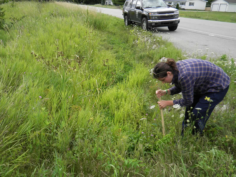
Road Information
Paved
County Road
Road Condition: Good
Road Width at Culvert: 58 ft.
Location of Low Point: At Stream
Runoff Path: Ditch
Embankments
Upstream
Fill Depth: 2 ft.
Slope: More than 1:2
Downstream
Fill Depth: 2 ft.
Slope: More than 1:2
Approaches
Left Approach
Length: 40 ft.
Slope: 1% to 5%
Vegetation: Heavy
LS Factor: 0.314
Erosion: 0.0241 tons/year
Right Approach
Length: 50 ft.
Slope: 1% to 5%
Vegetation: Heavy
LS Factor: 0.33
Erosion: 0.0316 tons/year
Erosion Information
Total Erosion at Crossing: 0.0557 tons/year
Extent of Erosion: Stabilized
Notes: previous erosion but stabilized by rock pics 26,27
Location of Erosion | Erosion Dimensions | Eroded Material | Material Eroded | Total Erosion | ||
facing downstream | Length | Width | Depth | Reaching Stream? | (tons/year) | |
Left Downstream Embankment |
12 ft. |
3 ft. |
1 ft. |
no |
Sand |
0 |
Left Upstream Embankment |
12 ft. |
3 ft. |
1 ft. |
no |
Sand |
0 |
Summary Information
Fish Passability 0.5
These non-native species were observerd at this site: Reed Canary Grass
�