Road Stream Crossing Site LTB-124
Little Traverse Bay Watershed, Bear River
Evergreen Trail
Bear Creek Twp,
Emmet County
Information collected by:
Site Location
GPS Coordinates: 45.32084008
, -84.92027851
Fish Passability 0.9
Total Erosion: 0.9564 tons/year
Severity: Moderate
Year Inventoried: 2014
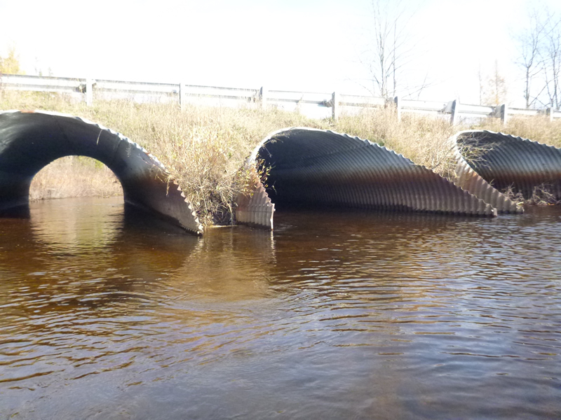
Inlet
Inlet
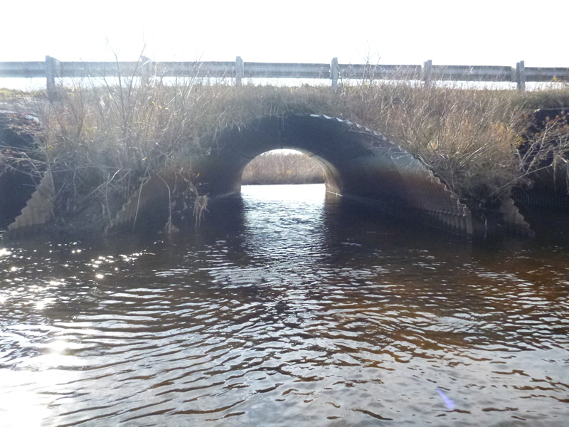
Outlet
Outlet
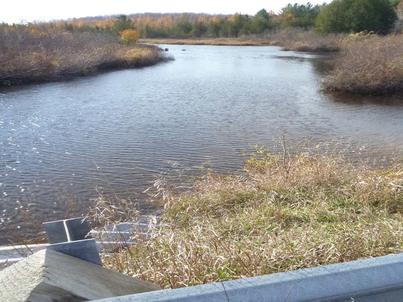
Upstream Conditions
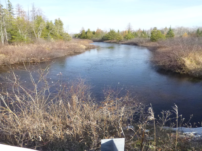
Downstream Conditions
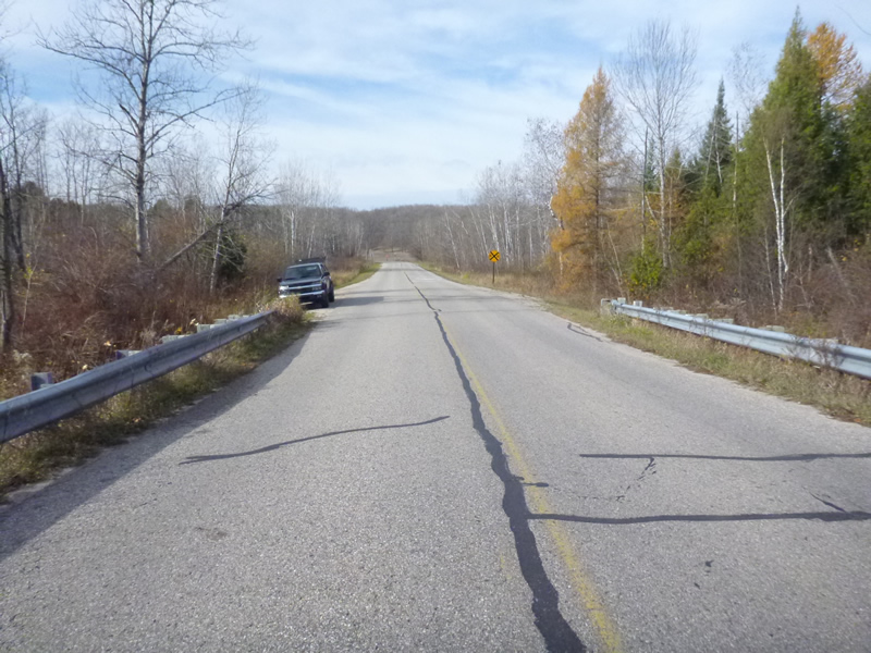
Road Approach - Left
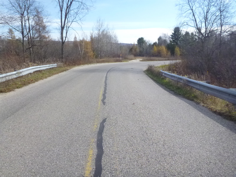
Road Approach - Right
Crossing Information
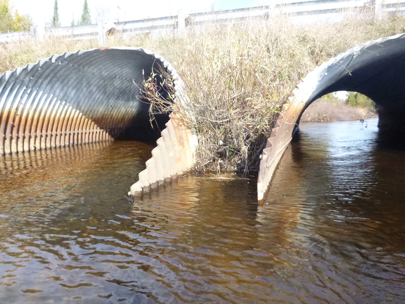
Type of Crossing: culvert(s)
Number of Structures: 3
Structure Shape: Ellipse
Inlet Type: Mitered
Outlet Type: At Stream Grade
Structure Material: Metal
Structure Substrate: Mixture
General Conditions: Good
Multiple Culverts/Spans | ||||
Culvert/Span | Width | Length | Height | Material |
1 |
13.5 ft. |
60 ft. |
9 ft. |
Metal |
2 |
13.5 ft. |
60 ft. |
9 ft. |
Metal |
3 |
13.5 ft. |
60 ft. |
9 ft. |
Metal |
Structure Interior: corrugated
Dimensions of Structure: Length 60 ft.
, Width 9 ft.
Percentage Plugged:
Inlet: 0%
Outlet: 0%
In Pipe: 0%
Percentage Crushed:
In Pipe: 1% to 25%
Structure Inlet
Water Depth: 2.75 ft.
Embedded Depth of Structure: 0.5 ft.
Water Velocity*: 1.38 ft./sec.
Structure Outlet
Water Depth: 2.4 ft.
Embedded Depth of Structure: 1 ft.
Water Velocity*: 1.21 ft./sec.
*Water Velocities were measured 0.6 ft. below Surface
(with Meter)
Additional Comments
Old site ID: E-1.
Stream Information
Stream Flow: Less than Bankfull
Scour Pool: Length 50 ft.
, Width 60 ft.
, Depth 5 ft.
Riffle Information
Water Depth: 1.75 ft.
Bankfull Width: 56 ft.
Wetted Width: 50.5 ft.
Water Velocity: 0.656 ft./sec.
(Measured with Meter)
Dominant Substrate: Sand
Road Information
Paved
County Road
Road Condition: Good
Road Width at Culvert: 30 ft.
Location of Low Point: Other
Runoff Path: Ditch
Embankments
Upstream
Fill Depth: 1 ft.
Slope: 1:1
Downstream
Fill Depth: 2 ft.
Slope: 1:1.5
Approaches
Left Approach
Length: 1000 ft.
Slope: 1% to 5%
Vegetation: Heavy
LS Factor: 0.57
Erosion: 0.5653 tons/year
Right Approach
Length: 20 ft.
Slope: 1% to 5%
Vegetation: Heavy
LS Factor: 0.275
Erosion: 0.0055 tons/year
Erosion Information
Total Erosion at Crossing: 0.9564 tons/year
Extent of Erosion: Moderate
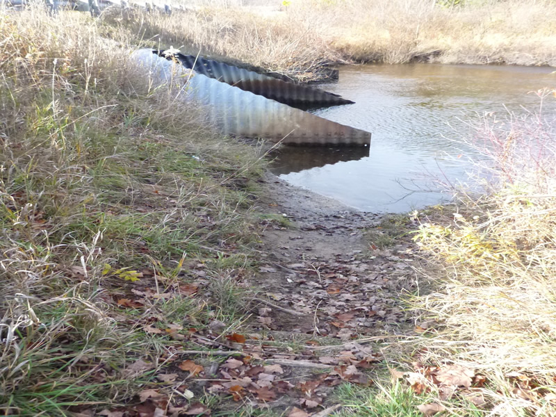
Notes: Erosion 1: moderate (photo 104-0930, 0931, 0932)
Erosion 2: minor, location-road runoff eroding fill on culvert (photo 104-0936, 0937)
Erosion 3: moderate, location-Right streambank, footpath, downstream 40 feet. (photo 104-0927)
Location of Erosion | Erosion Dimensions | Eroded Material | Material Eroded | Total Erosion | ||
facing downstream | Length | Width | Depth | Reaching Stream? | (tons/year) | |
Left Upstream Streambank |
15 ft. |
5 ft. |
1 ft. |
yes |
Gravel |
0.105 |
Left Downstream Ditch |
5 ft. |
1 ft. |
0.5 ft. |
yes |
Gravel |
0.0175 |
Right Downstream Streambank |
40 ft. |
1.5 ft. |
0.5 ft. |
yes |
Gravel |
0.14 |
Left Upstream Streambank |
10 ft. |
5 ft. |
2 ft. |
yes |
Loam |
0.1232 |
Summary Information
Fish Passability 0.9
A future visit to this site is recommended. Monitor conditions.
�