Road Stream Crossing Site LTB-140
Little Traverse Bay Watershed, Tributary to Bear River
Bear River Rd
Melrose Twp,
Charlevoix County
Information collected by:
Site Location
GPS Coordinates: 45.29052413
, -84.88465057
Fish Passability 0.5
Total Erosion: 7.9989 tons/year
Severity: Severe
Year Inventoried: 2014
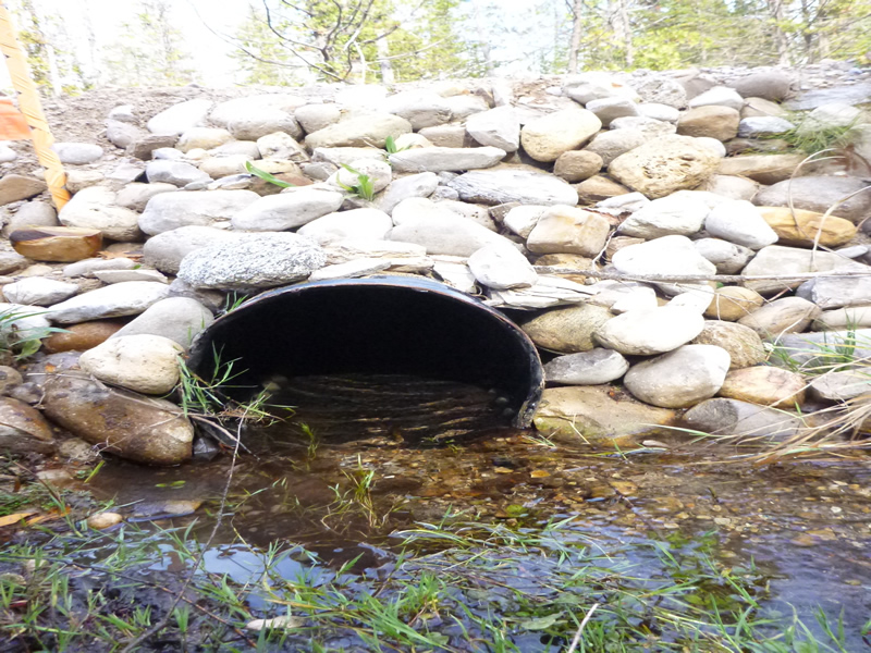
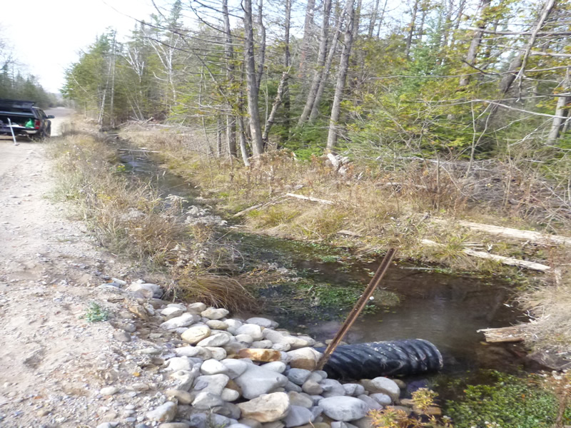
Inlet
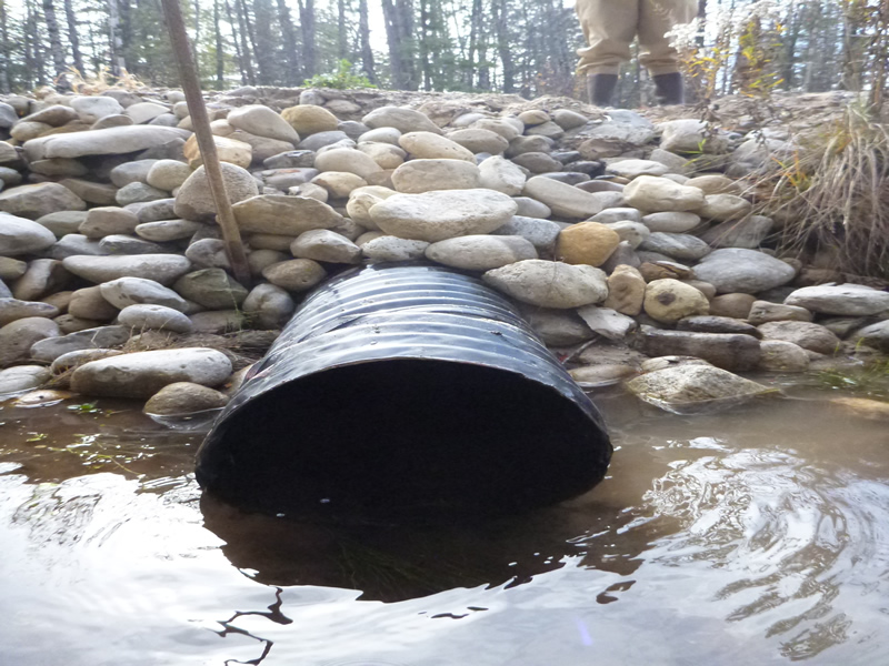
Outlet
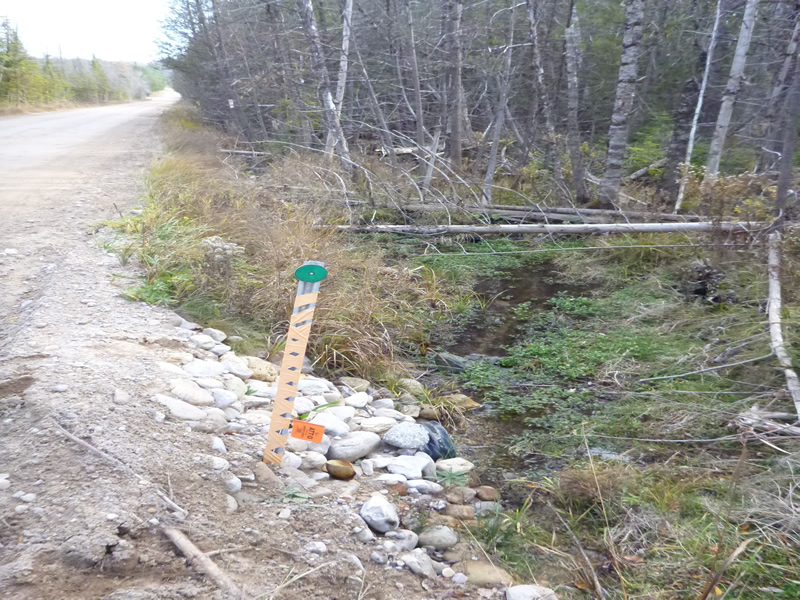
Upstream Conditions
Downstream Conditions
Road Approach - Left
Road Approach - Right
Crossing Information
Type of Crossing: culvert(s)
Number of Structures: 1
Structure Shape: Round
Inlet Type: Projecting
Outlet Type: At Stream Grade
Structure Material: Metal
Structure Substrate: None
General Conditions: New
Structure Interior: corrugated
Dimensions of Structure: Length 37 ft.
, Width 1.5 ft.
Percentage Plugged:
Inlet: 0%
Outlet: 0%
In Pipe: 0%
Percentage Crushed:
Inlet: 0%
Outlet: 0%
In Pipe: 0%
Structure Inlet
Water Depth: 0.2 ft.
Embedded Depth of Structure: 0 ft.
Water Velocity*: 0.7 ft./sec.
Structure Outlet
Water Depth: 0.5 ft.
Embedded Depth of Structure: 0 ft.
Water Velocity*: 0.2 ft./sec.
*Water Velocities were measured 0.6 ft. below Surface
(with Meter)
Additional Comments
Old site ID: UT-24.
Riffle Information
Water Depth: 0.3 ft.
Bankfull Width: 12 ft.
Wetted Width: 5.5 ft.
Water Velocity: 0.15 ft./sec.
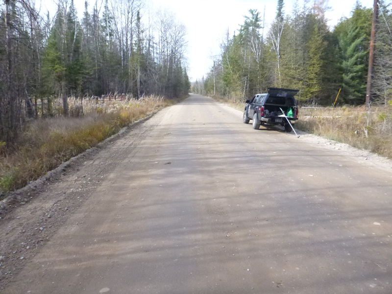
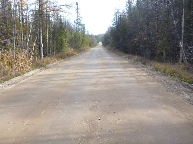
Road Information
Gravel
County Road
Road Condition: Fair
Road Width at Culvert: 25.5 ft.
Embankments
Upstream
Fill Depth: 2 ft.
Slope: 1:1.5
Downstream
Fill Depth: 2.5 ft.
Slope: 1:1.5
Approaches
Left Approach
Length: 999 ft.
Slope: 1% to 5%
Vegetation: Heavy
LS Factor: 0.57
Erosion: 3.9994 tons/year
Right Approach
Length: 999 ft.
Slope: 1% to 5%
Vegetation: Heavy
LS Factor: 0.57
Erosion: 3.9994 tons/year
Erosion Information
Total Erosion at Crossing: 7.9989 tons/year
Summary Information
Fish Passability 0.5
�