Road Stream Crossing Site LTB-146
Little Traverse Bay Watershed, Bear River
Eastwood
Charlevoix,
Charlevoix County
Information collected by:
Site Location
GPS Coordinates: 45.26180553
, -84.89611574
Fish Passability 0.9
Structure is NOT Perched
Total Erosion: 1.0002 tons/year
Severity: Moderate
Year Inventoried: 2014
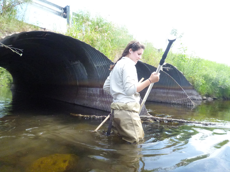
Inlet
Outlet
Upstream Conditions
Downstream Conditions
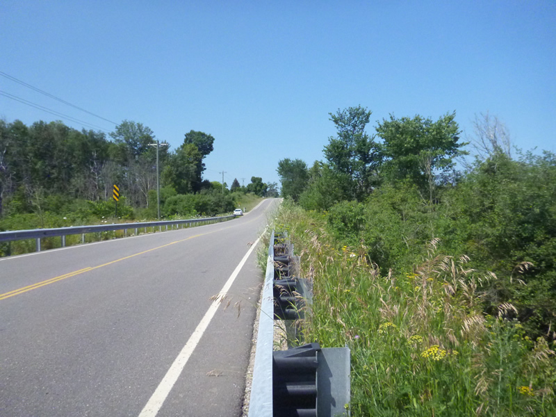
Road Approach - Left
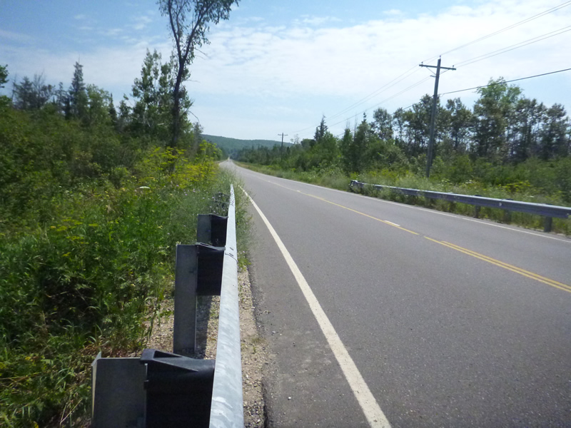
Road Approach - Right
Other
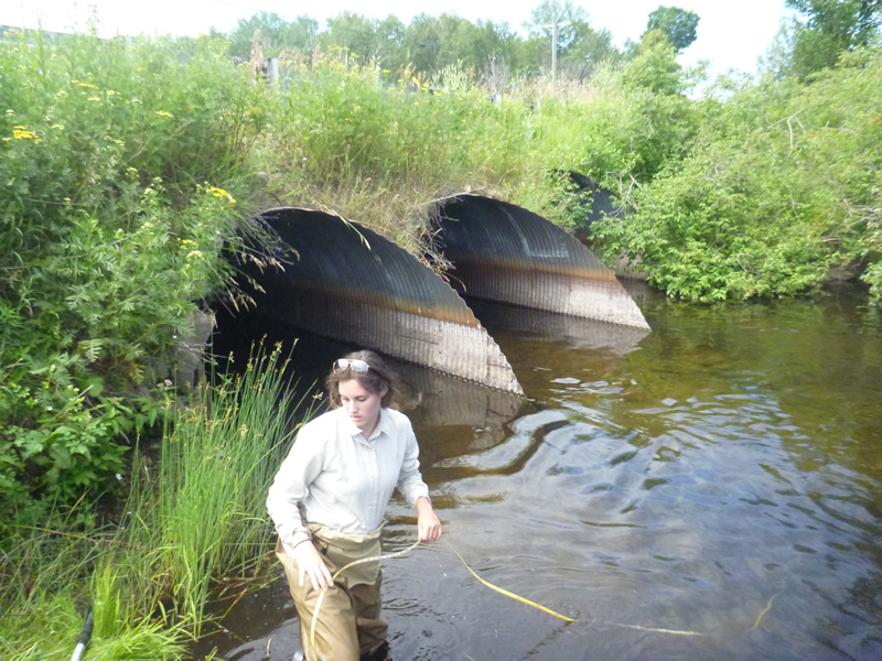
Crossing Information
Type of Crossing: culvert(s)
Number of Structures: 3
Structure Shape: Ellipse
Inlet Type: Projecting
Outlet Type: At Stream Grade
Structure Material: Metal
Structure Substrate: Rock
General Conditions: Fair
Multiple Culverts/Spans | ||||
Culvert/Span | Width | Length | Height | Material |
1 |
8 ft. |
40 ft. |
7 ft. |
Metal |
2 |
8 ft. |
40 ft. |
8 ft. |
Metal |
3 |
8 ft. |
40 ft. |
8 ft. |
Metal |
Structure Interior: corrugated
Structure is Rusted through
Dimensions of Structure: Length 40 ft.
, Width 8 ft.
, Height 7 ft.
Structure is NOT Perched
Structure Inlet
Water Depth: 2 ft.
Embedded Depth of Structure: 0.5 ft.
Water Velocity*: 1.6 ft./sec.
Structure Outlet
Water Depth: 21.42 ft.
Embedded Depth of Structure: 0.167 ft.
Water Velocity*: 0.3 ft./sec.
*Water Velocities were measured 1 ft. below Surface
(with Meter)
Additional Comments
Old site ID: BR-4.
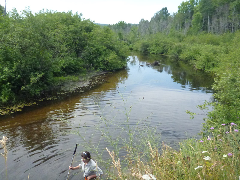
Stream Information
Stream Flow: Less than Bankfull
Riffle Information
Water Depth: 2.583 ft.
Bankfull Width: 40 ft.
Wetted Width: 37.33 ft.
Water Velocity: 0.8 ft./sec.
(Measured with Meter)
Dominant Substrate: Gravel
Road Information
Paved
County Road
Road Condition: Good
Road Width at Culvert: 25.42 ft.
Location of Low Point: At Stream
Runoff Path: Roadway
Embankments
Upstream
Fill Depth: 8 ft.
Slope: Vertical
Downstream
Fill Depth: 7 ft.
Slope: Vertical
Approaches
Left Approach
Length: 450 ft.
Slope: 6% to 10%
Vegetation: Partial
LS Factor: 2.14
Erosion: 0.8092 tons/year
Right Approach
Length: 900 ft.
Slope: Less Than 1%
Vegetation: Partial
LS Factor: 0.06
Erosion: 0.0454 tons/year
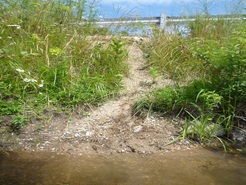
Erosion Information
Total Erosion at Crossing: 1.0002 tons/year
Extent of Erosion: Moderate
Notes: rusted retaining wall in place, erosion tarps observed.
Location of Erosion | Erosion Dimensions | Eroded Material | Material Eroded | Total Erosion | ||
facing downstream | Length | Width | Depth | Reaching Stream? | (tons/year) | |
Left Approach |
4 ft. |
2 ft. |
0.8 ft. |
yes |
Gravel |
0.0224 |
Left Downstream Embankment |
30 ft. |
3 ft. |
0.4 ft. |
no |
Gravel |
0.084 |
Right Downstream Embankment |
8 ft. |
2 ft. |
0.7 ft. |
no |
Gravel |
0.0392 |
Summary Information
Fish Passability 0.9
Erosion is an area of concern for this site.
plenty of fish! Erosion prevention in place but some fallen, bad erosion on left upstream facing downstream
A future visit to this site is recommended. possibly to look at erosion and to control.
�