Road Stream Crossing Site LTB-161
Little Traverse Bay Watershed, Schoofs Creek
Williams Rd @ Deere Rd
Resort Twp,
Emmet County
Information collected by:
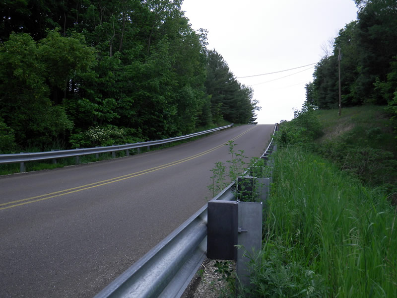
Site Location
GPS Coordinates: 45.32684877
, -84.98868908
Fish Passability 0.5
Total Erosion: 1.9455 tons/year
Severity: Severe
Year Inventoried: 2014
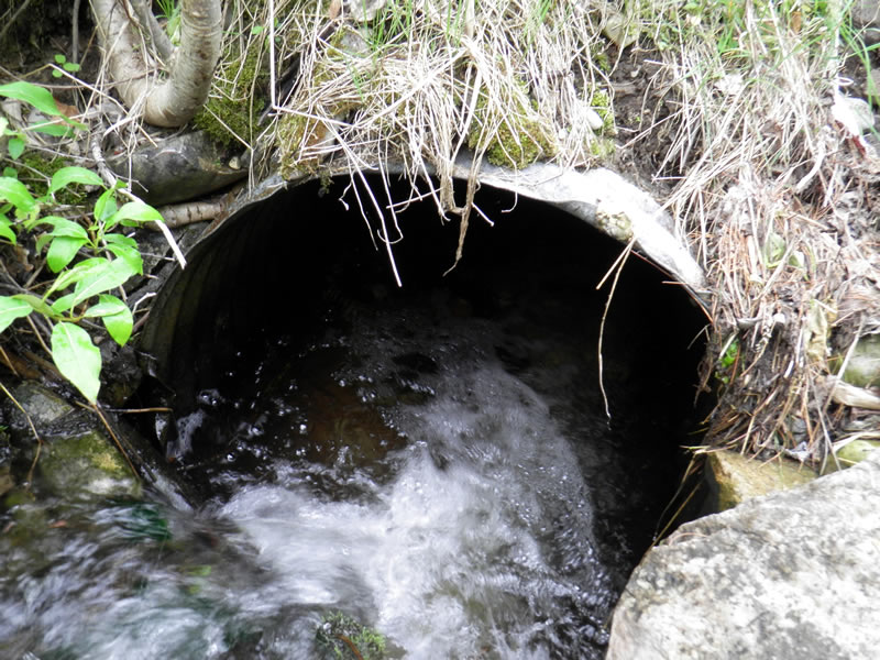
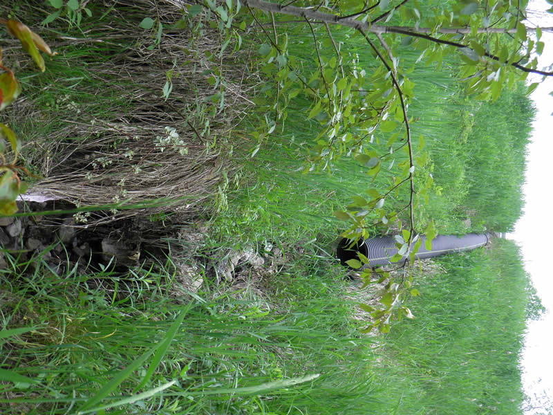
Inlet
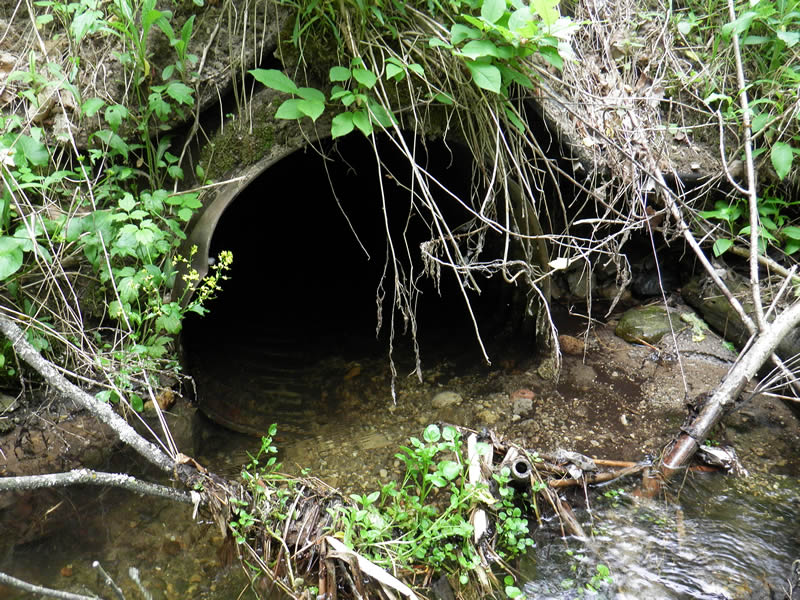
Outlet
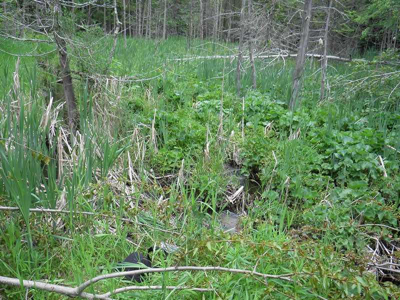
Upstream Conditions
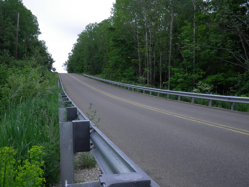
Road Approach - Left
Road Approach - Right
Other
Crossing Information
Type of Crossing: culvert(s)
Number of Structures: 1
Structure Shape: Round
Inlet Type: Projecting
Structure Material: Metal
Structure Substrate: Rock
General Conditions: Fair
Structure Interior: corrugated
Dimensions of Structure: Length 65 ft.
, Width 2.5 ft.
, Height 3 ft.
Percentage Crushed:
Inlet: 1% to 25%
Outlet: 1% to 25%
Structure Inlet
Water Depth: 1 ft.
Embedded Depth of Structure: 0 ft.
Water Velocity*: 0.9 ft./sec.
Structure Outlet
Water Depth: 0.084 ft.
Embedded Depth of Structure: 0.25 ft.
Water Velocity*: 0 ft./sec.
*Water Velocities were measured at the Surface
(with Float Test)
Additional Comments
Old site ID: SC-4.
Stream Information
Stream Flow: Less than 1/2 Bankfull
Riffle Information
Water Depth: 0.34 ft.
Bankfull Width: 5 ft.
Wetted Width: 3.2 ft.
Water Velocity: 3 ft./sec.
(Measured with Float Test)
Dominant Substrate: Sand
Road Information
Paved
State Road
Road Condition: Good
Road Width at Culvert: 25 ft.
Location of Low Point: At Stream
Runoff Path: Ditch
Embankments
Upstream
Fill Depth: 40 ft.
Slope: Vertical
Downstream
Fill Depth: 40 ft.
Slope: Vertical
Approaches
Left Approach
Length: 250 ft.
Slope: 6% to 10%
Vegetation: Heavy
LS Factor: 1.32
Erosion: 0.2727 tons/year
Right Approach
Length: 250 ft.
Slope: 6% to 10%
Vegetation: Heavy
LS Factor: 1.32
Erosion: 0.2727 tons/year
Erosion Information
Total Erosion at Crossing: 1.9455 tons/year
Extent of Erosion: Severe
Notes: picture 100-005 is ditch erosion.
Location of Erosion | Erosion Dimensions | Eroded Material | Material Eroded | Total Erosion | ||
facing downstream | Length | Width | Depth | Reaching Stream? | (tons/year) | |
Right Downtream Ditch |
35 ft. |
2 ft. |
2 ft. |
no |
Gravel |
1.4 |
Summary Information
Fish Passability 0.5
Erosion is an area of concern for this site.
lots of erosion on the steep hill
A future visit to this site is recommended. erosion
�