Road Stream Crossing Site LTB-209
Little Traverse Bay Watershed, Fineout Creek
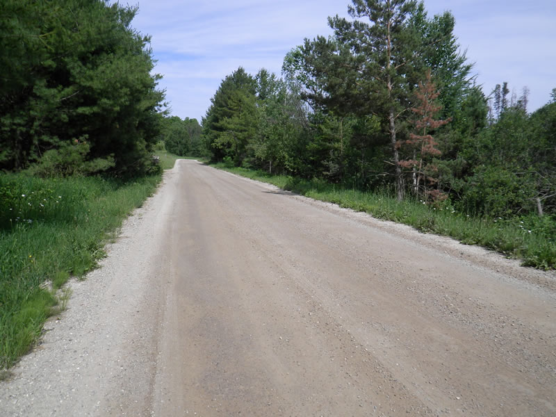
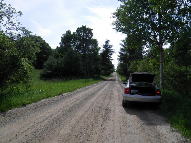
Fineout Rd Upstream
Melrose Twp,
Charlevoix County
Information collected by:
Site Location
GPS Coordinates: 45.25356796
, -84.9821025
Fish Passability 0
Total Erosion: 1.4735 tons/year
Severity: Severe
Year Inventoried: 2014
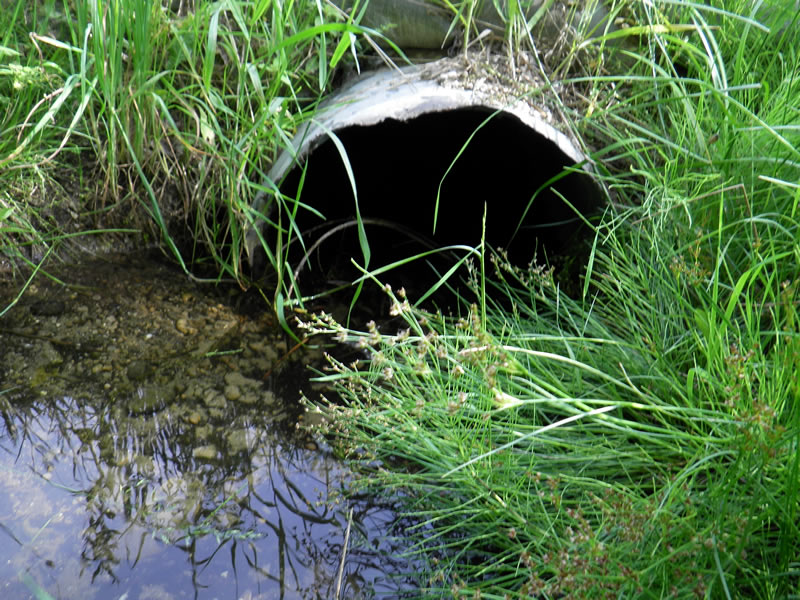
Inlet
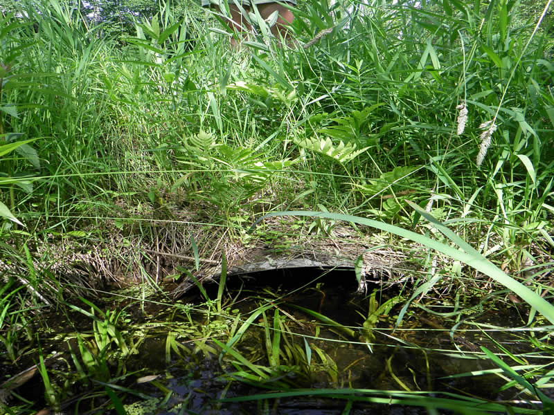
Outlet
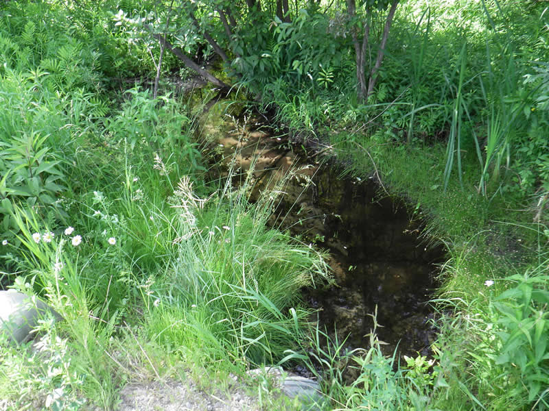
Upstream Conditions
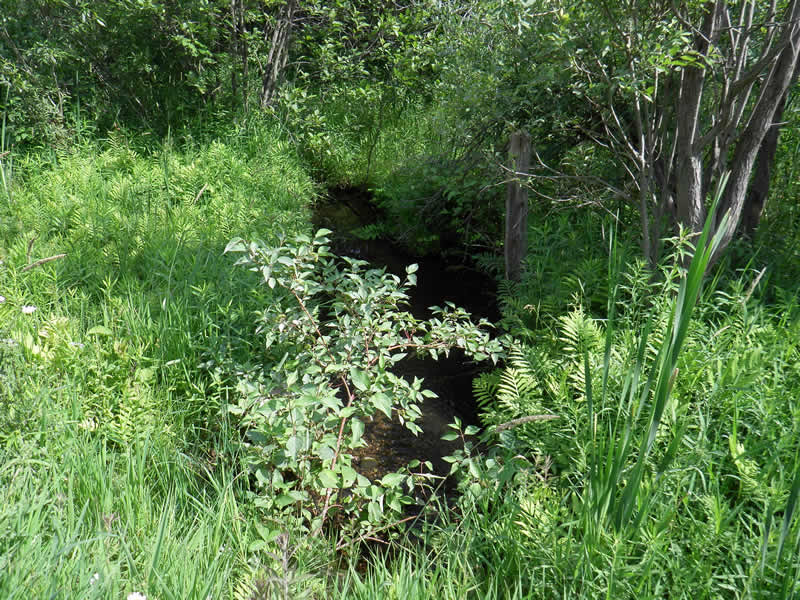
Downstream Conditions
Road Approach - Left
Road Approach - Right
Crossing Information
Type of Crossing: culvert(s)
Number of Structures: 1
Structure Shape: Round
Inlet Type: Projecting
Outlet Type: At Stream Grade
Structure Material: Metal
Structure Substrate: Sand
General Conditions: Good
Structure Interior: corrugated
Dimensions of Structure: Length 32 ft.
, Width 2 ft.
, Height 2 ft.
Percentage Plugged:
In Pipe: 1% to 25%
Percentage Crushed:
Outlet: 1% to 25%
Structure Inlet
Water Depth: 0.029 ft.
Embedded Depth of Structure: 0.33 ft.
Water Velocity*: 0.28 ft./sec.
Structure Outlet
Water Depth: 0.0125 ft.
Embedded Depth of Structure: 0.9 ft.
Water Velocity*: 0.43 ft./sec.
*Water Velocities were measured 0.0714 ft. below Surface
(with Meter)
Additional Comments
Old site ID: FO-10.
Stream Information
Stream Flow: Less than 1/2 Bankfull
Scour Pool: Length 8 ft.
, Width 5 ft.
, Depth 0.7 ft.
Riffle Information
Water Depth: 0.33 ft.
Bankfull Width: 3.75 ft.
Wetted Width: 2.42 ft.
Water Velocity: 0.19 ft./sec.
(Measured with Meter)
Dominant Substrate: Sand
Road Information
Gravel
County Road
Road Condition: Fair
Road Width at Culvert: 22 ft.
Location of Low Point: At Stream
Runoff Path: Roadway
Embankments
Upstream
Fill Depth: 2.58 ft.
Slope: 1:2
Downstream
Fill Depth: 3.83 ft.
Slope: 1:1.5
Approaches
Left Approach
Length: 300 ft.
Slope: Less Than 1%
Vegetation: Heavy
LS Factor: 0.05
Erosion: 0.0909 tons/year
Right Approach
Length: 450 ft.
Slope: 1% to 5%
Vegetation: Heavy
LS Factor: 0.49
Erosion: 1.3364 tons/year
Erosion Information
Total Erosion at Crossing: 1.4735 tons/year
Extent of Erosion: Moderate
Notes: put in erosion/landscaping fabric. Not enough space between road and stream for erosion control measures.
Location of Erosion | Erosion Dimensions | Eroded Material | Material Eroded | Total Erosion | ||
facing downstream | Length | Width | Depth | Reaching Stream? | (tons/year) | |
Right Upstream Ditch |
6 ft. |
4 ft. |
0.5 ft. |
yes |
Sand |
0.0231 |
Left Upstream Ditch |
6 ft. |
4 ft. |
0.5 ft. |
yes |
Sand |
0.0231 |
Summary Information
Fish Passability 0
A future visit to this site is recommended. culvert too short, condition questionable
These non-native species were observerd at this site: Scots Pine
�