Road Stream Crossing Site LTB-215
Little Traverse Bay Watershed, Haymrsh Creek
Romaniak
Melrose Twp,
Charlevoix County
Information collected by:
Site Location
GPS Coordinates: 45.21859671
, -84.91975939
Owned by State
Fish Passability 0.9
Total Erosion: 6.2769 tons/year
Severity: Severe
Year Inventoried: 2014
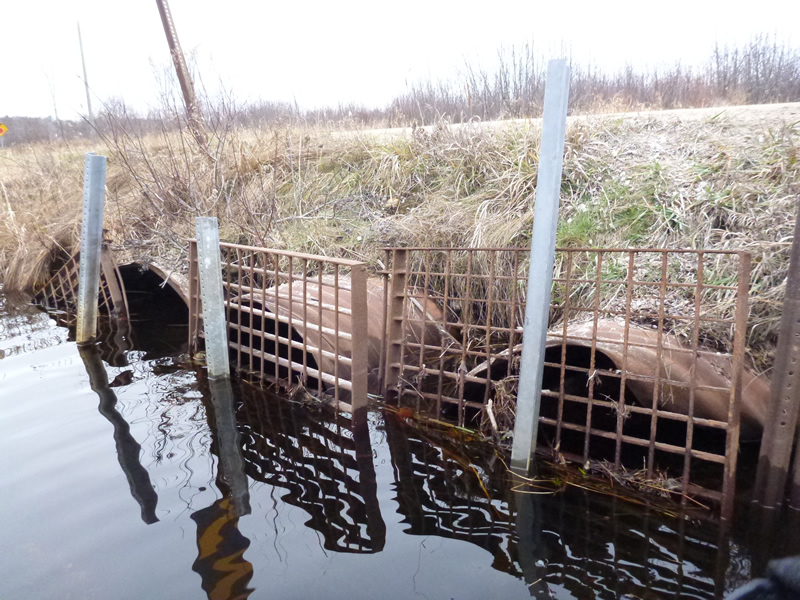
Inlet
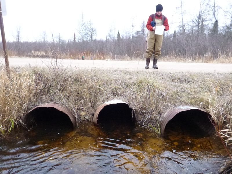
Outlet
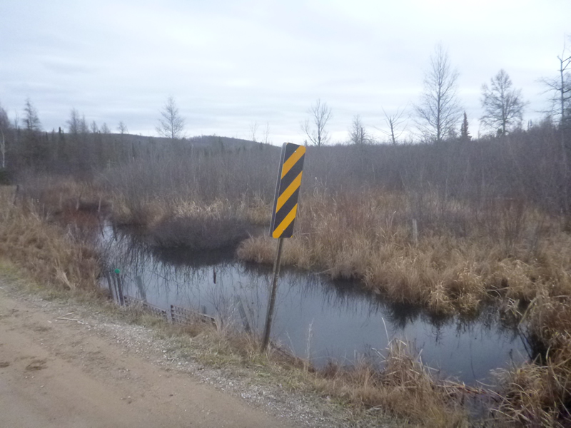
Upstream Conditions
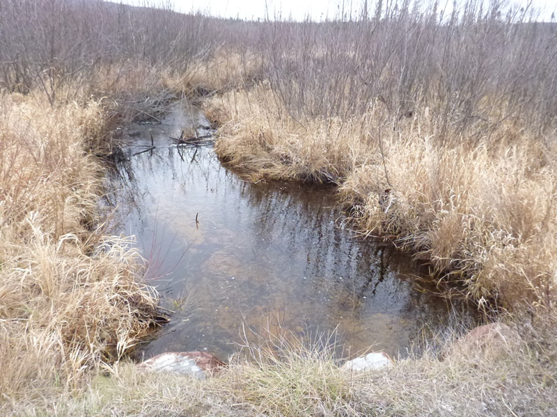
Downstream Conditions
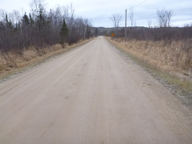
Road Approach - Left
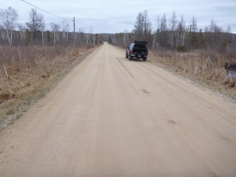
Road Approach - Right
Crossing Information
Type of Crossing: culvert(s)
Number of Structures: 3
Structure Shape: Round
Inlet Type: Projecting
Outlet Type: At Stream Grade
Structure Material: Metal
Structure Substrate: Sand
General Conditions: Poor
Multiple Culverts/Spans | ||||
Culvert/Span | Width | Length | Height | Material |
1 |
3 ft. |
31 ft. |
2.42 ft. |
|
2 |
2.58 ft. |
30 ft. |
2.67 ft. |
|
3 |
2.83 ft. |
30 ft. |
2.75 ft. |
|
Structure Interior: corrugated
Dimensions of Structure: Length 30 ft.
, Width 2.58 ft.
, Height 2.67 ft.
Structure Inlet
Water Depth: 1.67 ft.
Embedded Depth of Structure: 0.25 ft.
Water Velocity*: 0.1 ft./sec.
Structure Outlet
Water Depth: 0.75 ft.
Embedded Depth of Structure: 0.083 ft.
Water Velocity*: 0.5 ft./sec.
*Water Velocities were measured 0.67 ft. below Surface
(with Meter)
Additional Comments
Old site ID: C-27.
Stream Information
Stream Flow: Less than Bankfull
Upstream Pond: Length 15 ft.
, Width 30 ft.
Riffle Information
Water Depth: 1.4 ft.
Bankfull Width: 15 ft.
Wetted Width: 10.4 ft.
Water Velocity: 0.23 ft./sec.
(Measured with Meter)
Dominant Substrate: sand/organics
Road Information
Gravel
County Road
Road Condition: Fair
Road Width at Culvert: 20 ft.
Location of Low Point: At Stream
Runoff Path: Ditch
Embankments
Upstream
Fill Depth: 2 ft.
Slope: 1:1.5
Downstream
Fill Depth: 2 ft.
Slope: 1:2
Approaches
Left Approach
Length: 999 ft.
Slope: 1% to 5%
Vegetation: Heavy
LS Factor: 0.57
Erosion: 3.1368 tons/year
Right Approach
Length: 999 ft.
Slope: 1% to 5%
Vegetation: Heavy
LS Factor: 0.57
Erosion: 3.1368 tons/year
Erosion Information
Total Erosion at Crossing: 6.2769 tons/year
Extent of Erosion: Minor
Erosion is occurring and corrective actions can be installed to address the problem.
Notes: Erosion minor, but road in bad shape, road surface washing into stream.
*Note: Above for location of erosion, actually ABOVE the culvert, but not given that option.
Location of Erosion | Erosion Dimensions | Eroded Material | Material Eroded | Total Erosion | ||
facing downstream | Length | Width | Depth | Reaching Stream? | (tons/year) | |
Left Upstream Ditch |
10 ft. |
2 ft. |
0.3 ft. |
yes |
Sand |
0.0033 |
Summary Information
Fish Passability 0.9
A future visit to this site is recommended. culverts failing
�