Road Stream Crossing Site LTB-220
Little Traverse Bay Watershed, Haymrsh Creek
US-131 Railroad
Melrose Twp,
Charlevoix County
Information collected by:
Site Location
GPS Coordinates: 45.23072765
, -84.91669914
Owned by State
Fish Passability 0.9
Total Erosion: 2.7245 tons/year
Severity: Severe
Year Inventoried: 2014
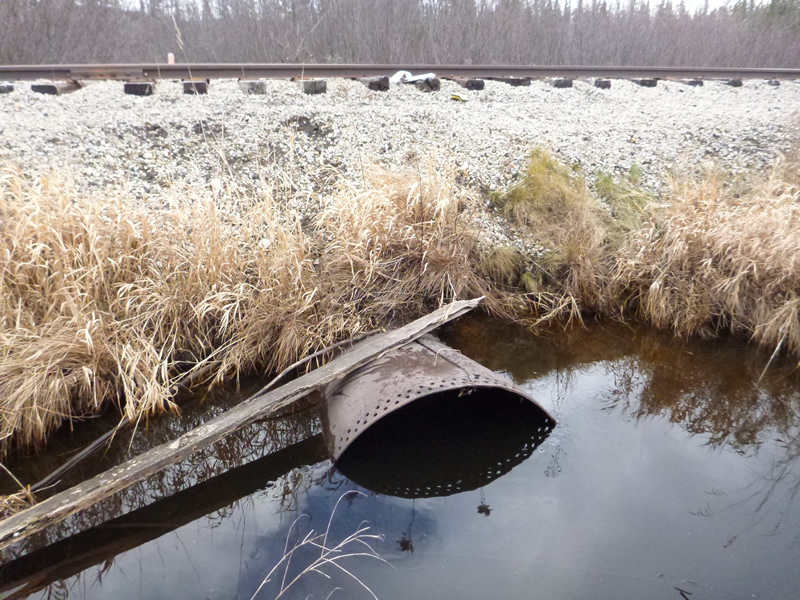
Inlet
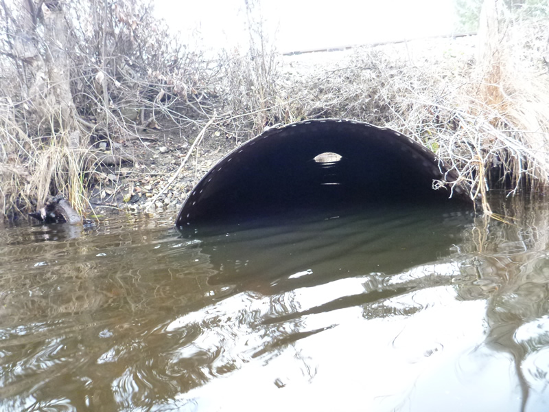
Outlet
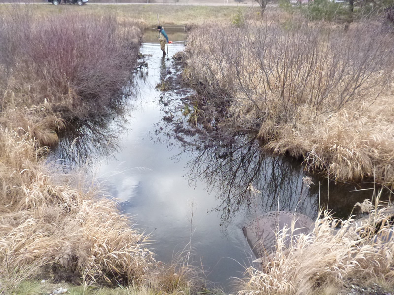
Upstream Conditions
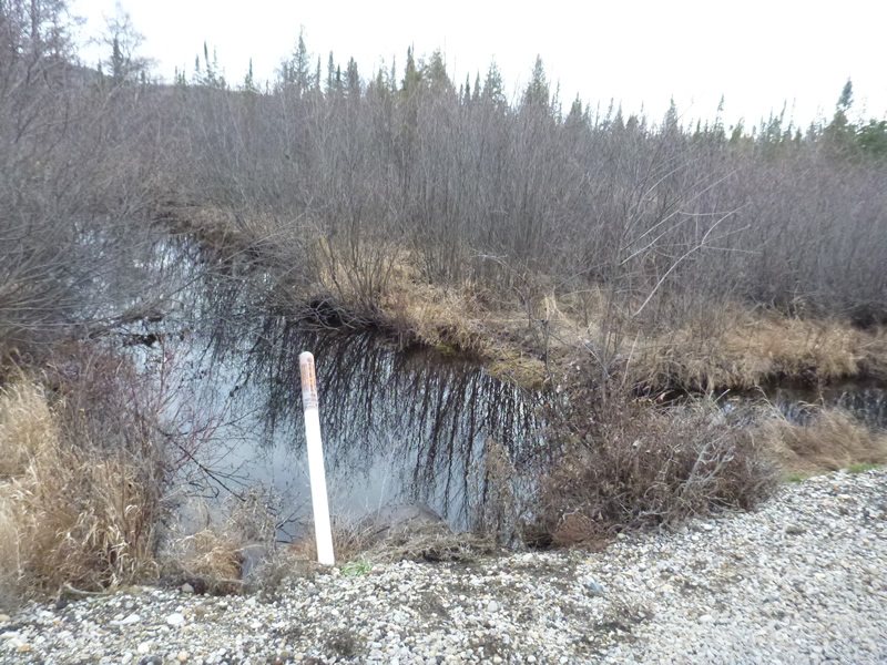
Downstream Conditions
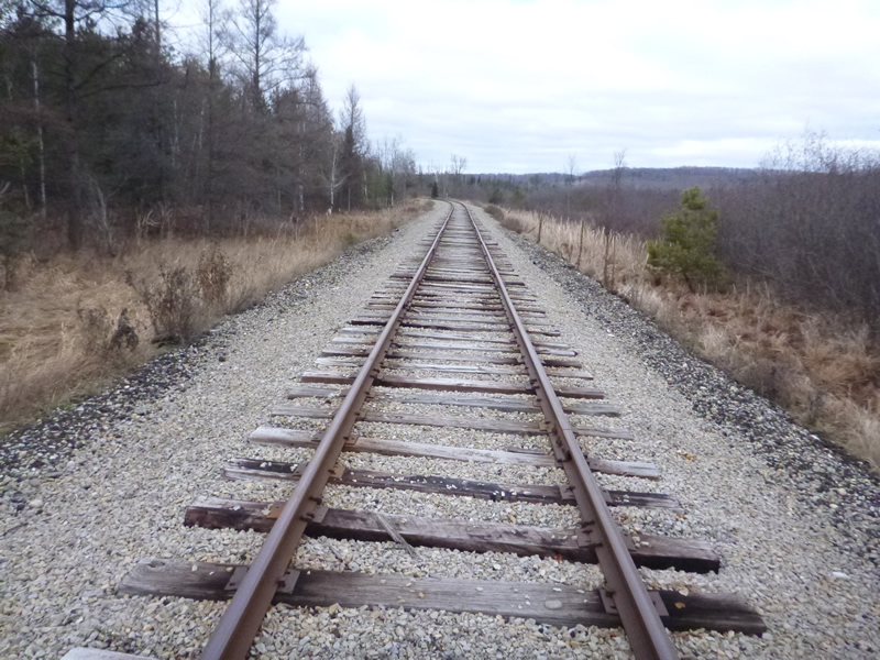
Road Approach - Left
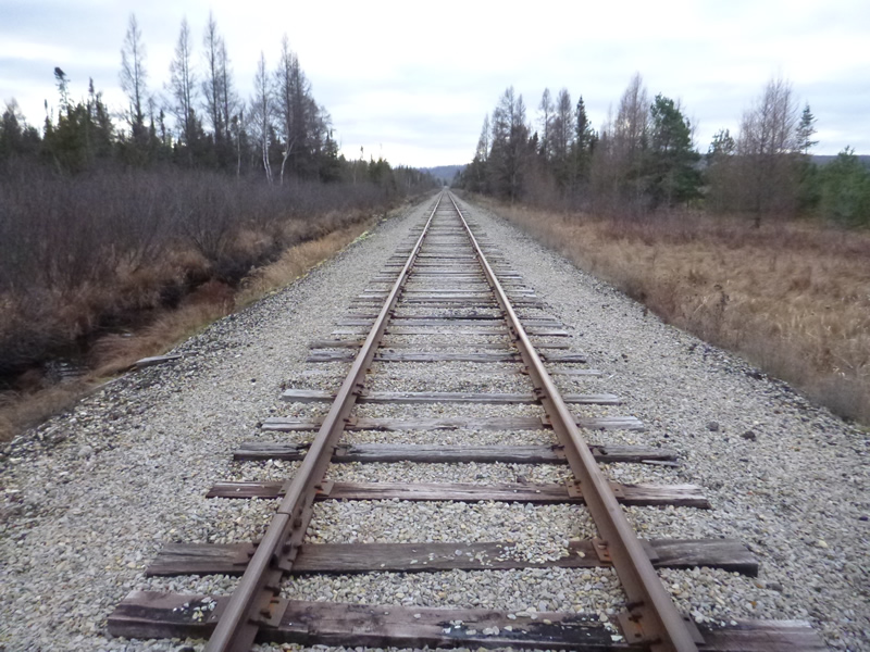
Road Approach - Right
Crossing Information
Type of Crossing: culvert(s)
Number of Structures: 1
Structure Shape: Round
Inlet Type: Projecting
Outlet Type: At Stream Grade
Structure Material: Metal
Structure Substrate: Gravel
General Conditions: Good
Structure Interior: smooth
Dimensions of Structure: Length 34 ft.
, Width 3.5 ft.
, Height 3.25 ft.
Percentage Plugged:
Inlet: 0%
Outlet: 0%
In Pipe: 0%
Percentage Crushed:
Inlet: 0%
Outlet: 0%
In Pipe: 0%
Structure Inlet
Water Depth: 2.8 ft.
Embedded Depth of Structure: 0.125 ft.
Water Velocity*: 0.41 ft./sec.
Structure Outlet
Water Depth: 2.1 ft.
Embedded Depth of Structure: 0.083 ft.
Water Velocity*: 0.39 ft./sec.
*Water Velocities were measured 0.6 ft. below Surface
(with Meter)
Additional Comments
Old site ID: C-32.
Stream Information
Stream Flow: Less than Bankfull
Scour Pool: Length 25 ft.
, Width 20 ft.
, Depth 3.3 ft.
Upstream Pond: Length 10 ft.
, Width 20 ft.
, Depth 2.8 ft.
Riffle Information
Water Depth: 0.75 ft.
Bankfull Width: 29 ft.
Wetted Width: 15 ft.
Water Velocity: 0.22 ft./sec.
(Measured with Meter)
Dominant Substrate: gravel/sand
Road Information
Gravel
Other Road
Road Condition: Fair
Road Width at Culvert: 12 ft.
Runoff Path: Ditch
Embankments
Upstream
Fill Depth: 3 ft.
Slope: 1:2
Downstream
Fill Depth: 3 ft.
Slope: More than 1:2
Approaches
Left Approach
Length: 500 ft.
Slope: 1% to 5%
Vegetation: Heavy
LS Factor: 0.5
Erosion: 0.8264 tons/year
Right Approach
Length: 999 ft.
Slope: 1% to 5%
Vegetation: Heavy
LS Factor: 0.57
Erosion: 1.8821 tons/year
Erosion Information
Total Erosion at Crossing: 2.7245 tons/year
Extent of Erosion: Minor
Notes: LOCATION: Upstream at CULVERT, and Downstream at culvert respectively; with material eroded being sand, gravel and silt for both sections
Sediments from the railroad grade washing in a culverts
Location of Erosion | Erosion Dimensions | Eroded Material | Material Eroded | Total Erosion | ||
facing downstream | Length | Width | Depth | Reaching Stream? | (tons/year) | |
Right Upstream Embankment |
10 ft. |
6 ft. |
1 ft. |
yes |
Sand |
0.011 |
Right Downstream Embankment |
10 ft. |
4 ft. |
0.5 ft. |
yes |
Gravel |
0.005 |
Summary Information
Fish Passability 0.9
These non-native species were observerd at this site: Scots Pine
�