Road Stream Crossing Site LTB-221
Little Traverse Bay Watershed, Haymrsh Creek
Holms Road
Melrose Twp,
Charlevoix County
Information collected by:
Site Location
GPS Coordinates: 45.24787786
, -84.91354121
Fish Passability 0.5
Total Erosion: 2.0677 tons/year
Severity: Severe
Year Inventoried: 2014
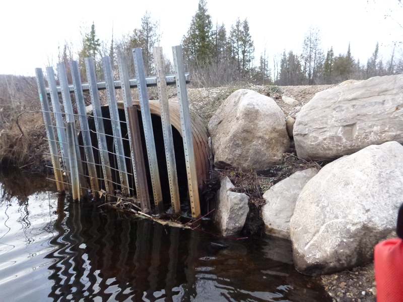
Inlet
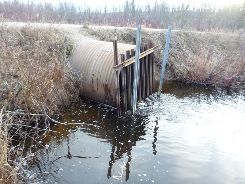
Outlet
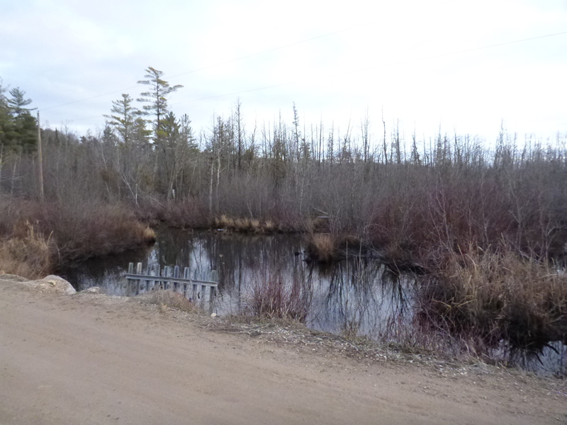
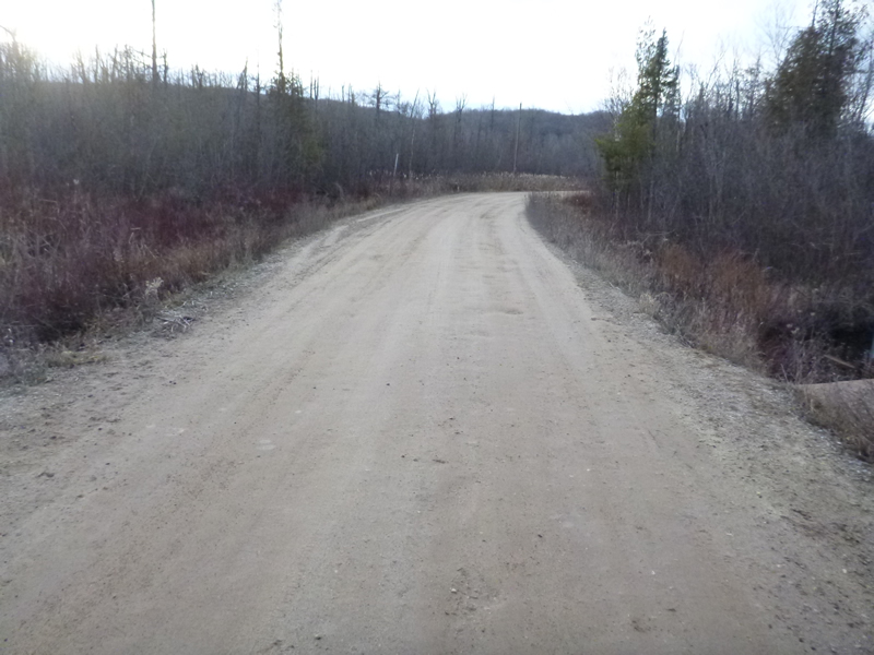
Upstream Conditions
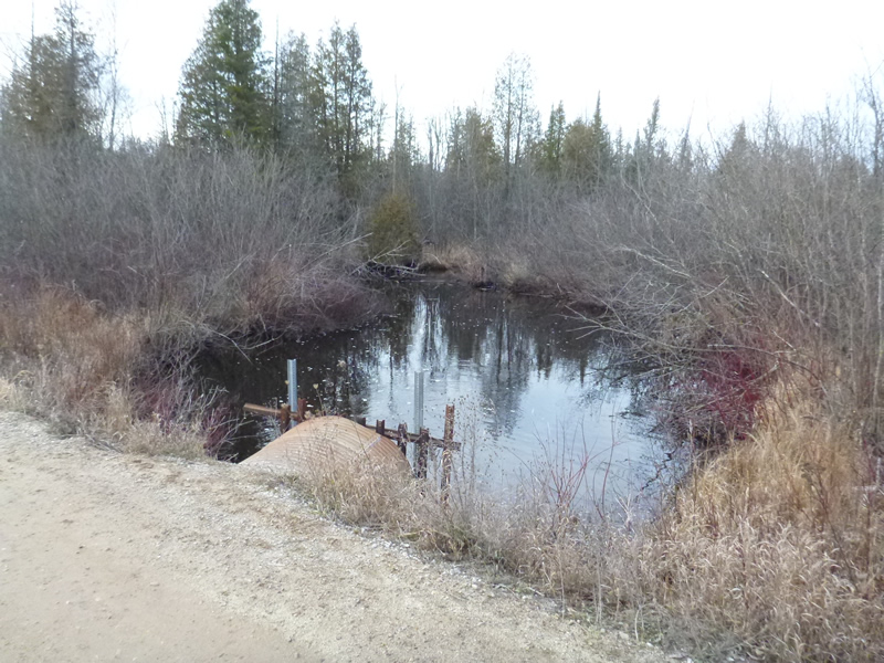
Downstream Conditions
Road Approach - Left
Road Approach - Right
Other
Crossing Information
Type of Crossing: culvert(s)
Number of Structures: 1
Structure Shape: Round
Inlet Type: Projecting
Outlet Type: Other
Structure Material: Metal
Structure Substrate: None
General Conditions: Good
Structure Interior: corrugated
Dimensions of Structure: Length 30.5 ft.
, Width 4.58 ft.
, Height 4.75 ft.
Percentage Plugged:
Inlet: 0%
Outlet: 0%
In Pipe: 0%
Percentage Crushed:
Inlet: 0%
Outlet: 0%
In Pipe: 0%
Structure Inlet
Water Depth: 1.4 ft.
Embedded Depth of Structure: 0 ft.
Water Velocity*: 1.6 ft./sec.
Structure Outlet
Water Depth: 1.4 ft.
Embedded Depth of Structure: 0 ft.
Water Velocity*: 2.24 ft./sec.
*Water Velocities were measured 0.6 ft. below Surface
(with Meter)
Additional Comments
Old site ID: C-33.
Stream Information
Stream Flow: Less than Bankfull
Scour Pool: Length 60 ft.
, Width 30 ft.
, Depth 3.7 ft.
Upstream Pond: Length 40 ft.
, Width 40 ft.
, Depth 1.5 ft.
Riffle Information
Water Depth: 1.5 ft.
Bankfull Width: 27 ft.
Wetted Width: 23.6 ft.
Water Velocity: 0.25 ft./sec.
(Measured with Meter)
Dominant Substrate: sand/organics/silt
Road Information
Gravel
County Road
Road Condition: Poor
Road Width at Culvert: 16 ft.
Location of Low Point: At Stream
Runoff Path: Ditch
Embankments
Upstream
Fill Depth: 1 ft.
Slope: Vertical
Downstream
Fill Depth: 1 ft.
Slope: Vertical
Approaches
Left Approach
Length: 80 ft.
Slope: 1% to 5%
Vegetation: Heavy
LS Factor: 0.364
Erosion: 0.1284 tons/year
Right Approach
Length: 800 ft.
Slope: 1% to 5%
Vegetation: Heavy
LS Factor: 0.55
Erosion: 1.9394 tons/year
Erosion Information
Total Erosion at Crossing: 2.0677 tons/year
Extent of Erosion: Severe
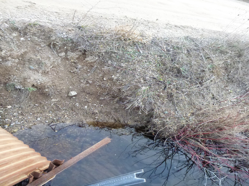
Notes: Severe with road falling into stream, need longer culvert and wider buffer between road and stream.
Summary Information
Fish Passability 0.5
Erosion is an area of concern for this site.
Yes, heavy erosion at CULVERTS (**Note: left above location data entry blank because the option "Downstream at Culvert" wasn't available) culvert to short, road to narrow
A future visit to this site is recommended. Erosion
�